Suspension Bridges 1835-1849 (1-100 of 248)
This is a list of bridges 1 through 100 (of 248 total) in the suspension bridge inventory completed from 1835 through 1849, the year the Wheeling suspension bridge was completed. Wherever you see a Bridgemeister ID number click it to isolate the bridge on its own page.
Related Lists:
1835: (footbridge)
Alipore, Kolkata, West Bengal, India - Tolly's Nullah (Adi Ganga)
| Bridgemeister ID: | 3551 (added 2019-12-26) |
| Year Completed: | 1835 |
| Name: | (footbridge) |
| Location: | Alipore, Kolkata, West Bengal, India |
| Crossing: | Tolly's Nullah (Adi Ganga) |
| Principals: | Captain John Thomson |
| References: | ISB |
| Use: | Footbridge |
| Status: | Removed |
| Main Cables: | Chain (iron) |
Notes:
- Described in ISB as located: "at the north side of the Great Jail of Alipoor, opposite the road leading from the General Hospital to the European Burying Ground."
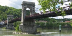
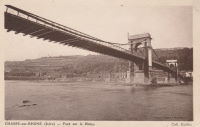
1835: Chasse
Chasse-sur-Rhône, Isère and Givors, Métropole De Lyon, France - Rhône River
| Bridgemeister ID: | 980 (added 2003-11-15) |
| Year Completed: | 1835 |
| Name: | Chasse |
| Also Known As: | Givors |
| Location: | Chasse-sur-Rhône, Isère and Givors, Métropole De Lyon, France |
| Crossing: | Rhône River |
| Coordinates: | 45.581666 N 4.780083 E |
| Maps: | Acme, GeoHack, Google, OpenStreetMap |
| References: | AAJ |
| Use: | Vehicular (one-lane) |
| Status: | In use (last checked: 2005) |
| Main Cables: | Wire (iron) |
| Suspended Spans: | 3 |
| Main Span: | 1 |
| Side Spans: | 2 |
Notes:
- Cables and deck appear to have been replaced (at least once).
- AAJ describes an accident in 1836: "...some of the iron-work, which was faulty, gave way and the platform fell into the river. Six persons were drowned."
External Links:
Image Sets:
1835: Ferro
Pomarance vicinity, Italy - Cecina River
| Bridgemeister ID: | 7601 (added 2023-05-16) |
| Year Completed: | 1835 |
| Name: | Ferro |
| Also Known As: | Iron |
| Location: | Pomarance vicinity, Italy |
| Crossing: | Cecina River |
| Use: | Vehicular |
| Status: | Destroyed, 1847 |
| Main Cables: | Chain (iron) |
| Suspended Spans: | 1 |
| Main Span: | 1 x 50 meters (164 feet) |
Notes:
- 1847, September: Destroyed by flood.
- Replaced by 1855 Ferro (Iron) - Pomarance vicinity, Italy.
- All past and present bridges at this location.
External Links:
- IL PONTE DI FERRO - I Risoluti - La Storia Continua. Detailed history of the bridge's construction and reconstruction.
1835: Kettenbrücke
Loket, Czechia - Ohre River
| Bridgemeister ID: | 2586 (added 2014-04-13) |
| Year Completed: | 1835 |
| Name: | Kettenbrücke |
| Location: | Loket, Czechia |
| Crossing: | Ohre River |
| Principals: | L. Wöllner, Friedrich Schnirch |
| Use: | Vehicular |
| Status: | Replaced, 1936 |
| Main Cables: | Chain (iron) |
| Suspended Spans: | 1 |
Notes:
- Bridge's location sometimes known as "Elbogen", the German name for the town of Loket.
Image Sets:

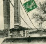
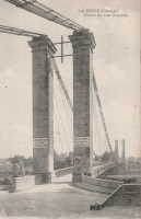
1835: La Réole
La Réole, Gironde, France - Garonne River
| Bridgemeister ID: | 1768 (added 2005-04-22) |
| Year Completed: | 1835 |
| Name: | La Réole |
| Location: | La Réole, Gironde, France |
| Crossing: | Garonne River |
| References: | AAJ |
| Use: | Vehicular |
| Suspended Spans: | 1 |
Notes:
- AAJ guesses this bridge was completed in 1835 due to contract let in 1833 specifying two-year construction period.
- See 1935 La Réole (Rouergue) - La Réole, Gironde, France. Unsure if the newer bridge is at the same location.
Image Sets:
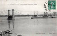
1835: Lagnieu
Lagnieu, Ain and Isère, France - Rhône River
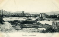
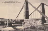
1835: Langeac
Langeac, Haute-Loire, France - Allier River
| Bridgemeister ID: | 1701 (added 2005-03-29) |
| Year Completed: | 1835 |
| Name: | Langeac |
| Location: | Langeac, Haute-Loire, France |
| Crossing: | Allier River |
| Coordinates: | 45.100706 N 3.498480 E |
| Maps: | Acme, GeoHack, Google, OpenStreetMap |
| References: | AAJ |
| Use: | Vehicular |
| Status: | Replaced, 1929 |
| Main Cables: | Wire (iron) |
| Suspended Spans: | 2 |
| Main Spans: | 2 |
Notes:
- AAJ guesses this bridge was completed in 1835 based on contract let in 1833 specifying a two-year construction period.
External Links:
- Art-et-Histoire - Troisième pont suspendu de Langeac - 1868. Indicates the bridge depicted here was competed 1868 after the first (1835) and second (1860) Langeac suspension bridges were destroyed by flood.
Image Sets:
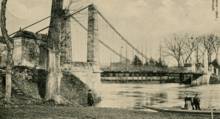
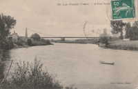
1835: Les Ormes
Les Ormes, Vienne, France - Vienne River
| Bridgemeister ID: | 2074 (added 2006-06-09) |
| Year Completed: | 1835 |
| Name: | Les Ormes |
| Location: | Les Ormes, Vienne, France |
| Crossing: | Vienne River |
| Use: | Vehicular |
| Suspended Spans: | 1 |
Notes:
Image Sets:
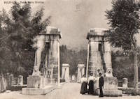
1835: Maria Cristina
Solopaca, Benevento, Italy - Calore River
| Bridgemeister ID: | 7938 (added 2023-10-29) |
| Year Completed: | 1835 |
| Name: | Maria Cristina |
| Also Known As: | Cristino |
| Location: | Solopaca, Benevento, Italy |
| Crossing: | Calore River |
| Coordinates: | 41.207944 N 14.571000 E |
| Maps: | Acme, GeoHack, Google, OpenStreetMap |
| Use: | Vehicular |
| Status: | Destroyed, October 4, 1943 |
| Main Cables: | Chain (iron) |
| Suspended Spans: | 1 |
Notes:
- 2023: Pylons and ornamental lion sculptures from the bridge are still present, but the pylons appear to have been moved back from their original locations.
External Links:
Image Sets:
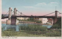
1835: Montmerle-sur-Saône
Montmerle-sur-Saône, Ain and Saint-Georges-de-Reneins, Rhône, France - Saône River
| Bridgemeister ID: | 1586 (added 2005-01-22) |
| Year Completed: | 1835 |
| Name: | Montmerle-sur-Saône |
| Location: | Montmerle-sur-Saône, Ain and Saint-Georges-de-Reneins, Rhône, France |
| Crossing: | Saône River |
| Coordinates: | 46.080483 N 4.754933 E |
| Maps: | Acme, GeoHack, Google, OpenStreetMap |
| References: | AGP |
| Use: | Vehicular (one-lane) |
| Status: | In use (last checked: 2022) |
| Main Cables: | Wire |
| Suspended Spans: | 2 |
| Main Spans: | 2 |
Notes:
- 1944: Heavily damaged during WWII. Repaired.
External Links:
Image Sets:

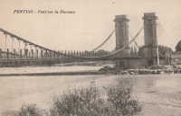
1835: Pertuis
Pertuis, Vaucluse and Bouches-du-Rhône, France - Durance River
| Bridgemeister ID: | 984 (added 2003-11-15) |
| Year Completed: | 1835 |
| Name: | Pertuis |
| Location: | Pertuis, Vaucluse and Bouches-du-Rhône, France |
| Crossing: | Durance River |
| Principals: | Seguin Brothers |
| References: | AAJ |
| Use: | Vehicular |
| Main Cables: | Wire (iron) |
| Suspended Spans: | 2 |
| Main Spans: | 2 x 10⁴ meters (341.2 feet) |
Notes:
- Repairs needed soon after opening. Damaged by flood 1843, reopened 1844.
- Replaced by 1952 Pertuis - Pertuis, Vaucluse and Bouches-du-Rhône, France.
- All past and present bridges at this location.
External Links:
Image Sets:
1835: Rognonas
Rognonas, Bouches-du-Rhône and Avignon, Vaucluse, France - Durance River
| Bridgemeister ID: | 2190 (added 2007-01-25) |
| Year Completed: | 1835 |
| Name: | Rognonas |
| Location: | Rognonas, Bouches-du-Rhône and Avignon, Vaucluse, France |
| Crossing: | Durance River |
| References: | AAJ |
| Use: | Vehicular |
| Status: | Removed |
| Main Cables: | Wire (iron) |
Image Sets:
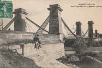
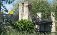
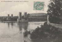
1835: Roquemaure
Roquemaure, Gard and Orange, Vaucluse, France - Rhône River
| Bridgemeister ID: | 1735 (added 2005-04-19) |
| Year Completed: | 1835 |
| Name: | Roquemaure |
| Location: | Roquemaure, Gard and Orange, Vaucluse, France |
| Crossing: | Rhône River |
| Coordinates: | 44.069467 N 4.7689 E |
| Maps: | Acme, GeoHack, Google, OpenStreetMap |
| References: | AAJ |
| Use: | Vehicular |
| Status: | Only towers remain (last checked: 2021) |
| Main Cables: | Wire (iron) |
| Suspended Spans: | 4 |
| Main Spans: | 4 |
Notes:
- One of the four spans, effectively a separate bridge over a small channel of the Rhône to an island that connected to the main river spans, was still standing in early 2005, but closed to all traffic. The deck and cables were removed or destroyed at some point in 2005 or 2006 leaving just the pylons of this span.
- Replaced by Roquemaure - Roquemaure, Gard and Orange, Vaucluse, France.
- All past and present bridges at this location.
External Links:
Image Sets:
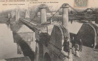
1835: Saint-Jean-de-Blaignac
Saint-Jean-de-Blaignac and Lavagnac, Gironde, France - Dordogne River
| Bridgemeister ID: | 2069 (added 2006-06-07) |
| Year Completed: | 1835 |
| Name: | Saint-Jean-de-Blaignac |
| Location: | Saint-Jean-de-Blaignac and Lavagnac, Gironde, France |
| Crossing: | Dordogne River |
| Coordinates: | 44.814153 N 0.138769 W |
| Maps: | Acme, GeoHack, Google, OpenStreetMap |
| Use: | Vehicular |
| Status: | Replaced, 1939 |
| Main Cables: | Wire (iron) |
| Suspended Spans: | 3 |
| Main Spans: | 3 |
Notes:
- Replaced by 1939 Saint-Jean-de-Blaignac - Saint-Jean-de-Blaignac and Lavagnac, Gironde, France.
- All past and present bridges at this location.
Image Sets:
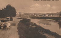
1835: San Leopoldo
Florence, Italy - Arno River
| Bridgemeister ID: | 4759 (added 2020-06-28) |
| Year Completed: | 1835 |
| Name: | San Leopoldo |
| Location: | Florence, Italy |
| Crossing: | Arno River |
| Coordinates: | 43.774903 N 11.234414 E |
| Maps: | Acme, GeoHack, Google, OpenStreetMap |
| Principals: | Seguin Brothers |
| Use: | Vehicular |
| Status: | Demolished, 1932 |
| Main Cables: | Wire (iron) |
External Links:
Image Sets:
1836: Agde
Agde, Hérault, France - Hérault River
| Bridgemeister ID: | 1129 (added 2004-01-15) |
| Year Completed: | 1836 |
| Name: | Agde |
| Location: | Agde, Hérault, France |
| Crossing: | Hérault River |
| References: | AAJ |
| Use: | Vehicular |
| Status: | Removed |
| Main Cables: | Wire (iron) |
| Suspended Spans: | 1 |
| Main Span: | 1 |
External Links:
Image Sets:
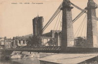
1836: Attichy
Attichy, Oise, France - Aisne River
| Bridgemeister ID: | 7444 (added 2022-12-23) |
| Year Completed: | 1836 |
| Name: | Attichy |
| Location: | Attichy, Oise, France |
| Crossing: | Aisne River |
| Status: | Removed, 1892 |
| Suspended Spans: | 1 |
External Links:
Image Sets:
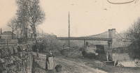
1836: Bonhill
Bonhill and Alexandria, Scotland, United Kingdom - River Leven
| Bridgemeister ID: | 5553 (added 2020-12-16) |
| Year Completed: | 1836 |
| Name: | Bonhill |
| Also Known As: | Bawbee |
| Location: | Bonhill and Alexandria, Scotland, United Kingdom |
| Crossing: | River Leven |
| Coordinates: | 55.984853 N 4.573088 W |
| Maps: | Acme, GeoHack, Google, OpenStreetMap |
| Use: | Vehicular |
| Status: | Removed, c. 1898 |
| Main Cables: | Chain (iron) |
| Suspended Spans: | 1 |
Notes:
- Coordinates are for the present-day (2020) bridge at this location, the replacement for the bridge that replaced the suspension bridge. The suspension bridge was either on the identical alignment of the current bridge or immediately adjacent.
1836: Branne
Branne, Gironde, France - Dordogne River
| Bridgemeister ID: | 6999 (added 2022-04-24) |
| Year Completed: | 1836 |
| Name: | Branne |
| Location: | Branne, Gironde, France |
| Crossing: | Dordogne River |
| Coordinates: | 44.832286 N 0.186143 W |
| Maps: | Acme, GeoHack, Google, OpenStreetMap |
| Use: | Vehicular |
| Status: | Removed, 1911 |
| Main Cables: | Wire (iron) |
| Main Spans: | 2 |
External Links:
Image Sets:
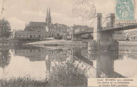
| Bridgemeister ID: | 3208 (added 2019-11-10) |
| Year Completed: | 1836 |
| Name: | Brest |
| Location: | Brest, Belarus |
| Crossing: | Bug River |
| At or Near Feature: | Terespol Gate, Brest-Litovsk Fortress |
| Coordinates: | 52.082272 N 23.650872 E |
| Maps: | Acme, GeoHack, Google, OpenStreetMap |
| Status: | Demolished |
| Main Cables: | Wire |
Notes:
- Damaged during World War I. Replaced by 1941, likely demolished long before. Coordinates are for likely location.
- Near (footbridge) - Brest, Belarus.
External Links:
1836: Choisy-au-bac
Choisy-au-bac, Oise, France - Aisne River
| Bridgemeister ID: | 1767 (added 2005-04-22) |
| Year Completed: | 1836 |
| Name: | Choisy-au-bac |
| Location: | Choisy-au-bac, Oise, France |
| Crossing: | Aisne River |
| Principals: | Seguin Brothers |
| References: | AAJ |
| Main Cables: | Wire (iron) |
Notes:
External Links:
1836: Conflans
Conflans-Sainte-Honorine, Yvelines, France - Seine River
| Bridgemeister ID: | 1774 (added 2005-04-22) |
| Year Completed: | 1836 |
| Name: | Conflans |
| Location: | Conflans-Sainte-Honorine, Yvelines, France |
| Crossing: | Seine River |
| References: | AAJ |
| Use: | Vehicular |
| Status: | Removed |
External Links:
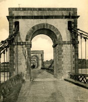
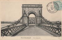
1836: Fourchambault
Fourchambault, Nièvre and Cher, France - Loire River
| Bridgemeister ID: | 1598 (added 2005-02-06) |
| Year Completed: | 1836 |
| Name: | Fourchambault |
| Location: | Fourchambault, Nièvre and Cher, France |
| Crossing: | Loire River |
| Coordinates: | 47.012339 N 3.073304 E |
| Maps: | Acme, GeoHack, Google, OpenStreetMap |
| References: | AAJ |
| Use: | Vehicular |
| Status: | Destroyed, c. 1940's |
| Main Cables: | Chain (iron) |
| Suspended Spans: | 6 |
| Main Spans: | 6 |
Notes:
- Dynamited in 1940 or 1941. Eventually replaced by a long low-lying truss bridge.
Image Sets:
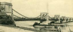
1836: Fourneau
Le Fourneau, Bourbon-Lancy vicinity, Saône-et-Loire and Allier, France - Loire River
| Bridgemeister ID: | 1771 (added 2005-04-22) |
| Year Completed: | 1836 |
| Name: | Fourneau |
| Location: | Le Fourneau, Bourbon-Lancy vicinity, Saône-et-Loire and Allier, France |
| Crossing: | Loire River |
| References: | AAJ |
| Use: | Vehicular |
| Status: | Destroyed, October 1846, by flood. |
| Suspended Spans: | 2 |
| Main Spans: | 2 x 85 meters (278.88 feet) |
| Deck width: | 19.73 feet |
Notes:
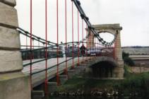
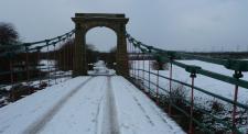
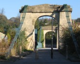
1836: Horkstow
Horkstow, England, United Kingdom - River Ancholme
| Bridgemeister ID: | 1649 (added 2005-03-19) |
| Year Completed: | 1836 |
| Name: | Horkstow |
| Location: | Horkstow, England, United Kingdom |
| Crossing: | River Ancholme |
| Coordinates: | 53.65842 N 0.52837 W |
| Maps: | Acme, GeoHack, Google, OpenStreetMap |
| Principals: | Sir John Rennie |
| References: | AAJ |
| Use: | Vehicular (one-lane) |
| Status: | In use (last checked: 2013) |
| Main Cables: | Chain (iron) |
| Suspended Spans: | 1 |
| Main Span: | 1 x 40.8 meters (133.75 feet) |
Notes:
- 1835, 1836, and 1844 all sometimes cited as the year of completion.
External Links:
Image Sets:
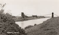
1836: Kalemouth
Eckford, Scotland, United Kingdom - River Teviot
| Bridgemeister ID: | 396 (added before 2003) |
| Year Completed: | 1836 |
| Name: | Kalemouth |
| Location: | Eckford, Scotland, United Kingdom |
| Crossing: | River Teviot |
| Coordinates: | 55.539902 N 2.463519 W |
| Maps: | Acme, GeoHack, Google, OpenStreetMap |
| Principals: | Sir Samuel Brown |
| References: | SBR |
| Use: | Vehicular (one-lane) |
| Status: | Restricted to foot traffic, since 2020 (last checked: 2022) |
| Main Cables: | Eyebar (iron) |
| Suspended Spans: | 1 |
| Main Span: | 1 x 64.6 meters (212 feet) |
Image Sets:

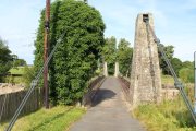
1836: Le Guétin
Le Guétin, Cuffy vicinity, Cher and Gimouille, Nièvre, France - Allier River
| Bridgemeister ID: | 1652 (added 2005-03-19) |
| Year Completed: | 1836 |
| Name: | Le Guétin |
| Location: | Le Guétin, Cuffy vicinity, Cher and Gimouille, Nièvre, France |
| Crossing: | Allier River |
| Coordinates: | 46.947218 N 3.074370 E |
| Maps: | Acme, GeoHack, Google, OpenStreetMap |
| References: | AAJ |
| Use: | Vehicular |
| Status: | Replaced, 1930 |
| Main Cables: | Wire (iron) |
| Suspended Spans: | 5 |
| Main Spans: | 5 x 62 meters (203.42 feet) |
Notes:
- Replaced by 1930 Le Guétin - Le Guétin, Cuffy vicinity, Cher and Gimouille, Nièvre, France.
- All past and present bridges at this location.
External Links:
Image Sets:
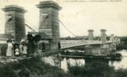
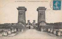
1836: Meung-sur-Loire
Meung-sur-Loire, Loiret, France - Loire River
| Bridgemeister ID: | 1537 (added 2004-10-31) |
| Year Completed: | 1836 |
| Name: | Meung-sur-Loire |
| Location: | Meung-sur-Loire, Loiret, France |
| Crossing: | Loire River |
| Use: | Vehicular |
| Status: | Destroyed, June, 1940 |
| Main Cables: | Wire (iron) |
| Suspended Spans: | 4 |
| Main Spans: | 4 |
Notes:
- 1872-1874: Bridge is partially rebuilt.
- 1925: Bridge undergoes heavy reconstruction, keeping the original piers, pillars, and abutments, but with modifications.
- 1935: Suspension system is reinforced.
- 1940: Destroyed June, 1940.
- Replaced by 1948 Meung-sur-Loire - Meung-sur-Loire, Loiret, France.
- All past and present bridges at this location.
External Links:
Image Sets:
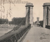
1836: Pontavert
Pontavert, Aisne, France - Aisne River
| Bridgemeister ID: | 7714 (added 2023-07-07) |
| Year Completed: | 1836 |
| Name: | Pontavert |
| Location: | Pontavert, Aisne, France |
| Crossing: | Aisne River |
| Coordinates: | 49.403533 N 3.820659 E |
| Maps: | Acme, GeoHack, Google, OpenStreetMap |
| Status: | Removed, 1904 |
| Main Cables: | Wire |
| Suspended Spans: | 1 |
External Links:
Image Sets:
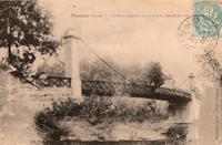
1836: Saint-Perreux
Saint-Perreux, Morbihan and Redon, Ille-et-Vilaine, France - L'Oust
1836: Saint-Sever
Rouen, Seine-Maritime, France - Seine River
| Bridgemeister ID: | 1154 (added 2004-01-18) |
| Year Completed: | 1836 |
| Name: | Saint-Sever |
| Location: | Rouen, Seine-Maritime, France |
| Crossing: | Seine River |
| Principals: | Marc Seguin |
| Status: | Destroyed, 1884 |
| Main Cables: | Wire (iron) |
| Suspended Spans: | 2 |
| Main Spans: | 2 |
Image Sets:

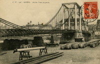
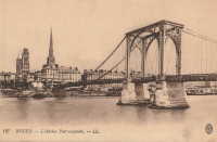
1836: Sully-sur-Loire
Sully-sur-Loire and Saint-Père-sur-Loire, Loiret, France - Loire River
| Bridgemeister ID: | 7851 (added 2023-09-09) |
| Year Completed: | 1836 |
| Name: | Sully-sur-Loire |
| Location: | Sully-sur-Loire and Saint-Père-sur-Loire, Loiret, France |
| Crossing: | Loire River |
| Use: | Vehicular |
| Status: | Destroyed, 1856 |
| Main Cables: | Wire (iron) |
| Suspended Spans: | 3 |
| Main Span: | 1 |
| Side Spans: | 2 |
Notes:
- 1856: Heavily damaged by flood.
- Replaced by 1859 Sully-sur-Loire - Sully-sur-Loire and Saint-Père-sur-Loire, Loiret, France.
- All past and present bridges at this location.
External Links:
Image Sets:

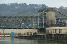
1836: Victoria
Bath, England, United Kingdom - River Avon
| Bridgemeister ID: | 397 (added before 2003) |
| Year Completed: | 1836 |
| Name: | Victoria |
| Location: | Bath, England, United Kingdom |
| Crossing: | River Avon |
| Coordinates: | 51.38350 N 2.37327 W |
| Maps: | Acme, GeoHack, Google, OpenStreetMap |
| Principals: | James Dredge |
| References: | AAJ |
| Use: | Vehicular (one-lane) |
| Status: | Restricted to foot traffic (last checked: 2019) |
| Main Cables: | Eyebar (iron) |
| Suspended Spans: | 1 |
| Main Span: | 1 x 45.7 meters (150 feet) |
| Deck width: | 18 feet |
Notes:
- Dredge patent bridge.
- Closed in 2010 due to safety concerns. Scheduled to be largely rebuilt as a replica, starting April 2013 to be completed April 2014. Temporary truss installed through the bridge to permit traffic during the refurbishment. Reopened January 2015.
External Links:
Image Sets:
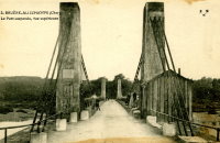
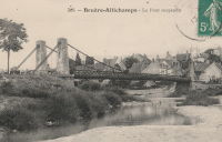
1837: Bruère-Allichamps
Bruère-Allichamps, Saint-Amand-Montrond vicinity, Cher, France - Cher River
| Bridgemeister ID: | 1437 (added 2004-07-30) |
| Year Completed: | 1837 |
| Name: | Bruère-Allichamps |
| Location: | Bruère-Allichamps, Saint-Amand-Montrond vicinity, Cher, France |
| Crossing: | Cher River |
| Coordinates: | 46.767639 N 2.428833 E |
| Maps: | Acme, GeoHack, Google, OpenStreetMap |
| Use: | Vehicular |
| Status: | Removed |
| Main Cables: | Wire |
| Suspended Spans: | 1 |
External Links:
Image Sets:
1837: Cavaillon
Cavaillon, Vaucluse and Bouches-du-Rhône, France - Durance River
| Bridgemeister ID: | 1012 (added 2003-11-21) |
| Year Completed: | 1837 |
| Name: | Cavaillon |
| Location: | Cavaillon, Vaucluse and Bouches-du-Rhône, France |
| Crossing: | Durance River |
| Coordinates: | 43.826278 N 5.030083 E |
| Maps: | Acme, GeoHack, Google, OpenStreetMap |
| Principals: | Jules Seguin |
| References: | AAJ |
| Use: | Vehicular |
| Status: | Replaced |
| Main Cables: | Wire (iron) |
Notes:
- Destroyed by flood 1838, rebuilt 1840, wrecked by wind 1850, rebuilt 1851, damaged by floods 1886, rebuilt 1887, rebuilt 1914.
- Replaced by 1931 Cavaillon - Cavaillon, Vaucluse and Bouches-du-Rhône, France.
- All past and present bridges at this location.
External Links:
Image Sets:
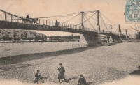
1837: Constantine
Paris, France - Seine River
| Bridgemeister ID: | 1775 (added 2005-04-22) |
| Year Completed: | 1837 |
| Name: | Constantine |
| Location: | Paris, France |
| Crossing: | Seine River |
| At or Near Feature: | left bank |
| References: | AAJ |
| Use: | Footbridge |
| Status: | Replaced, c. 1860's |
| Main Cables: | Wire (iron) |
| Suspended Spans: | 3 |
| Main Span: | 1 x 101.4 meters (332.69 feet) |
| Side Spans: | 2 x 25.8 meters (84.75 feet) |
Notes:
- Connected l'Ile Saint-Louis and Quai St. Bernard.
- AAJ says replaced in 1863, but the current bridge at this location (Pont Sully) was not completed until 1876.
- Companion to 1837 Damiette - Paris, France.
External Links:
1837: Damiette
Paris, France - Seine River
| Bridgemeister ID: | 1776 (added 2005-04-22) |
| Year Completed: | 1837 |
| Name: | Damiette |
| Location: | Paris, France |
| Crossing: | Seine River |
| At or Near Feature: | right bank |
| References: | AAJ |
| Use: | Footbridge |
| Status: | Destroyed, 1848 |
| Suspended Spans: | 2 |
| Main Spans: | 1 x 58 meters (190.3 feet), 1 x 76.8 meters (251.85 feet) |
Notes:
- AAJ: It connected "the Quai of Célestins with the l'Ile Saint-Louis on one side, and with the I'lle of Louviers on the other."
- Companion to 1837 Constantine - Paris, France.
External Links:
1837: Grand River North West
Port Louis, Mauritius - Grand River North West
| Bridgemeister ID: | 528 (added before 2003) |
| Year Completed: | 1837 |
| Name: | Grand River North West |
| Location: | Port Louis, Mauritius |
| Crossing: | Grand River North West |
| Coordinates: | 20.176395 S 57.472176 E |
| Maps: | Acme, GeoHack, Google, OpenStreetMap |
| Use: | Vehicular (one-lane) |
| Status: | Removed |
| Suspended Spans: | 1 |
Notes:
- Replaced by a steel arch bridge, built on the same abutments, that is still standing (as of 2019).
1837: La Balme
La Balme, Savoie and Virignin, Ain, France - Rhône River
1837: Novéant-Corny-sur-Moselle
Novéant-sur-Moselle and Corny-sur-Moselle, Moselle, France - Moselle/Mosel River
| Bridgemeister ID: | 1722 (added 2005-04-05) |
| Year Completed: | 1837 |
| Name: | Novéant-Corny-sur-Moselle |
| Location: | Novéant-sur-Moselle and Corny-sur-Moselle, Moselle, France |
| Crossing: | Moselle/Mosel River |
| Principals: | Seguin Brothers |
| Use: | Vehicular |
| Status: | Replaced, c. 1909 |
| Main Cables: | Wire (iron) |
Image Sets:
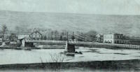
1837: Port-Boulet
Port-Boulet, Bourgueil vicinity, Indre-et-Loire, France - Loire River
| Bridgemeister ID: | 1773 (added 2005-04-22) |
| Year Completed: | 1837 |
| Name: | Port-Boulet |
| Location: | Port-Boulet, Bourgueil vicinity, Indre-et-Loire, France |
| Crossing: | Loire River |
| Principals: | Seguin Brothers |
| References: | AAJ |
| Status: | Destroyed, 1871 |
| Main Cables: | Wire (iron) |
External Links:
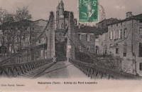
1837: Rabastens
Rabastens and Coufouleux, Tarn, France - Tarn River
| Bridgemeister ID: | 1599 (added 2005-02-06) |
| Year Completed: | 1837 |
| Name: | Rabastens |
| Location: | Rabastens and Coufouleux, Tarn, France |
| Crossing: | Tarn River |
| Use: | Vehicular (one-lane) |
| Status: | Replaced, 1924 |
| Suspended Spans: | 1 |
Notes:
- Eventually replaced by present-day arch bridge.
External Links:
Image Sets:
1837: San Ferdinando
Florence, Italy - Arno River
| Bridgemeister ID: | 7934 (added 2023-10-28) |
| Year Completed: | 1837 |
| Name: | San Ferdinando |
| Location: | Florence, Italy |
| Crossing: | Arno River |
| Coordinates: | 43.765141 N 11.271111 E |
| Maps: | Acme, GeoHack, Google, OpenStreetMap |
| Principals: | Seguin Brothers |
| Use: | Vehicular |
| Status: | Destroyed, 1844 |
| Main Cables: | Wire (iron) |
Notes:
- 1844: Destroyed by flood.
- Replaced by 1853 San Ferdinando - Florence, Italy.
- All past and present bridges at this location.
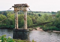
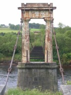
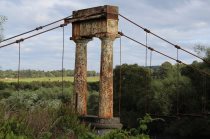
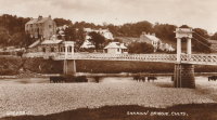
1837: Shakkin
Cults, Aberdeen, Scotland, United Kingdom - River Dee
| Bridgemeister ID: | 1546 (added 2004-11-13) |
| Year Completed: | 1837 |
| Name: | Shakkin |
| Also Known As: | Shakin, St. Devenick's, Morrison |
| Location: | Cults, Aberdeen, Scotland, United Kingdom |
| Crossing: | River Dee |
| Coordinates: | 57.11460 N 2.17056 W |
| Maps: | Acme, GeoHack, Google, OpenStreetMap |
| Principals: | John Smith |
| Use: | Footbridge |
| Status: | Derelict (last checked: 2014) |
| Main Cables: | Chain (iron) |
| Suspended Spans: | 3 |
| Main Span: | 1 x 54.9 meters (180.1 feet) |
| Side Spans: | 2 |
Notes:
- Damaged by flood, 1876, and 1920. Reconstructed, 1921-1922. "Stranded" by shift in river's course, 1970's and 1980's, sweeping away southern approach spans. Deck removed, 1984.
- Known locally as "Shakin' Briggie" or "Shakkin' Briggie," but also referred to as Morrison Bridge and St. Devenick's Bridge.
- Restoration under consideration, 2005.
External Links:
Image Sets:
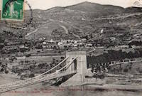
1837: Trébaste
Château-Arnoux and L'Escale, Alpes-de-Haute-Provence, France - Durance River
| Bridgemeister ID: | 2003 (added 2005-12-26) |
| Year Completed: | 1837 |
| Name: | Trébaste |
| Location: | Château-Arnoux and L'Escale, Alpes-de-Haute-Provence, France |
| Crossing: | Durance River |
| Use: | Vehicular |
| Status: | Demolished, 1962 |
External Links:
Image Sets:
1837: Vallon
Vallon-Pont-D'arc and Salavas, Ardèche, France - Ardèche River
| Bridgemeister ID: | 1766 (added 2005-04-22) |
| Year Completed: | 1837 |
| Name: | Vallon |
| Also Known As: | Salavas |
| Location: | Vallon-Pont-D'arc and Salavas, Ardèche, France |
| Crossing: | Ardèche River |
| Coordinates: | 44.398624 N 4.385082 E |
| Maps: | Acme, GeoHack, Google, OpenStreetMap |
| References: | AAJ |
| Use: | Vehicular |
| Status: | Removed |
| Main Cables: | Wire |
| Main Spans: | 2 |
Notes:
- The current (2022) bridge at this location is built on the piers of the suspension bridge.
Image Sets:
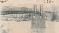
1838: Ancenis
Ancenis, Loire-Atlantique and Le Fourneau, Maine-et-Loire, France - Loire River
| Bridgemeister ID: | 1036 (added 2003-12-03) |
| Year Completed: | 1838 |
| Name: | Ancenis |
| Location: | Ancenis, Loire-Atlantique and Le Fourneau, Maine-et-Loire, France |
| Crossing: | Loire River |
| Coordinates: | 47.361194 N 1.175944 W |
| Maps: | Acme, GeoHack, Google, OpenStreetMap |
| Principals: | Marc Seguin |
| References: | AAJ |
| Use: | Vehicular |
| Status: | Destroyed, 1944 |
| Main Cables: | Wire (iron) |
Notes:
- Destroyed 1940, temporarily rebuilt, destroyed 1944.
- Replaced by 1953 Ancenis - Ancenis, Loire-Atlantique and Le Fourneau, Maine-et-Loire, France.
- All past and present bridges at this location.
External Links:
Image Sets:

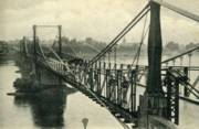
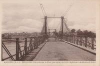
1838: Buzet-sur-Baïse
Buzet-sur-Baïse, Lot-et-Garonne, France - Petite Baïse River
| Bridgemeister ID: | 4909 (added 2020-07-19) |
| Year Completed: | 1838 |
| Name: | Buzet-sur-Baïse |
| Location: | Buzet-sur-Baïse, Lot-et-Garonne, France |
| Crossing: | Petite Baïse River |
| Principals: | Seguin Brothers |
| Status: | Removed |
| Main Cables: | Wire (iron) |
| Suspended Spans: | 1 |
External Links:
Image Sets:
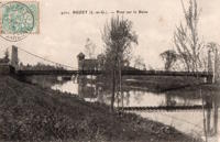
1838: Chambilly
Chambilly and Marcigny, Saône-et-Loire, France - Loire River
| Bridgemeister ID: | 7964 (added 2023-11-23) |
| Year Completed: | 1838 |
| Name: | Chambilly |
| Location: | Chambilly and Marcigny, Saône-et-Loire, France |
| Crossing: | Loire River |
| Coordinates: | 46.277222 N 4.015778 E |
| Maps: | Acme, GeoHack, Google, OpenStreetMap |
| Use: | Vehicular |
| Status: | Removed |
| Main Cables: | Wire (iron) |
| Suspended Spans: | 3 |
External Links:
Image Sets:
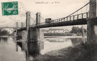
1838: Conflans
Andrésy and Conflans-Sainte-Honorine, Yvelines, France - Oise River
| Bridgemeister ID: | 1687 (added 2005-03-26) |
| Year Completed: | 1838 |
| Name: | Conflans |
| Also Known As: | Fin d'Oise |
| Location: | Andrésy and Conflans-Sainte-Honorine, Yvelines, France |
| Crossing: | Oise River |
| Principals: | Seguin Brothers |
| Use: | Vehicular |
| Status: | Replaced |
| Main Cables: | Wire (iron) |
| Suspended Spans: | 1 |
| Main Span: | 1 x 75 meters (246.1 feet) |
| Deck width: | 5.5 meters |
Notes:
- Likely replaced by the current concrete arch bridge at this location.
External Links:
Image Sets:
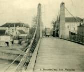
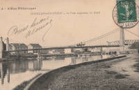
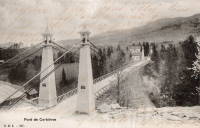
1838: Corbières
Corbières, Switzerland - Sarine River
| Bridgemeister ID: | 1778 (added 2005-04-22) |
| Year Completed: | 1838 |
| Name: | Corbières |
| Location: | Corbières, Switzerland |
| Crossing: | Sarine River |
| References: | AAJ |
| Use: | Vehicular (one-lane) |
| Status: | Replaced, 1931 |
| Main Cables: | Wire (iron) |
| Suspended Spans: | 1 |
Image Sets:
| Bridgemeister ID: | 1128 (added 2004-01-15) |
| Year Completed: | 1838 |
| Name: | Kermélo |
| Location: | Lorient, Morbihan, France |
| Crossing: | Le Ter |
| Coordinates: | 47.731083 N 3.386194 W |
| Maps: | Acme, GeoHack, Google, OpenStreetMap |
| Principals: | Marc Seguin |
| Use: | Footbridge |
| Status: | Replaced, 1919 |
| Main Cables: | Wire (iron) |
| Suspended Spans: | 2 |
| Main Spans: | 2 |
Notes:
- Appears to have been mainly a footbridge. Likely removed.
External Links:
Image Sets:
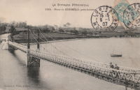
1838: La Charité
Île du Faubourg de Loire, La Charité-sur-Loire, Nièvre and La Chapelle-Montlinard, Cher, France - Loire River
| Bridgemeister ID: | 8867 (added 2024-10-02) |
| Year Completed: | 1838 |
| Name: | La Charité |
| Location: | Île du Faubourg de Loire, La Charité-sur-Loire, Nièvre and La Chapelle-Montlinard, Cher, France |
| Crossing: | Loire River |
| Coordinates: | 47.175139 N 3.009389 E |
| Maps: | Acme, GeoHack, Google, OpenStreetMap |
| References: | AAJ |
| Use: | Vehicular |
| Status: | Removed |
| Main Cables: | Wire (iron) |
| Suspended Spans: | 1 |
| Main Span: | 1 |
External Links:
1838: La Roche-Guyon
La Roche-Guyon, Val-d'Oise and Yvelines, France - Seine River
| Bridgemeister ID: | 7649 (added 2023-06-10) |
| Year Completed: | 1838 |
| Name: | La Roche-Guyon |
| Location: | La Roche-Guyon, Val-d'Oise and Yvelines, France |
| Crossing: | Seine River |
| Coordinates: | 49.079205 N 1.631693 E |
| Maps: | Acme, GeoHack, Google, OpenStreetMap |
| Use: | Vehicular |
| Status: | Destroyed, 1882 |
| Main Cables: | Wire (iron) |
| Suspended Spans: | 1 |
| Main Span: | 1 x 161 meters (528.2 feet) |
Notes:
- 1882: Wrecked by wind. Rebuilt with two main suspension spans instead of one.
- Replaced by La Roche-Guyon - La Roche-Guyon, Val-d'Oise and Yvelines, France.
- All past and present bridges at this location.
Image Sets:
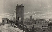
1838: Löwenbrücke
Berlin, Germany
| Bridgemeister ID: | 858 (added 2003-08-09) |
| Year Completed: | 1838 |
| Name: | Löwenbrücke |
| Also Known As: | Lion's Bridge |
| Location: | Berlin, Germany |
| At or Near Feature: | Tiergarten |
| Coordinates: | 52.512383 N 13.345667 E |
| Maps: | Acme, GeoHack, Google, OpenStreetMap |
| Principals: | Ludwig Ferdinand Hesse |
| References: | PTS2 |
| Use: | Footbridge |
| Status: | Closed (last checked: 2013) |
| Main Cables: | Chain |
| Suspended Spans: | 1 |
| Main Span: | 1 x 17.3 meters (56.8 feet) |
| Deck width: | 2 meters |
Notes:
- Now supported by wire cable.
- In the early 2010s, the bridge was closed and the deck was removed (see accompanying 2013 photo set). By 2019 it had been further dismantled awaiting rehabilitation.
External Links:
Image Sets:


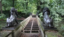
1838: Les Andelys
Les Andelys, Eure, France - Seine River
| Bridgemeister ID: | 4215 (added 2020-04-08) |
| Year Completed: | 1838 |
| Name: | Les Andelys |
| Location: | Les Andelys, Eure, France |
| Crossing: | Seine River |
| Coordinates: | 49.236464 N 1.397978 E |
| Maps: | Acme, GeoHack, Google, OpenStreetMap |
| Principals: | Marie Fortuné de Vergès, Ferdinand Bayard de la Vingtrie |
| Use: | Vehicular |
| Status: | Destroyed, 1870 |
| Main Cables: | Wire (iron) |
Notes:
- Likely destroyed in 1870 during Franco-Prussian war to prevent advance of the Prussian army.
- Later at same location 1920 Les Andelys - Les Andelys, Eure, France. The 1920 bridge was not an immediate replacement.
- All past and present bridges at this location.
Image Sets:
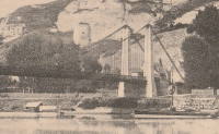
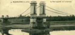
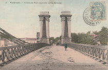
1838: Marmande
Marmande, Lot-et-Garonne, France - Garonne River
| Bridgemeister ID: | 1603 (added 2005-02-06) |
| Year Completed: | 1838 |
| Name: | Marmande |
| Location: | Marmande, Lot-et-Garonne, France |
| Crossing: | Garonne River |
| Coordinates: | 44.499538 N 0.156698 E |
| Maps: | Acme, GeoHack, Google, OpenStreetMap |
| References: | AAJ |
| Use: | Vehicular |
| Status: | Failed, 1930 |
| Main Cables: | Wire (iron) |
| Suspended Spans: | 2 |
| Side Spans: | 2 |
Notes:
- AAJ lists this bridge as completed in 1835.
- Near 1845 Couthures - Couthures-sur-Garonne, Lot-et-Garonne, France.
- Replaced by 1932 Marmande (Renaud Jean) - Marmande, Lot-et-Garonne, France.
- All past and present bridges at this location.
Image Sets:
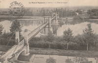
1838: Mas-d'Agenais
Le Mas-d'Agenais, Lot-et-Garonne, France - Garonne River
| Bridgemeister ID: | 1033 (added 2003-11-30) |
| Year Completed: | 1838 |
| Name: | Mas-d'Agenais |
| Location: | Le Mas-d'Agenais, Lot-et-Garonne, France |
| Crossing: | Garonne River |
| Coordinates: | 44.412101 N 0.222131 E |
| Maps: | Acme, GeoHack, Google, OpenStreetMap |
| References: | AAJ |
| Use: | Vehicular |
| Status: | In use (last checked: 2016) |
| Main Cables: | Wire (iron) |
| Suspended Spans: | 3 |
| Main Spans: | 3 |
Notes:
- 1930: The bridge is strengthened. The suspension system is replaced, the deck is stiffened with a plate girder system, and the pairs of end pylons are transformed to (or replaced with) towers with gothic arches.
External Links:
Image Sets:
1838: Montfrin
Montfrin, Gard, France - Gardon River
| Bridgemeister ID: | 1934 (added 2005-10-28) |
| Year Completed: | 1838 |
| Name: | Montfrin |
| Location: | Montfrin, Gard, France |
| Crossing: | Gardon River |
| Use: | Vehicular (one-lane) |
| Status: | Removed |
| Main Cables: | Wire |
Notes:
External Links:
Image Sets:
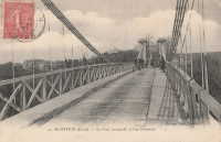
1838: Ruoms
Ruoms and Labeaume, Ardèche, France - Ardèche River
| Bridgemeister ID: | 7314 (added 2022-08-28) |
| Year Completed: | 1838 |
| Name: | Ruoms |
| Also Known As: | Les Brasseries |
| Location: | Ruoms and Labeaume, Ardèche, France |
| Crossing: | Ardèche River |
| Coordinates: | 44.456715 N 4.334095 E |
| Maps: | Acme, GeoHack, Google, OpenStreetMap |
| Use: | Vehicular |
| Status: | Only towers remain (last checked: 2022) |
| Main Span: | 1 |
External Links:
Image Sets:
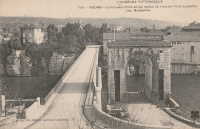
1838: Saint Laurent
Grenoble, Isère, France - Isère River
| Bridgemeister ID: | 1158 (added 2004-01-18) |
| Year Completed: | 1838 |
| Name: | Saint Laurent |
| Location: | Grenoble, Isère, France |
| Crossing: | Isère River |
| Coordinates: | 45.194433 N 5.729017 E |
| Maps: | Acme, GeoHack, Google, OpenStreetMap |
| Use: | Vehicular |
| Status: | Restricted to foot traffic (last checked: 2022) |
| Main Cables: | Wire (iron) |
| Suspended Spans: | 1 |
| Main Span: | 1 x 61 meters (200.1 feet) estimated |
Notes:
- 1909: The bridge is extensively renovated.
External Links:
Image Sets:
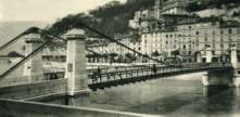
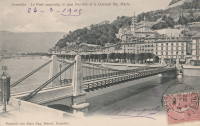
1838: Saint-Bernard
Saint-Bernard, Ain and Anse, Rhône, France - Saône River
| Bridgemeister ID: | 1716 (added 2005-04-05) |
| Year Completed: | 1838 |
| Name: | Saint-Bernard |
| Location: | Saint-Bernard, Ain and Anse, Rhône, France |
| Crossing: | Saône River |
| Principals: | Seguin Brothers |
| Use: | Vehicular |
| Status: | Replaced, 1940s |
| Main Cables: | Wire (iron) |
Notes:
- 1933, October 4: A section of the bridge deck collapses under the weight of a truck.
Image Sets:
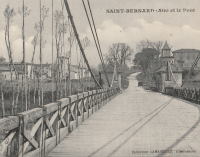
1838: Tournus
Tournus, Saône-et-Loire, France - Saône River
| Bridgemeister ID: | 5660 (added 2021-01-01) |
| Year Completed: | 1838 |
| Name: | Tournus |
| Location: | Tournus, Saône-et-Loire, France |
| Crossing: | Saône River |
| Coordinates: | 46.564107 N 4.912460 E |
| Maps: | Acme, GeoHack, Google, OpenStreetMap |
| References: | AAJ |
| Status: | Removed, 1869 |
| Main Cables: | Wire (iron) |
Notes:
- Later at same location 1950 Tournus - Tournus, Saône-et-Loire, France.
- All past and present bridges at this location.
External Links:
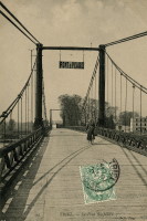
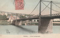
1838: Triel-sur-Seine
Triel-sur-Seine and Vernouillet, Yvelines, France - Seine River
| Bridgemeister ID: | 1756 (added 2005-04-20) |
| Year Completed: | 1838 |
| Name: | Triel-sur-Seine |
| Location: | Triel-sur-Seine and Vernouillet, Yvelines, France |
| Crossing: | Seine River |
| Coordinates: | 48.978606 N 2.001981 E |
| Maps: | Acme, GeoHack, Google, OpenStreetMap |
| Principals: | Seguin Brothers |
| Use: | Vehicular |
| Status: | Destroyed, 1940 |
| Main Cables: | Wire (iron) |
| Suspended Spans: | 3 |
| Main Span: | 1 |
| Side Spans: | 2 |
Notes:
- Replaced by 1945 Triel-sur-Seine - Triel-sur-Seine and Vernouillet, Yvelines, France.
- All past and present bridges at this location.
External Links:
Image Sets:
1838: Vianne
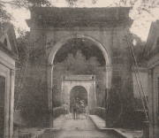
Vianne, Lot-et-Garonne, France - Baïse River
| Bridgemeister ID: | 1110 (added 2004-01-03) |
| Year Completed: | 1838 |
| Name: | Vianne |
| Location: | Vianne, Lot-et-Garonne, France |
| Crossing: | Baïse River |
| Coordinates: | 44.196545 N 0.324949 E |
| Maps: | Acme, GeoHack, Google, OpenStreetMap |
| Use: | Vehicular (one-lane), with walkway |
| Status: | In use (last checked: 2019) |
| Main Cables: | Wire |
| Suspended Spans: | 1 |
External Links:
Image Sets:
1839: Balbigny
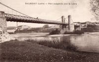
Balbigny, Loire, France - Loire River
| Bridgemeister ID: | 1777 (added 2005-04-22) |
| Year Completed: | 1839 |
| Name: | Balbigny |
| Location: | Balbigny, Loire, France |
| Crossing: | Loire River |
| References: | AAJ |
| Use: | Vehicular |
| Status: | Destroyed, 1940 |
| Suspended Spans: | 2 |
External Links:
Image Sets:
1839: Basse-Chaîne
Angers, Maine-et-Loire, France - Maine River
| Bridgemeister ID: | 993 (added 2003-11-16) |
| Year Completed: | 1839 |
| Name: | Basse-Chaîne |
| Also Known As: | Angers |
| Location: | Angers, Maine-et-Loire, France |
| Crossing: | Maine River |
| Principals: | Joseph Chaley |
| References: | AAJ, GHD, HBE, PTS2 |
| Status: | Collapsed, 1850 |
| Main Cables: | Wire (iron) |
| Suspended Spans: | 1 |
| Main Span: | 1 x 10² meters (334.66 feet) |
| Deck width: | 23.62 feet |
Notes:
- Collapsed under weight of maching troops, April 16, 1850, killing more than 200 soldiers. Collapse precipitated French virtual moratorium on suspension bridge building bringing to a close the prolific era of French wire cable suspension bridges.
External Links:
Image Sets:
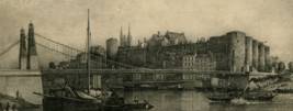
1839: Belleperche
Cordes-Tolosannes, Tarn-et-Garonne, France - Garonne River
| Bridgemeister ID: | 2101 (added 2006-07-23) |
| Year Completed: | 1839 |
| Name: | Belleperche |
| Location: | Cordes-Tolosannes, Tarn-et-Garonne, France |
| Crossing: | Garonne River |
| Coordinates: | 43.995722 N 1.125750 E |
| Maps: | Acme, GeoHack, Google, OpenStreetMap |
| Use: | Vehicular (one-lane) |
| Status: | Removed |
Notes:
- Later at same location 1941 Belleperche - Cordes-Tolosannes, Tarn-et-Garonne, France.
- All past and present bridges at this location.
External Links:
Image Sets:
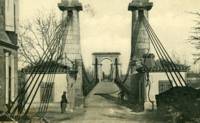
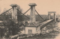
1839: Builth Wells
Builth Wells, Wales, United Kingdom - River Irfon
| Bridgemeister ID: | 1916 (added 2005-10-09) |
| Year Completed: | 1839 |
| Name: | Builth Wells |
| Location: | Builth Wells, Wales, United Kingdom |
| Crossing: | River Irfon |
| Coordinates: | 52.153074 N 3.414589 W |
| Maps: | Acme, GeoHack, Google, OpenStreetMap |
| Use: | Footbridge |
| Status: | Removed, 1983 |
Notes:
- Replaced by a stayed footbridge, opened 1984.
- See 1922 Llanstephan - Llanstephan, Wales, United Kingdom. This small vehicular bridge in nearby Llanstephan is sometimes misattributed as being located at Builth Wells. It is not.
Image Sets:
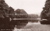
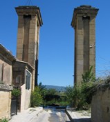
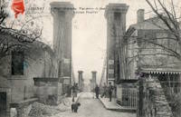
1839: Cadenet
Cadenet, Vaucluse and Bouches-du-Rhône, France - Durance River
| Bridgemeister ID: | 1008 (added 2003-11-21) |
| Year Completed: | 1839 |
| Name: | Cadenet |
| Location: | Cadenet, Vaucluse and Bouches-du-Rhône, France |
| Crossing: | Durance River |
| Coordinates: | 43.712117 N 5.365317 E |
| Maps: | Acme, GeoHack, Google, OpenStreetMap |
| Principals: | Adolphe Boulland |
| References: | AAJ |
| Use: | Vehicular |
| Status: | Only towers remain (last checked: 2005) |
Notes:
- Damaged by flood 1843, closed until 1844, destroyed 1944. Towers still standing, 2005.
External Links:
Image Sets:
1839: Caille
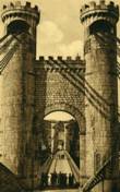
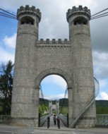
Allonzier-La-Caille vicinity, Haute-Savoie, France - Usses Torrent
| Bridgemeister ID: | 859 (added 2003-08-09) |
| Year Completed: | 1839 |
| Name: | Caille |
| Also Known As: | Charles-Albert |
| Location: | Allonzier-La-Caille vicinity, Haute-Savoie, France |
| Crossing: | Usses Torrent |
| Coordinates: | 46.0126 N 6.111633 E |
| Maps: | Acme, GeoHack, Google, OpenStreetMap |
| Principals: | E. Belin |
| References: | AAJ, BPF, PTS2 |
| Use: | Vehicular |
| Status: | Restricted to foot traffic (last checked: 2019) |
| Main Cables: | Wire (iron) |
| Suspended Spans: | 1 |
| Main Span: | 1 x 192 meters (629.9 feet) |
External Links:
Image Sets:
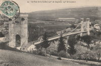
1839: Coudette
Peyrehorade, Landes, France - Gave de Pau River
| Bridgemeister ID: | 2310 (added 2007-05-02) |
| Year Completed: | 1839 |
| Name: | Coudette |
| Location: | Peyrehorade, Landes, France |
| Crossing: | Gave de Pau River |
| Use: | Vehicular (one-lane) |
| Status: | Replaced |
| Main Cables: | Wire (iron) |
| Suspended Spans: | 1 |
Image Sets:
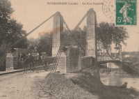
1839: Cournon
Pérignat-sur-Allier and Cournon-d'Auvergne, Puy-de-Dôme, France - Allier River
| Bridgemeister ID: | 1726 (added 2005-04-05) |
| Year Completed: | 1839 |
| Name: | Cournon |
| Location: | Pérignat-sur-Allier and Cournon-d'Auvergne, Puy-de-Dôme, France |
| Crossing: | Allier River |
| Coordinates: | 45.729820 N 3.213100 E |
| Maps: | Acme, GeoHack, Google, OpenStreetMap |
| Use: | Vehicular (one-lane), with walkway |
| Status: | Removed |
| Main Cables: | Wire (iron) |
| Suspended Spans: | 1 |
Image Sets:
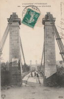
1839: Hameln
Hameln, Niedersachsen, Germany - Weser River
| Bridgemeister ID: | 2298 (added 2007-04-26) |
| Year Completed: | 1839 |
| Name: | Hameln |
| Location: | Hameln, Niedersachsen, Germany |
| Crossing: | Weser River |
| Coordinates: | 52.101511 N 9.351547 E |
| Maps: | Acme, GeoHack, Google, OpenStreetMap |
| Principals: | Georg Theodor Wendelstadt |
| References: | AAJ, PTS2 |
| Use: | Vehicular |
| Status: | Dismantled, c. 1890s |
| Main Cables: | Chain (iron) |
| Main Spans: | 2 |
Notes:
- Replaced in the 1890s by a (likely) cantilever bridge having the general shape of a suspension bridge.
- AAJ writes: "the first use of triangular bracing between double chain cables" and mentions that it was dismantled and moved to Hessisch Oldendorf 1880-1890 or 1899. Most accounts suggest the bridge was reassembled in the 1898-1899 time frame.
- Moved to 1899 Weserbrücke - Hessisch Oldendorf and Fuhlen, Germany.
External Links:
Image Sets:
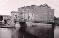
1839: Kettenbrücke
Aarburg, Switzerland - Aare River
| Bridgemeister ID: | 7844 (added 2023-09-04) |
| Year Completed: | 1839 |
| Name: | Kettenbrücke |
| Location: | Aarburg, Switzerland |
| Crossing: | Aare River |
| Coordinates: | 47.320377 N 7.898142 E |
| Maps: | Acme, GeoHack, Google, OpenStreetMap |
| Use: | Vehicular |
| Status: | Replaced, c. 1911 |
| Suspended Spans: | 1 |
Image Sets:
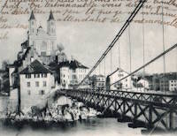
1839: L'Hôtel Dieu
Lyon, Métropole de Lyon, France - Rhône River
| Bridgemeister ID: | 966 (added 2003-11-01) |
| Year Completed: | 1839 |
| Name: | L'Hôtel Dieu |
| Location: | Lyon, Métropole de Lyon, France |
| Crossing: | Rhône River |
| Principals: | Clauzel |
| References: | AAJ, PQL |
| Use: | Vehicular |
| Status: | Demolished, 1912 |
| Main Cables: | Wire (iron) |
Notes:
- Was at location of present-day Pont Wilson.
- Rebuilt, 1850.
- Near 1845 College (Collège) - Lyon, Métropole de Lyon, France.
External Links:
Image Sets:
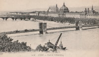
1839: Laer Castle
Meschede vicinity, North Rhine-Westphalia, Germany - Ruhr River
| Bridgemeister ID: | 2237 (added 2007-03-19) |
| Year Completed: | 1839 |
| Name: | Laer Castle |
| Also Known As: | Schlosspark Laer |
| Location: | Meschede vicinity, North Rhine-Westphalia, Germany |
| Crossing: | Ruhr River |
| Coordinates: | 51.349452 N 8.256528 E |
| Maps: | Acme, GeoHack, Google, OpenStreetMap |
| Principals: | A. Bruns |
| Use: | Footbridge |
| Status: | In use (last checked: 2021) |
| Main Cables: | Eyebar (iron) |
| Suspended Spans: | 1 |
| Main Span: | 1 x 28.14 meters (92.3 feet) |
| Deck width: | 1.85 meters |
External Links:
1839: Lisle-sur-Tarn
Lisle-sur-Tarn, Tarn, France - Tarn River
| Bridgemeister ID: | 4556 (added 2020-06-01) |
| Year Completed: | 1839 |
| Name: | Lisle-sur-Tarn |
| Also Known As: | L'Isle-sur-Tarn |
| Location: | Lisle-sur-Tarn, Tarn, France |
| Crossing: | Tarn River |
| Coordinates: | 43.851028 N 1.812759 E |
| Maps: | Acme, GeoHack, Google, OpenStreetMap |
| Use: | Vehicular |
| Status: | Removed |
| Main Cables: | Wire |
| Suspended Spans: | 1 |
External Links:
Image Sets:

1839: Loyettes
Loyettes, Ain and Isère, France - Rhône River
| Bridgemeister ID: | 2334 (added 2007-07-09) |
| Year Completed: | 1839 |
| Name: | Loyettes |
| Location: | Loyettes, Ain and Isère, France |
| Crossing: | Rhône River |
| Coordinates: | 45.772075 N 5.205653 E |
| Maps: | Acme, GeoHack, Google, OpenStreetMap |
| Use: | Vehicular |
| Status: | Replaced, 1940 |
| Main Cables: | Wire (iron) |
| Suspended Spans: | 2 |
| Main Spans: | 2 |
Image Sets:
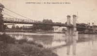
1839: Manosque
Manosque, Alpes-de-Haute-Provence, France - Durance River
| Bridgemeister ID: | 2001 (added 2005-12-26) |
| Year Completed: | 1839 |
| Name: | Manosque |
| Location: | Manosque, Alpes-de-Haute-Provence, France |
| Crossing: | Durance River |
| References: | AAJ |
| Use: | Vehicular |
| Status: | Replaced |
Notes:
- Heavily damaged by flood debris, 1843.
- Later at same location 1939 Manosque - Manosque, Alpes-de-Haute-Provence, France.
- All past and present bridges at this location.
External Links:
Image Sets:
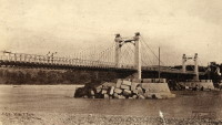
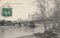
1839: Neuville-sur-Oise
Neuville-sur-Oise, Val-d'Oise, France - Oise River
| Bridgemeister ID: | 2081 (added 2006-06-10) |
| Year Completed: | 1839 |
| Name: | Neuville-sur-Oise |
| Location: | Neuville-sur-Oise, Val-d'Oise, France |
| Crossing: | Oise River |
| Use: | Vehicular |
| Status: | Removed |
Image Sets:
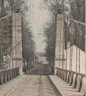

1839: Port-à-Binson
Port-à-Binson, Marne, France - Marne River
| Bridgemeister ID: | 2057 (added 2006-06-03) |
| Year Completed: | 1839 |
| Name: | Port-à-Binson |
| Location: | Port-à-Binson, Marne, France |
| Crossing: | Marne River |
| Principals: | Seguin Brothers |
| Use: | Vehicular |
| Status: | Destroyed, 1910s |
| Main Cables: | Wire (iron) |
| Suspended Spans: | 1 |
| Main Span: | 1 |
Image Sets:
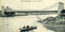
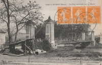
1839: Roche-Bernard
La Roche-Bernard, Morbihan, France - Vilaine River
| Bridgemeister ID: | 1027 (added 2003-11-22) |
| Year Completed: | 1839 |
| Name: | Roche-Bernard |
| Location: | La Roche-Bernard, Morbihan, France |
| Crossing: | Vilaine River |
| Coordinates: | 47.524972 N 2.304944 W |
| Maps: | Acme, GeoHack, Google, OpenStreetMap |
| Principals: | P. Leblanc |
| References: | AAJ, HBE, PTS2 |
| Use: | Vehicular |
| Status: | Replaced, 1911 |
| Main Cables: | Wire (iron) |
| Suspended Spans: | 1 |
| Main Span: | 1 x 198 meters (649.6 feet) |
Notes:
- Wrecked by wind 1852, rebuilt, damaged 1866, 1869, 1870, and 1871. After the 1871 repairs, it was restricted to foot traffic. It was replaced in 1911 by an arch. Approaches still extant next to the later suspension bridge as of 2004.
- Later at same location 1960 Roche-Bernard - La Roche-Bernard, Morbihan, France.
- All past and present bridges at this location.
External Links:
Image Sets:
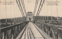
1839: Saint André-de-Cubzac
Saint André-de-Cubzac, Gironde, France - Dordogne River
| Bridgemeister ID: | 550 (added before 2003) |
| Year Completed: | 1839 |
| Name: | Saint André-de-Cubzac |
| Also Known As: | Cubzac |
| Location: | Saint André-de-Cubzac, Gironde, France |
| Crossing: | Dordogne River |
| Coordinates: | 44.962000 N 0.461444 W |
| Maps: | Acme, GeoHack, Google, OpenStreetMap |
| Principals: | Marie Fortuné de Vergès, Emil Martin |
| References: | AAJ, HBE, PTS2 |
| Use: | Vehicular |
| Status: | Destroyed, 1869 |
| Main Cables: | Wire (iron) |
| Suspended Spans: | 5 |
| Main Spans: | 5 x 10⁹ meters (357.6 feet) |
| Deck width: | 23 feet |
Notes:
- This is perhaps one of the most fanciful large suspension bridges ever built.
- Destroyed in a storm, 1869. Its replacement (a truss bridge) was completed in 1883. The approaches and the bottom halves of the suspension bridge towers were strengthened and used for the replacement.
- AAJ citing Engineering News-Record: "Vergès used inclined tie cables running from the top of the tower at one end of a span to a roadway-level connection on the opposite tower."
External Links:
- Structurae - Cubzac Bridge. Photos of the replacement truss structure.
- Structurae - Structure ID 20000898
Image Sets:
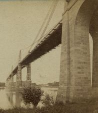

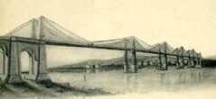
1839: Saint-Gervais
Saint-Gervais and L'Albenc, Isère, France - Isère River
| Bridgemeister ID: | 1753 (added 2005-04-20) |
| Year Completed: | 1839 |
| Name: | Saint-Gervais |
| Location: | Saint-Gervais and L'Albenc, Isère, France |
| Crossing: | Isère River |
| Coordinates: | 45.207083 N 5.465333 E |
| Maps: | Acme, GeoHack, Google, OpenStreetMap |
| Principals: | Escarraguel Brothers |
| Use: | Vehicular |
| Status: | Only towers remain, since 1940 (last checked: 2022) |
| Suspended Spans: | 1 |
| Main Span: | 1 x 93 meters (305.1 feet) |
Notes:
- 1940: Destroyed during WWII.
Image Sets:
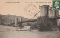
1839: Teil
Le Teil, Ardèche and Montélimar, Drôme, France - Rhône River
| Bridgemeister ID: | 1733 (added 2005-04-06) |
| Year Completed: | 1839 |
| Name: | Teil |
| Location: | Le Teil, Ardèche and Montélimar, Drôme, France |
| Crossing: | Rhône River |
| Coordinates: | 44.552213 N 4.691909 E |
| Maps: | Acme, GeoHack, Google, OpenStreetMap |
| References: | AAJ |
| Status: | Replaced, 1931 |
| Main Cables: | Wire (iron) |
| Suspended Spans: | 4 |
| Main Spans: | 4 |
| Deck width: | 19.68 feet |
Notes:
- Damaged by flood, 1840. Rebuilt and reopened, 1843. Damaged by floods, 1856 and 1881.
- Replaced by 1931 Teil - Le Teil, Ardèche and Montélimar, Drôme, France.
- All past and present bridges at this location.
External Links:
- Pont routier du Teil - Inventaire Général du Patrimoine Culturel. Detailed history and many images of the suspension bridges at Le Teil.
Image Sets:
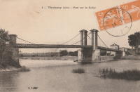
1839: Thoissey
Thoissey, Ain and Dracé, Rhône, France - Saône River
| Bridgemeister ID: | 5643 (added 2020-12-30) |
| Year Completed: | 1839 |
| Name: | Thoissey |
| Location: | Thoissey, Ain and Dracé, Rhône, France |
| Crossing: | Saône River |
| Coordinates: | 46.165206 N 4.789349 E |
| Maps: | Acme, GeoHack, Google, OpenStreetMap |
| References: | AAJ |
| Use: | Vehicular |
| Status: | Removed |
| Main Cables: | Wire (iron) |
| Suspended Spans: | 2 |
| Main Spans: | 2 |
Notes:
- Various sources suggest completed 1837-1839. The bridge may have initially failed upon its completion in 1837 and then opened in 1839.
Image Sets:
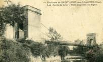
1840: Bigny
Saint-Loup-des-Chaumes and Bigny, Cher, France - Cher River
| Bridgemeister ID: | 2005 (added 2006-01-02) |
| Year Completed: | 1840 |
| Name: | Bigny |
| Location: | Saint-Loup-des-Chaumes and Bigny, Cher, France |
| Crossing: | Cher River |
| Coordinates: | 46.804972 N 2.371306 E |
| Maps: | Acme, GeoHack, Google, OpenStreetMap |
| Use: | Vehicular (one-lane) |
| Status: | Demolished, 1951 |
| Suspended Spans: | 1 |
External Links:
Image Sets:
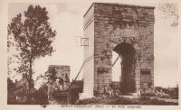
1840: Bono
Le Bono and Auray, Morbihan, France - Bono River
| Bridgemeister ID: | 997 (added 2003-11-16) |
| Year Completed: | 1840 |
| Name: | Bono |
| Location: | Le Bono and Auray, Morbihan, France |
| Crossing: | Bono River |
| Coordinates: | 47.640896 N 2.953463 W |
| Maps: | Acme, GeoHack, Google, OpenStreetMap |
| References: | BPF |
| Use: | Vehicular (one-lane) |
| Status: | Restricted to foot traffic (last checked: 2019) |
| Main Cables: | Wire (iron) |
| Suspended Spans: | 1 |
| Main Span: | 1 x 68.22 meters (223.8 feet) |
Notes:
- Located at the confluence of the Bono River with the Auray River.
- Substantial repairs 1859 and 1863, damaged by storm 1865, renovated 1867, traffic restricted 1869, more repairs 1869-1870, rebuilt 1925.
External Links:
Image Sets:
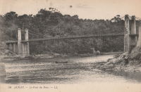
1840: Brignoud
Brignoud, Isère, France - Isère River
| Bridgemeister ID: | 2320 (added 2007-05-05) |
| Year Completed: | 1840 |
| Name: | Brignoud |
| Location: | Brignoud, Isère, France |
| Crossing: | Isère River |
| Use: | Vehicular |
| Status: | Removed |
Image Sets:
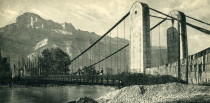
1840: Cordon
Brégnier-Cordon, Ain, France - Rhône River
| Bridgemeister ID: | 7050 (added 2022-05-26) |
| Year Completed: | 1840 |
| Name: | Cordon |
| Location: | Brégnier-Cordon, Ain, France |
| Crossing: | Rhône River |
| Use: | Vehicular |
| Status: | Destroyed, 1940 |
| Main Cables: | Wire |
Notes:
- Destroyed, 1940, during WWII.
Image Sets:
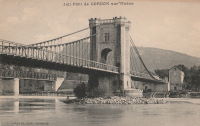
1840: Couzon
Couzon-au-Mont-d'Or and Rochetaillée-sur-Saône, Métropole de Lyon, France - Saône River
| Bridgemeister ID: | 1830 (added 2005-05-30) |
| Year Completed: | 1840 |
| Name: | Couzon |
| Location: | Couzon-au-Mont-d'Or and Rochetaillée-sur-Saône, Métropole de Lyon, France |
| Crossing: | Saône River |
| Coordinates: | 45.84503 N 4.83355 E |
| Maps: | Acme, GeoHack, Google, OpenStreetMap |
| Use: | Vehicular |
| Status: | In use (last checked: 2019) |
| Main Cables: | Wire |
| Suspended Spans: | 2 |
| Main Spans: | 2 |
External Links:
Image Sets:
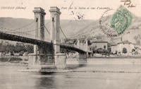
1840: Domène
Domène and Montbonnot-Saint-Martin, Isère, France - Isère River
| Bridgemeister ID: | 7573 (added 2023-04-16) |
| Year Completed: | 1840 |
| Name: | Domène |
| Location: | Domène and Montbonnot-Saint-Martin, Isère, France |
| Crossing: | Isère River |
| Coordinates: | 45.211855 N 5.829792 E |
| Maps: | Acme, GeoHack, Google, OpenStreetMap |
| Use: | Vehicular |
| Status: | Removed |
| Main Cables: | Wire (iron) |
| Main Span: | 1 |
External Links:
Image Sets:
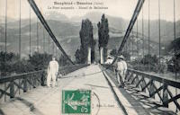
1840: Gotteron
Fribourg, Switzerland - Sarine River
| Bridgemeister ID: | 398 (added before 2003) |
| Year Completed: | 1840 |
| Name: | Gotteron |
| Location: | Fribourg, Switzerland |
| Crossing: | Sarine River |
| Principals: | Joseph Chaley |
| References: | AAJ, GHD, PTS2 |
| Use: | Vehicular |
| Status: | Removed |
| Main Cables: | Wire (iron) |
| Suspended Spans: | 1 |
| Main Span: | 1 x 220 meters (721.8 feet) |
Notes:
- 1919, May 9: An overloaded truck carrying logs causes the failure of several suspenders and collapse of a large section of the deck.
- Near 1834 Zaehringen (Grand Pont Suspendu) - Fribourg, Switzerland.
External Links:
Image Sets:
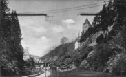
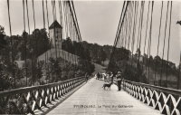
1840: La Gâche
Barraux and Pontcharra, Isère, France - Isère River
| Bridgemeister ID: | 7140 (added 2022-06-25) |
| Year Completed: | 1840 |
| Name: | La Gâche |
| Location: | Barraux and Pontcharra, Isère, France |
| Crossing: | Isère River |
| Coordinates: | 45.434917 N 6.004250 E |
| Maps: | Acme, GeoHack, Google, OpenStreetMap |
| Use: | Vehicular |
| Status: | Removed |
| Main Cables: | Wire |
| Suspended Spans: | 1 |
| Main Span: | 1 |
External Links:
Image Sets:
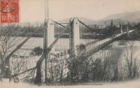
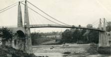
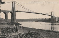
1840: Lézardrieux
Lézardrieux, Côtes-d'Armor, France - Trieux River
| Bridgemeister ID: | 1116 (added 2004-01-05) |
| Year Completed: | 1840 |
| Name: | Lézardrieux |
| Location: | Lézardrieux, Côtes-d'Armor, France |
| Crossing: | Trieux River |
| Coordinates: | 48.780778 N 3.106222 W |
| Maps: | Acme, GeoHack, Google, OpenStreetMap |
| Principals: | Seguin Brothers |
| References: | AAJ, PTS2 |
| Use: | Vehicular (one-lane) |
| Status: | Replaced, 1925 |
| Main Cables: | Wire (iron) |
| Suspended Spans: | 1 |
| Main Span: | 1 x 150 meters (492.1 feet) |
Notes:
- 1925: Replaced by a Gisclard suspension bridge reusing the approach spans and piers of the 1840 suspension bridge.
External Links:
Image Sets:
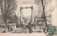
| Bridgemeister ID: | 5663 (added 2021-01-01) |
| Year Completed: | 1840 |
| Name: | Maria Teresa |
| Location: | Turin, Italy |
| Crossing: | Po River |
| Coordinates: | 45.058161 N 7.692020 E |
| Maps: | Acme, GeoHack, Google, OpenStreetMap |
| Use: | Vehicular (one-lane) |
| Status: | Removed, c. 1907 |
| Main Cables: | Wire (iron) |
| Suspended Spans: | 1 |
Notes:
- Replaced by the current (2020) Ponte Umberto I.
External Links:
Image Sets:
1840: Montjean-sur-Loire
Montjean-sur-Loire, Maine-et-Loire, France - Loire River
| Bridgemeister ID: | 1780 (added 2005-04-23) |
| Year Completed: | 1840 |
| Name: | Montjean-sur-Loire |
| Location: | Montjean-sur-Loire, Maine-et-Loire, France |
| Crossing: | Loire River |
| Coordinates: | 47.394880 N 0.859161 W |
| Maps: | Acme, GeoHack, Google, OpenStreetMap |
| References: | AAJ |
| Use: | Vehicular |
| Status: | Replaced, 1927 |
| Main Cables: | Wire (iron) |
Notes:
- Replaced by 1927 Montjean-sur-Loire - Montjean-sur-Loire, Maine-et-Loire, France.
- All past and present bridges at this location.
Image Sets:
Do you have any information or photos for these bridges that you would like to share? Please email david.denenberg@bridgemeister.com.
Mail | Facebook | X (Twitter) | Bluesky
