Suspension Bridges 1884-1909 (1-100 of 277)
This is a list of bridges 1 through 100 (of 277 total) in the suspension bridge inventory completed from 1884 through 1909, the year the Manhattan Bridge was completed. Wherever you see a Bridgemeister ID number click it to isolate the bridge on its own page.
Related Lists:
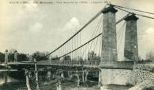
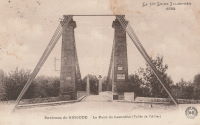
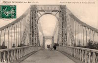
1884: Lamothe
Lamothe and Brioude, Haute-Loire, France - Allier River
| Bridgemeister ID: | 1764 (added 2005-04-22) |
| Year Completed: | 1884 |
| Name: | Lamothe |
| Location: | Lamothe and Brioude, Haute-Loire, France |
| Crossing: | Allier River |
| Coordinates: | 45.302968 N 3.406201 E |
| Maps: | Acme, GeoHack, Google, OpenStreetMap |
| References: | PTS2 |
| Use: | Vehicular |
| Status: | Only towers remain, since 1977 (last checked: 2019) |
| Main Cables: | Wire |
| Suspended Spans: | 1 |
| Main Span: | 1 |
Notes:
- Next to 1834 Lamothe - Lamothe and Brioude, Haute-Loire, France. In 1866, a flood caused a major change in the course of the Allier River such that the main channel no longer flowed under the older bridge. The newer bridge crossed the main channel of the Allier just slightly east of the older bridge.
- All past and present bridges at this location.
External Links:
Image Sets:
1884: McKeesport-Reynoldton
McKeesport, Pennsylvania, USA - Youghiogheny River
| Bridgemeister ID: | 90 (added before 2003) |
| Year Completed: | 1884 |
| Name: | McKeesport-Reynoldton |
| Also Known As: | Third Avenue |
| Location: | McKeesport, Pennsylvania, USA |
| Crossing: | Youghiogheny River |
| Coordinates: | 40.352359 N 79.870561 W |
| Maps: | Acme, GeoHack, Google, OpenStreetMap |
| Principals: | McKeesport and Reynoldton Bridge Co. |
| References: | AAJ, HAERPA461 |
| Use: | Rail (streetcar) and Vehicular |
| Status: | Dismantled, 1961 |
| Main Cables: | Wire (steel) |
| Suspended Spans: | 3 |
| Main Span: | 1 x 97.5 meters (320 feet) |
| Side Spans: | 2 x 48.8 meters (160 feet) |
Notes:
- 1896: Reconstructed by Hermann Laub
External Links:
1884: North Side
Pittsburgh, Pennsylvania, USA - Allegheny River
| Bridgemeister ID: | 91 (added before 2003) |
| Year Completed: | 1884 |
| Name: | North Side |
| Also Known As: | Seventh Street |
| Location: | Pittsburgh, Pennsylvania, USA |
| Crossing: | Allegheny River |
| Coordinates: | 40.445972 N 80.001361 W |
| Maps: | Acme, GeoHack, Google, OpenStreetMap |
| Principals: | Gustav Lindenthal |
| References: | AAJ, BPL, HBE, PBR, PTS2 |
| Use: | Vehicular |
| Status: | Removed, 1924 |
| Main Cables: | Eyebar |
| Suspended Spans: | 4 |
| Main Spans: | 2 x 97.5 meters (320 feet) |
| Side Spans: | 2 x 50.3 meters (165 feet) |
| Deck width: | 42 feet |
Notes:
- Next to 1860 Allegheny River (Sixth Street, St. Clair) - Pittsburgh, Pennsylvania, USA.
- Replaced by 1926 Andy Warhol (Seventh Street) - Pittsburgh, Pennsylvania, USA.
- All past and present bridges at this location.
External Links:
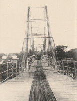
1884: Real
Girardot, Colombia - Magdalena River
| Bridgemeister ID: | 3606 (added 2019-12-31) |
| Year Completed: | 1884 |
| Name: | Real |
| Also Known As: | Royal |
| Location: | Girardot, Colombia |
| Crossing: | Magdalena River |
| Coordinates: | 4.288316 N 74.808793 W |
| Maps: | Acme, GeoHack, Google, OpenStreetMap |
| Use: | Vehicular, with walkway |
| Status: | Collapsed |
| Main Cables: | Wire |
Notes:
- Coordinates provided are for the 1950 replacement bridge which is assumed to be the approximate location of the earlier bridge.
- Replaced by 1950 Ospina Perez - Girardot, Colombia.
- All past and present bridges at this location.
Image Sets:
1884: Spring Street
Charleston, West Virginia, USA - Elk River
| Bridgemeister ID: | 1427 (added 2004-07-24) |
| Year Completed: | 1884 |
| Name: | Spring Street |
| Also Known As: | Virginia Street |
| Location: | Charleston, West Virginia, USA |
| Crossing: | Elk River |
| Coordinates: | 38.358306 N 81.627444 W |
| Maps: | Acme, GeoHack, Google, OpenStreetMap |
| References: | AAJ, HBE, PTS2 |
| Use: | Vehicular and Rail (streetcar) |
| Status: | Removed |
| Main Cables: | Wire |
| Main Span: | 1 x 83.2 meters (273 feet) |
Notes:
- Originally crossed the Elk River at Virginia Street. The bridge was dismantled and erected at Sprint Street a bit. The 1884 year of completion may represent the relocation to Spring Street and not the original construction at Virginia Street.
- AAJ: Repaired by William Hildenbrand a few years after completion.
- Near 1852 Charleston (Lovell Street) - Charleston, West Virginia, USA.
External Links:
- Spring Street Bridge - mywvhome.com. Images and history of the bridge.
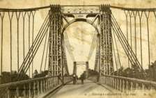
1884: Tonnay-Charente
Tonnay-Charente, Charente-Maritime, France - Charente River
| Bridgemeister ID: | 7337 (added 2022-09-04) |
| Year Completed: | 1884 |
| Name: | Tonnay-Charente |
| Location: | Tonnay-Charente, Charente-Maritime, France |
| Crossing: | Charente River |
| Coordinates: | 45.940048 N 0.886059 W |
| Maps: | Acme, GeoHack, Google, OpenStreetMap |
| Use: | Vehicular |
| Status: | Replaced, 1934 |
| Main Cables: | Wire |
| Suspended Spans: | 3 |
| Main Span: | 1 x 90 meters (295.3 feet) |
| Side Spans: | 2 |
Notes:
- Replaced 1842 Tonnay-Charente - Tonnay-Charente, Charente-Maritime, France.
- Replaced by 1934 Tonnay-Charente - Tonnay-Charente, Charente-Maritime, France.
- All past and present bridges at this location.
External Links:
Image Sets:
1885: Abergeldie Castle
Balmoral vicinity, Scotland, United Kingdom - River Dee
| Bridgemeister ID: | 1705 (added 2005-03-29) |
| Year Completed: | 1885 |
| Name: | Abergeldie Castle |
| Location: | Balmoral vicinity, Scotland, United Kingdom |
| Crossing: | River Dee |
| Coordinates: | 57.043806 N 3.176197 W |
| Maps: | Acme, GeoHack, Google, OpenStreetMap |
| Principals: | Blaikie Brothers |
| References: | AAJ, HBR |
| Use: | Footbridge |
| Status: | Derelict (last checked: 2016) |
| Main Cables: | Wire |
| Suspended Spans: | 1 |
Notes:
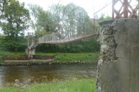
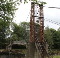
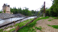
- William Craig describes the bridge, "A wood and angle iron deck supported from two pairs of wire cables and rod suspenders. The railings are of light woven wire. Pylons with ornamental heads are of lattice gider construction on concrete bases five miles west of Ballater, Scotland."
- Was already derelict before December 2015 flooding (Storm Frank) that severely damaged several River Dee bridges. Dave Cooper writes in early 2016: "The bridge's southern tower and its base are gone. The river bank has eroded back to within feet of the grade one listed Abergeldie Castle. Seat of Baron Abergeldie."
External Links:
Image Sets:


1885: Argenbrücke Achberg
Flunau, Achberg vicinity and Blumegg, Baden-Württemberg, Germany - Argen River
| Bridgemeister ID: | 2242 (added 2007-03-28) |
| Year Completed: | 1885 |
| Name: | Argenbrücke Achberg |
| Location: | Flunau, Achberg vicinity and Blumegg, Baden-Württemberg, Germany |
| Crossing: | Argen River |
| Coordinates: | 47.632307 N 9.710757 E |
| Maps: | Acme, GeoHack, Google, OpenStreetMap |
| Use: | Footbridge |
| Status: | In use (last checked: 2019) |
| Main Cables: | Wire |
| Suspended Spans: | 1 |
| Main Span: | 1 x 48.6 meters (159.4 feet) |
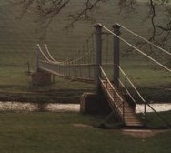
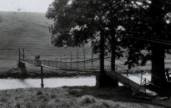
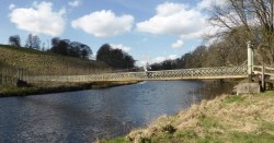
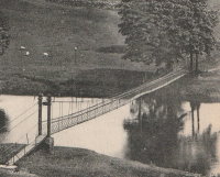
1885: Hebden
Hebden, England, United Kingdom - River Wharfe
| Bridgemeister ID: | 1340 (added 2004-05-02) |
| Year Completed: | 1885 |
| Name: | Hebden |
| Location: | Hebden, England, United Kingdom |
| Crossing: | River Wharfe |
| Coordinates: | 54.057126 N 1.962584 W |
| Maps: | Acme, GeoHack, Google, OpenStreetMap |
| Principals: | William Bell |
| Use: | Footbridge |
| Status: | In use (last checked: 2014) |
| Main Cables: | Wire |
| Suspended Spans: | 1 |
Notes:
- Refurbished, 1989.
- John Gardner writes that William Bell was the village blacksmith and that the bridge once had an unusual mid-span support pillar. John writes: "It is not known when [the pillar] was dismantled, but the bottom section (you can see the dividing flange in the linked picture) can still be seen in normal water conditions."
- John Gardner later added: "[the bridge] was badly damaged by floods on December 14th 1936. It was reconstructed with the span a little higher, which was when the supporting pillar was removed."
Image Sets:
1885: Hope River Stock
Glynn Wye, North Canterbury, New Zealand - Hope River
| Bridgemeister ID: | 670 (added 2003-03-08) |
| Year Completed: | 1885 |
| Name: | Hope River Stock |
| Location: | Glynn Wye, North Canterbury, New Zealand |
| Crossing: | Hope River |
| Coordinates: | 42.588804 S 172.510846 E |
| Maps: | Acme, GeoHack, Google, OpenStreetMap |
| Principals: | J. & A. Anderson Ltd. |
| References: | GAP |
| Use: | Footbridge and Stock |
| Status: | Derelict (last checked: 2019) |
| Main Cables: | Wire |
| Suspended Spans: | 1 |
| Main Span: | 1 x 75.3 meters (247 feet) |
Notes:
- GAP: Collapsed late 20th century.
External Links:
Image Sets:
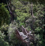
1885: Sutton
Sutton vicinity and Middlemarch vicinity, New Zealand - Taieri River
| Bridgemeister ID: | 669 (added 2003-03-08) |
| Year Completed: | 1885 |
| Name: | Sutton |
| Location: | Sutton vicinity and Middlemarch vicinity, New Zealand |
| Crossing: | Taieri River |
| Coordinates: | 45.575599 S 170.131762 E |
| Maps: | Acme, GeoHack, Google, OpenStreetMap |
| Principals: | Bain |
| References: | GAP |
| Use: | Vehicular (one-lane) |
| Status: | Dismantled, October, 2017 (last checked: 2017) |
| Main Cables: | Wire |
| Suspended Spans: | 1 |
| Main Span: | 1 x 44 meters (144.4 feet) estimated |
Notes:
- Wrecked by flood, July 2017. Dismantled, October 2017
External Links:
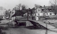
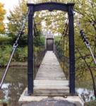
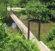
1885: Swinging
Frederick, Maryland, USA - Carroll Creek
| Bridgemeister ID: | 253 (added before 2003) |
| Year Completed: | 1885 |
| Name: | Swinging |
| Location: | Frederick, Maryland, USA |
| Crossing: | Carroll Creek |
| At or Near Feature: | Baker Park |
| Coordinates: | 39.415033 N 77.4208 W |
| Maps: | Acme, GeoHack, Google, OpenStreetMap |
| Principals: | Buckey and Firestone |
| Use: | Footbridge |
| Status: | In use (last checked: 2022) |
| Main Cables: | Wire |
| Suspended Spans: | 1 |
Notes:
- Local legend states this bridge was used by Stonewall Jackson and his troops when they entered Frederick on September 10, 1862. Some sources state the bridge was constructed in 1875. The Maryland Inventory of Historic Properties states it was constructed in 1885 and includes a detailed chronology of the events of 1885 leading to its construction.
- c. 1928: The bridge is relocated from Bentz Street (then Mill Alley) to nearby Baker Park. Some sources indicate it was relocated twice to different locations within Baker Park).
- 2008, March: Closed due to safety concerns. Eventually reopened.
- Near 2006 William O. Lee (Carroll Creek Park) - Frederick, Maryland, USA.
External Links:
- Baker Park - Maryland Historic District. States bridge was built in 1875.
- Maryland Inventory of Historic Properties - Swinging Bridge
- Bridgehunter.com - BH63316
- Structurae - Structure ID 20011117
Image Sets:
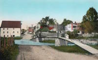
1886: (footbridge)
Huttons Ambo, North Yorkshire, England, United Kingdom - River Derwent
| Bridgemeister ID: | 417 (added before 2003) |
| Year Completed: | 1886 |
| Name: | (footbridge) |
| Location: | Huttons Ambo, North Yorkshire, England, United Kingdom |
| Crossing: | River Derwent |
| Coordinates: | 54.09975 N 0.8311 W |
| Maps: | Acme, GeoHack, Google, OpenStreetMap |
| References: | NTB |
| Use: | Footbridge |
| Status: | In use (last checked: 2014) |
| Main Cables: | Wire |
| Suspended Spans: | 1 |
| Main Span: | 1 x 29 meters (95 feet) |
Image Sets:
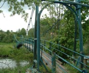
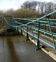
1886: Blairgowrie
Blairgowrie, Scotland, United Kingdom - River Ericht
| Bridgemeister ID: | 2181 (added 2007-01-13) |
| Year Completed: | 1886 |
| Name: | Blairgowrie |
| Location: | Blairgowrie, Scotland, United Kingdom |
| Crossing: | River Ericht |
| At or Near Feature: | Craighall Castle |
| Principals: | Louis Harper |
| References: | HARPER |
| Use: | Footbridge |
| Status: | Removed |
| Main Cables: | Wire |
| Suspended Spans: | 1 |
| Main Span: | 1 x 27.4 meters (89.9 feet) |
Notes:
- HARPER: Some remnants of the bridge still present, 2006.
External Links:
1886: Lower
Easton, Pennsylvania, USA - Lehigh River
| Bridgemeister ID: | 813 (added 2003-05-29) |
| Year Completed: | 1886 |
| Name: | Lower |
| Location: | Easton, Pennsylvania, USA |
| Crossing: | Lehigh River |
| Coordinates: | 40.683778 N 75.223472 W |
| Maps: | Acme, GeoHack, Google, OpenStreetMap |
| References: | DSL20030414, WGE20030513 |
| Use: | Footbridge |
| Status: | Demolished, 1951 |
| Main Cables: | Wire |
| Suspended Spans: | 2 |
| Main Spans: | 1 x 158.5 meters (520 feet), 1 x 136.7 meters (448.6 feet) |
Notes:
- Damaged by windstorm 1950.
- From WGE20030513 (email from Lance Metz to Wayne Grodkiewicz): "Crossed the Lehigh at 10th street in Easton and went to the Lehigh Valley Railroad Shops in South Easton. This bridge was erected in 1886 and it cost a penny to walk across it. The bridge was over 1,020 feet in length and 128 feet above the Lehigh River and canal. Its cables were suspended from two steel towers. It remained in use until 1950 when it was damaged by a windstorm. It was demolished in 1951." It appears the bridge was actually closer to the alignment of 11th street than 10th street, terminating near the present-day playground southwest of the corner of Elm and South Warren streets.
- Near 1900 Upper - Easton, Pennsylvania, USA.
External Links:
- YouTube - Easton Pa & Walking Bridge over Lehigh River 1940s. Starting from 1:13, film of the derelict bridge supposedly in the 1940s but may reflect the windstorm damage of 1950.
Image Sets:
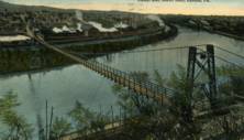
1886: Pescadero Ituango
Ituango, Antioquia, Colombia - Cauca River
| Bridgemeister ID: | 7637 (added 2023-05-28) |
| Year Completed: | 1886 |
| Name: | Pescadero Ituango |
| Location: | Ituango, Antioquia, Colombia |
| Crossing: | Cauca River |
| Coordinates: | 7.088510 N 75.694706 W |
| Maps: | Acme, GeoHack, Google, OpenStreetMap |
| Principals: | José María Villa |
| Use: | Footbridge and Vehicular |
| Status: | Removed |
| Main Cables: | Wire |
| Suspended Spans: | 1 |
Notes:
- 1963: Replaced by Puente Juan de la Cruz Posada
- 2018: Former location of both bridges completely inundated behind the Pescadero-Ituango dam.
External Links:
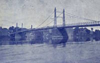
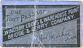
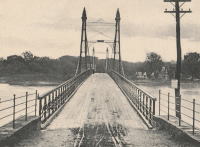
1886: Windsor Locks
Windsor Locks and Warehouse Point, Connecticut, USA - Connecticut River
| Bridgemeister ID: | 306 (added before 2003) |
| Year Completed: | 1886 |
| Name: | Windsor Locks |
| Also Known As: | Bridge Street |
| Location: | Windsor Locks and Warehouse Point, Connecticut, USA |
| Crossing: | Connecticut River |
| Coordinates: | 41.929111 N 72.624167 W |
| Maps: | Acme, GeoHack, Google, OpenStreetMap |
| Principals: | James Shipman |
| References: | AAJ, PTS2 |
| Use: | Vehicular (one-lane) |
| Status: | Removed, c. 1921 |
| Main Cables: | Wire |
| Suspended Spans: | 3 |
| Main Span: | 1 x 167.6 meters (550 feet) |
| Side Spans: | 2 x 91.4 meters (300 feet) |
Notes:
- 1921: Replacement multi-span truss bridge completed. Unclear when the suspension bridge was removed.
External Links:
Image Sets:
1887: (footbridge)
Offord, England, United Kingdom - Great Northern Railway track
| Bridgemeister ID: | 5084 (added 2020-09-04) |
| Year Completed: | 1887 |
| Name: | (footbridge) |
| Location: | Offord, England, United Kingdom |
| Crossing: | Great Northern Railway track |
| Principals: | John Harper, Harpers Limited |
| References: | HARPER |
| Use: | Footbridge |
| Status: | Removed |
| Main Cables: | Wire |
| Suspended Spans: | 1 |
External Links:
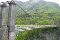
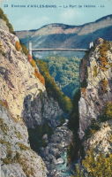
1887: de l'Abîme
Cusy and Gruffy, Haute-Savoie, France - Chéran River
| Bridgemeister ID: | 418 (added before 2003) |
| Year Completed: | 1887 |
| Name: | de l'Abîme |
| Location: | Cusy and Gruffy, Haute-Savoie, France |
| Crossing: | Chéran River |
| Coordinates: | 45.764583 N 6.057117 E |
| Maps: | Acme, GeoHack, Google, OpenStreetMap |
| Principals: | Ferdinand Arnodin |
| References: | BPF |
| Use: | Vehicular (one-lane) |
| Status: | In use (last checked: 2021) |
| Main Cables: | Wire |
| Suspended Spans: | 1 |
| Main Span: | 1 x 64 meters (210 feet) |
External Links:
Image Sets:
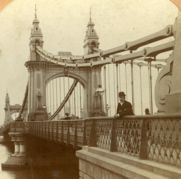
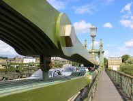
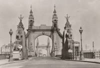
1887: Hammersmith
London, England, United Kingdom - River Thames
| Bridgemeister ID: | 419 (added before 2003) |
| Year Completed: | 1887 |
| Name: | Hammersmith |
| Location: | London, England, United Kingdom |
| Crossing: | River Thames |
| Coordinates: | 51.48845 N 0.23019 W |
| Maps: | Acme, GeoHack, Google, OpenStreetMap |
| Principals: | Sir Joseph Bazalgette |
| References: | BEM, BPL, HBE, NTB, PTS2 |
| Use: | Vehicular (two-lane), with walkway |
| Status: | Restricted to foot traffic, since 2021 (last checked: 2021) |
| Main Cables: | Eyebar |
| Suspended Spans: | 3 |
| Main Span: | 1 |
| Side Spans: | 2 |
Notes:
- 2019, April: Closed to vehicular traffic due to safety concerns after an inspection found fractures in the cast iron casings around the bridge pedestals. Some repair work followed, but was not fully funded or finished (as of mid-2020)
- 2020, August: Fractures found to have worsened during recent heatwave. Bridge is completely closed to all pedestrian and bicycle traffic. Pedestrian walkways under the bridge and all river traffic under the bridge are also prohibited (implying risk of collapse).
- 2020, December: Bridge may reopen to pedestrians and cyclists if deemed safe by maintenance contractor, Mott MacDonald.
- 2021, January: Plan discussed to "thread" a temporary truss along the length of the deck to permit traffic while the suspension bridge undergoes repairs.
- 2021, March: Feasibility study on "double-decker" temporary truss plan determines it is feasible, possibly opening to pedestrian and vehicular traffic by mid-2022.
- 2021, July: Reopened for pedestrian and bicycle use.
- Replaced 1827 Hammersmith - London, England, United Kingdom.
- All past and present bridges at this location.
External Links:
- ENR - Engineers Ponder Solutions for Damaged London Bridge. February 22, 2021 Engineering News-Record article discusses proposal to thread a temporary truss between the towers to allow traffic while the larger suspension bridge repairs are completed. Recaps the issue: "Cracks have been found in the cast-iron pedestals that support suspension cable saddles at the abutments. Engineers suspect that roller bearings between the saddles and pedestals seized up at least 30 years ago…"
- Hammersmith Bridge | Temporary ‘double-decker’ proposal deemed technically feasible - New Civil Engineer. March 22, 2021
- The Happy Pontist: London Bridges: 33. Hammersmith Bridge
- Structurae - Structure ID 20008013
Image Sets:
1887: Jubilee
Nairn, Scotland, United Kingdom - River Nairn
| Bridgemeister ID: | 1945 (added 2005-10-29) |
| Year Completed: | 1887 |
| Name: | Jubilee |
| Location: | Nairn, Scotland, United Kingdom |
| Crossing: | River Nairn |
| Principals: | Harpers Limited |
| References: | HARPER |
| Use: | Footbridge |
| Status: | Replaced, 1915 |
| Main Cables: | Wire |
| Suspended Spans: | 1 |
| Main Span: | 1 x 30.5 meters (100 feet) |
External Links:
Image Sets:
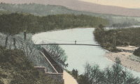
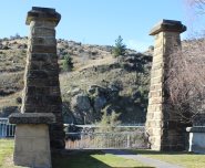
1887: Roxburgh
Roxburgh, New Zealand - Clutha River
| Bridgemeister ID: | 671 (added 2003-03-08) |
| Year Completed: | 1887 |
| Name: | Roxburgh |
| Location: | Roxburgh, New Zealand |
| Crossing: | Clutha River |
| Coordinates: | 45.542731 S 169.320220 E |
| Maps: | Acme, GeoHack, Google, OpenStreetMap |
| Principals: | J. McCormack |
| References: | GAP |
| Use: | Vehicular (one-lane) |
| Status: | Only towers remain (last checked: 2017) |
| Main Cables: | Wire |
| Suspended Spans: | 1 |
Notes:
- Bypassed, 1974.
External Links:
Image Sets:
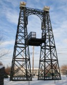
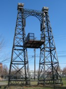
1887: Swinging
Reading, Pennsylvania, USA - Philadelphia and Reading Railroad tracks
| Bridgemeister ID: | 92 (added before 2003) |
| Year Completed: | 1887 |
| Name: | Swinging |
| Location: | Reading, Pennsylvania, USA |
| Crossing: | Philadelphia and Reading Railroad tracks |
| Coordinates: | 40.3405 N 75.923638 W |
| Maps: | Acme, GeoHack, Google, OpenStreetMap |
| Principals: | William Hildenbrand, John A. Roebling's Sons Co. |
| Use: | Footbridge |
| Status: | Dismantled, 1983 |
| Main Cables: | Wire |
| Suspended Spans: | 1 |
Notes:
- Dismantled 1983. One tower used in extant (2007) Workers Memorial Tower at Reading, PA.
- The coordinates provided are for the original location of the bridge. The memorial is located at N 40.3245 W 75.9263.
External Links:
Image Sets:
1888: Évieu
Évieu, Ain and Les Avenières Veyrins-Thuellin, Isère, France - Rhône River
| Bridgemeister ID: | 7099 (added 2022-06-03) |
| Year Completed: | 1888 |
| Name: | Évieu |
| Location: | Évieu, Ain and Les Avenières Veyrins-Thuellin, Isère, France |
| Crossing: | Rhône River |
| Status: | Removed |
| Main Cables: | Wire |
| Main Spans: | 2 |
Notes:
- Replaced 1847 Évieu - Évieu, Ain and Les Avenières Veyrins-Thuellin, Isère, France.
- All past and present bridges at this location.
Image Sets:
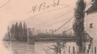
1888: Crathorne
Carthorne, England, United Kingdom - River Leven
| Bridgemeister ID: | 2195 (added 2007-01-26) |
| Year Completed: | 1888 |
| Name: | Crathorne |
| Location: | Carthorne, England, United Kingdom |
| Crossing: | River Leven |
| Principals: | Louis Harper |
| References: | HARPER |
| Use: | Footbridge |
| Status: | Destroyed, by flood, July 1930 |
| Main Cables: | Wire |
| Main Span: | 1 x 16.8 meters (55 feet) estimated |
External Links:
- Crathorne | Harper Bridges
- Suspension Bridge, Yorkshire – Arberdeen Archives, Gallery and Museums. Image of the bridge: "Suspension bridge at Craythorne, Yorkshire."
1888: Oregon City
Oregon City and West Linn, Oregon, USA - Willamette River
| Bridgemeister ID: | 295 (added before 2003) |
| Year Completed: | 1888 |
| Name: | Oregon City |
| Location: | Oregon City and West Linn, Oregon, USA |
| Crossing: | Willamette River |
| Coordinates: | 45.359000 N 122.609611 W |
| Maps: | Acme, GeoHack, Google, OpenStreetMap |
| References: | AAJ |
| Use: | Vehicular |
| Status: | Dismantled, 1922 |
| Main Cables: | Wire |
| Suspended Spans: | 3 |
| Main Span: | 1 |
| Side Spans: | 2 |
Notes:
External Links:
Image Sets:
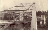
1888: Suspension
Sheldon Springs, Vermont, USA - Missisquoi River
| Bridgemeister ID: | 94 (added before 2003) |
| Year Completed: | 1888 |
| Name: | Suspension |
| Location: | Sheldon Springs, Vermont, USA |
| Crossing: | Missisquoi River |
| Coordinates: | 44.909917 N 72.972806 W |
| Maps: | Acme, GeoHack, Google, OpenStreetMap |
| Use: | Vehicular |
| Status: | Removed, c. 1927-1929 |
| Main Cables: | Wire |
| Suspended Spans: | 1 |
Notes:
- Likely damaged or destroyed during the catastrophic Vermont flood event in early November 1927. Replacement completed in 1929.
External Links:
Image Sets:
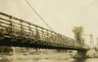
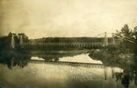
1888: Swing
Keeseville, New York, USA - Ausable River
| Bridgemeister ID: | 93 (added before 2003) |
| Year Completed: | 1888 |
| Name: | Swing |
| Location: | Keeseville, New York, USA |
| Crossing: | Ausable River |
| Coordinates: | 44.503653 N 73.482490 W |
| Maps: | Acme, GeoHack, Google, OpenStreetMap |
| Principals: | Berlin Iron Bridge Co. |
| References: | ONC |
| Use: | Footbridge |
| Status: | In use (last checked: 2023) |
| Main Cables: | Wire (steel) |
| Suspended Spans: | 1 |
| Main Span: | 1 x 73.2 meters (240 feet) |
Notes:
- 2024, June: New York State announces US$1,948,000 awarded to to the Clinton County Planning Department for rehabilitation and refurbishment of the Keeseville Swing Bridge.
- At (or near) former location of Swing - Keeseville, New York, USA.
- All past and present bridges at this location.
External Links:
1888: Swinging
Skowhegan, Maine, USA - Kennebec River
| Bridgemeister ID: | 1576 (added 2004-12-19) |
| Year Completed: | 1888 |
| Name: | Swinging |
| Location: | Skowhegan, Maine, USA |
| Crossing: | Kennebec River |
| References: | KJ20030410 |
| Use: | Footbridge |
| Status: | Destroyed, 1901 |
| Main Cables: | Wire |
Notes:
- Destroyed by flood, 1901.
- Replaced 1883 Swinging - Skowhegan, Maine, USA.
- Replaced by 1902 Swinging - Skowhegan, Maine, USA.
- All past and present bridges at this location.
1888: Tidewater Pipeline
Jim Thorpe, Pennsylvania, USA - Lehigh River
| Bridgemeister ID: | 1527 (added 2004-10-24) |
| Year Completed: | 1888 |
| Name: | Tidewater Pipeline |
| Location: | Jim Thorpe, Pennsylvania, USA |
| Crossing: | Lehigh River |
| Coordinates: | 40.90714 N 75.748544 W |
| Maps: | Acme, GeoHack, Google, OpenStreetMap |
| Principals: | William Hildenbrand |
| References: | AAJ, HBE |
| Use: | Pipeline |
| Status: | Extant (last checked: 2020) |
| Main Cables: | Wire |
| Main Span: | 1 x 109.7 meters (360 feet) |
Notes:
- The town was named "Mauch Chunk" at the time the pipeline was built.
Image Sets:
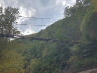
1889: Chesterfield
Chesterfield vicinity, New Hampshire and Brattleboro, Vermont, USA - Connecticut River
| Bridgemeister ID: | 95 (added before 2003) |
| Year Completed: | 1889 |
| Name: | Chesterfield |
| Also Known As: | Brattleboro |
| Location: | Chesterfield vicinity, New Hampshire and Brattleboro, Vermont, USA |
| Crossing: | Connecticut River |
| Coordinates: | 42.883889 N 72.551833 W |
| Maps: | Acme, GeoHack, Google, OpenStreetMap |
| Principals: | Berlin Iron Bridge Co. |
| References: | AAJ, CCR |
| Use: | Vehicular |
| Status: | Destroyed, March 19, 1936 |
| Main Cables: | Wire |
| Suspended Spans: | 1 |
Notes:
- Destroyed by flood March 19, 1936.
External Links:
- The one-bridge idea that faded into history | Community-news | reformer.com. Article about the bridge by the Brattleboro Historic Society. Dated August 5, 2021. Photos and history of the bridge.
- Bridgehunter.com - BH64259
Image Sets:
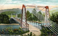
1889: Fiorentini
Rome, Italy - Tiber River
| Bridgemeister ID: | 828 (added 2003-05-31) |
| Year Completed: | 1889 |
| Name: | Fiorentini |
| Also Known As: | Ferro, Soldo, Soldino |
| Location: | Rome, Italy |
| Crossing: | Tiber River |
| Coordinates: | 41.898801 N 12.463689 E |
| Maps: | Acme, GeoHack, Google, OpenStreetMap |
| References: | AAJ, ONF, PTS2 |
| Use: | Vehicular |
| Status: | Demolished, July 15, 1941 |
| Main Cables: | Eyebar |
| Suspended Spans: | 1 |
| Characteristics: | Braced (trussed) chain/cable, Hinged cables |
Notes:
- Jakkula (AAJ) lists this bridge as completed in 1889 based on articles from 1899-1900 discussing braced chain suspension bridges. Various internet sources consistently cite 1863 as the year of completion. The 1889 date is more consistent with several similar braced-chain suspension bridges built in the 1890, but it is unclear which sources are accurate.
- "Braced chain" main cables.
- Similar to 1936 Ininskiy (Ининский) - Inya (Иня), Altai Republic, Russia.
- Similar to 1936 Kindee - Kindee, Ellenborough vicinity, New South Wales, Australia.
- Similar to 1951 Marias River (Pugsley) - Chester vicinity, Montana, USA.
- Similar to (footbridge) - Sarov (Саров), Nizhny Novgorod Oblast, Russia.
- Similar to Allan - Segenhoe, Scone vicinity, New South Wales, Australia.
- Similar to Reku Vel' - Solginskiy (Солгинский), Arkhangelsk Oblast, Russia.
External Links:
Image Sets:
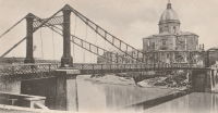
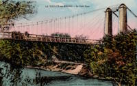
1889: La Voulte-sur-Rhône
La Voulte-sur-Rhône, Rhône, France - Rhône River
| Bridgemeister ID: | 1521 (added 2004-10-10) |
| Year Completed: | 1889 |
| Name: | La Voulte-sur-Rhône |
| Location: | La Voulte-sur-Rhône, Rhône, France |
| Crossing: | Rhône River |
| Coordinates: | 44.800217 N 4.784367 E |
| Maps: | Acme, GeoHack, Google, OpenStreetMap |
| Use: | Vehicular |
| Status: | In use (last checked: 2022) |
| Main Cables: | Wire |
| Suspended Spans: | 3 |
| Main Span: | 1 |
| Side Spans: | 2 |
Notes:
External Links:
Image Sets:
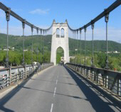
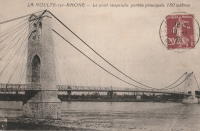
1889: Market Street
Williamsport, Pennsylvania, USA - Susquehanna River
| Bridgemeister ID: | 2134 (added 2006-10-27) |
| Year Completed: | 1889 |
| Name: | Market Street |
| Location: | Williamsport, Pennsylvania, USA |
| Crossing: | Susquehanna River |
| Coordinates: | 41.237333 N 76.997611 W |
| Maps: | Acme, GeoHack, Google, OpenStreetMap |
| Use: | Vehicular |
| Status: | Removed |
| Main Cables: | Wire |
| Suspended Spans: | 5 |
| Main Spans: | 5 x 61 meters (200 feet) |
Notes:
- Replaced 1865 Market Street - Williamsport, Pennsylvania, USA.
- All past and present bridges at this location.
Image Sets:
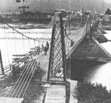
1889: Second Falls View
Niagara Falls, New York, USA and Niagara Falls, Ontario, Canada - Niagara River
| Bridgemeister ID: | 2120 (added 2006-09-17) |
| Year Completed: | 1889 |
| Name: | Second Falls View |
| Also Known As: | Upper |
| Location: | Niagara Falls, New York, USA and Niagara Falls, Ontario, Canada |
| Crossing: | Niagara River |
| Coordinates: | 43.088806 N 79.068722 W |
| Maps: | Acme, GeoHack, Google, OpenStreetMap |
| Principals: | G.M. Harrington, George W. McNulty |
| Use: | Vehicular |
| Status: | Removed, late 1890's |
| Main Cables: | Wire |
| Suspended Spans: | 1 |
Notes:
- Damaged by wind, January 1890. Repaired. Dismantled after being replaced by a steel arch bridge (the famous "Honeymoon Bridge"), 1899. Much of the dismantled bridge was reused for the 1899 Lewiston-Queenston bridge.
- Replaced 1869 Clifton (Upper, Niagara-Clifton, Falls View, First Falls View) - Niagara Falls, New York, USA and Niagara Falls, Ontario, Canada.
- See 1899 Lewiston-Queenston - Lewiston, New York, USA and Queenston, Ontario, Canada.
- All past and present bridges at this location.
1889: Stapenhill
Burton-upon-Trent, Staffordshire, England, United Kingdom - River Trent
| Bridgemeister ID: | 2138 (added 2006-10-28) |
| Year Completed: | 1889 |
| Name: | Stapenhill |
| Also Known As: | Ferry |
| Location: | Burton-upon-Trent, Staffordshire, England, United Kingdom |
| Crossing: | River Trent |
| Coordinates: | 52.79455 N 1.62607 W |
| Maps: | Acme, GeoHack, Google, OpenStreetMap |
| Principals: | Thornewill & Warham |
| Use: | Footbridge |
| Status: | In use (last checked: 2007) |
| Suspended Spans: | 3 |
| Main Span: | 1 x 36.6 meters (120 feet) |
| Side Spans: | 2 x 18.3 meters (60 feet) |
| Deck width: | 11.5 feet |
External Links:
- The Happy Pontist: Staffordshire Bridges: 1. Ferry Bridge, Stapenhill
- Structurae - Structure ID 20024241
Image Sets:
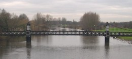
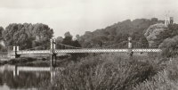
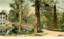
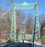
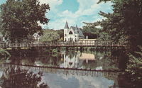
1889: Swing
Milford, New Hampshire, USA - Souhegan River
| Bridgemeister ID: | 293 (added before 2003) |
| Year Completed: | 1889 |
| Name: | Swing |
| Location: | Milford, New Hampshire, USA |
| Crossing: | Souhegan River |
| Coordinates: | 42.8366 N 71.645533 W |
| Maps: | Acme, GeoHack, Google, OpenStreetMap |
| Principals: | Berlin Iron Bridge Co. |
| Use: | Footbridge |
| Status: | In use (last checked: 2021) |
| Main Cables: | Wire (steel) |
| Suspended Spans: | 1 |
External Links:
Image Sets:
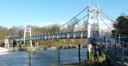
1889: Teddington
Teddington, England, United Kingdom - River Thames
| Bridgemeister ID: | 783 (added 2003-03-16) |
| Year Completed: | 1889 |
| Name: | Teddington |
| Location: | Teddington, England, United Kingdom |
| Crossing: | River Thames |
| Coordinates: | 51.42981 N 0.322517 W |
| Maps: | Acme, GeoHack, Google, OpenStreetMap |
| Use: | Footbridge |
| Status: | In use (last checked: 2015) |
| Main Cables: | Wire |
| Suspended Spans: | 2 |
| Main Span: | 1 |
| Side Span: | 1 |
External Links:
Image Sets:

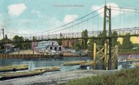
1890: (flume bridge)
Trimmer, California, USA - Kings River
| Bridgemeister ID: | 3351 (added 2019-12-14) |
| Year Completed: | 1890 |
| Name: | (flume bridge) |
| Location: | Trimmer, California, USA |
| Crossing: | Kings River |
| Principals: | Pacific Bridge Co. |
| Use: | Flume |
| Status: | Removed |
| Main Cables: | Wire |
Notes:
- Large suspension bridge carrying a flume to transport lumber for the Kings River Lumber Company of Sanger, California.
1890: (footbridge)
Hittisau, Austria - Bolgenach River
| Bridgemeister ID: | 1168 (added 2004-01-21) |
| Year Completed: | 1890 |
| Name: | (footbridge) |
| Location: | Hittisau, Austria |
| Crossing: | Bolgenach River |
| Coordinates: | 47.461957 N 9.970007 E |
| Maps: | Acme, GeoHack, Google, OpenStreetMap |
| Use: | Footbridge |
| Status: | In use (last checked: 2019) |
| Main Cables: | Wire |
| Suspended Spans: | 1 |
Notes:
- Rebuilt 1985.
External Links:
1890: (footbridge)
Lincoln, England, United Kingdom - Great Northern Railway track
| Bridgemeister ID: | 5083 (added 2020-09-02) |
| Year Completed: | 1890 |
| Name: | (footbridge) |
| Location: | Lincoln, England, United Kingdom |
| Crossing: | Great Northern Railway track |
| Principals: | Louis Harper |
| References: | HARPER |
| Use: | Footbridge |
| Status: | Removed |
| Main Cables: | Wire |
| Main Span: | 1 x 21.3 meters (70 feet) |
Notes:
- HARPER: Likely located at Pelham Street, just east of the present-day (2020) Lincoln train station.
1890: (suspension bridge)
Brookneal, Virginia, USA - Roanoke River
| Bridgemeister ID: | 4665 (added 2020-06-19) |
| Year Completed: | 1890 |
| Name: | (suspension bridge) |
| Location: | Brookneal, Virginia, USA |
| Crossing: | Roanoke River |
| Coordinates: | 37.083602 N 78.935547 W |
| Maps: | Acme, GeoHack, Google, OpenStreetMap |
| Principals: | Berlin Iron Bridge Co. |
| Use: | Vehicular |
| Status: | Demolished, 1940s |
| Main Cables: | Wire (steel) |
| Suspended Spans: | 1 |
1890: Ardnacarrig
Bandon, Ireland - River Bandon
| Bridgemeister ID: | 5076 (added 2020-08-30) |
| Year Completed: | 1890 |
| Name: | Ardnacarrig |
| Location: | Bandon, Ireland |
| Crossing: | River Bandon |
| Principals: | Harper & Co. |
| References: | HARPER |
| Use: | Footbridge |
| Status: | Removed |
| Main Cables: | Wire |
| Suspended Spans: | 1 |
| Main Span: | 1 x 36.6 meters (120 feet) |
| Deck width: | 4 feet |
External Links:
1890: Grand Avenue
St. Louis, Missouri, USA - Mill Creek Valley
| Bridgemeister ID: | 96 (added before 2003) |
| Year Completed: | 1890 |
| Name: | Grand Avenue |
| Location: | St. Louis, Missouri, USA |
| Crossing: | Mill Creek Valley |
| Coordinates: | 38.629167 N 90.235611 W |
| Maps: | Acme, GeoHack, Google, OpenStreetMap |
| Principals: | Carl Gayler |
| References: | AAJ, HBE, IEA, ONF, PTS2, SSB |
| Use: | Vehicular, with walkway |
| Status: | Demolished, 1960 |
| Main Cables: | Eyebar |
| Suspended Spans: | 3 |
| Main Span: | 1 x 121.9 meters (400 feet) |
| Side Spans: | 2 x 45.7 meters (150 feet) |
| Deck width: | 60 feet |
| Characteristics: | Braced (trussed) chain/cable |
Notes:
- Sometimes misidentified as the "Jefferson Avenue" bridge.
- Braced chain (stiffened-eyebar) design often espoused by Gustav Lindenthal. ONF (an article by Lindenthal) refers to this as the Jefferson Ave. bridge while Fowler's book (IEA) calls it "Grand Avenue". AAJ describes it as "a three-hinged inverted arch with two stiffened chains, one on each side."
External Links:
Image Sets:
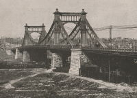
1890: Kellams
Kellams, New York and Stalker, Pennsylvania, USA - Delaware River
| Bridgemeister ID: | 7595 (added 2023-05-07) |
| Year Completed: | 1890 |
| Name: | Kellams |
| Also Known As: | Little Equinunk, Kellams-Stalker, Kellam |
| Location: | Kellams, New York and Stalker, Pennsylvania, USA |
| Crossing: | Delaware River |
| Coordinates: | 41.823641 N 75.113282 W |
| Maps: | Acme, GeoHack, Google, OpenStreetMap |
| Principals: | David Kellam |
| Use: | Vehicular |
| Status: | Replaced |
| Main Cables: | Wire |
| Main Span: | 1 |
Notes:
- Replaced by 1936 Kellams (Little Equinunk, Kellams-Stalker, Kellam) - Kellams, New York and Stalker, Pennsylvania, USA.
- All past and present bridges at this location.
Image Sets:
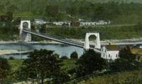
1890: Santa Isabel
Santa Isabel, Zaragoza, Spain - Gállego River
| Bridgemeister ID: | 7488 (added 2022-12-30) |
| Year Completed: | 1890 |
| Name: | Santa Isabel |
| Location: | Santa Isabel, Zaragoza, Spain |
| Crossing: | Gállego River |
| Coordinates: | 41.670978 N 0.841962 W |
| Maps: | Acme, GeoHack, Google, OpenStreetMap |
| References: | JSE |
| Use: | Vehicular |
| Status: | Demolished, c. 1930 |
| Main Cables: | Wire |
| Suspended Spans: | 1 |
External Links:
- (PDF) Jules Seguin en España: prefabricación e innovación en los puentes colgantes de Fuentidueña, Arganda, Carandia y Zaragoza construidos por el empresario francés. Paper from the Proceedings of the Ninth National Congress and First Hispano-American International Congress on the History of Construction. See references.
- Zaragoza - Puente Colgante y puente de hierro sobre el río Gállego (en Santa Isabel) | Europeana. 1930 image of the bridge just before it was demolished.
Image Sets:
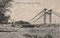
1890: Sylvéréal
Sylvéréal, Gard and Bouches-du-Rhône, France - Petit Rhône River
| Bridgemeister ID: | 7319 (added 2022-08-31) |
| Year Completed: | 1890 |
| Name: | Sylvéréal |
| Location: | Sylvéréal, Gard and Bouches-du-Rhône, France |
| Crossing: | Petit Rhône River |
| Coordinates: | 43.546406 N 4.350111 E |
| Maps: | Acme, GeoHack, Google, OpenStreetMap |
| Use: | Vehicular |
| Status: | Removed |
| Main Cables: | Wire |
| Suspended Spans: | 1 |
Image Sets:
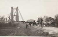
1890: Wollaston
Warrnambool, Victoria, Australia - Merri River
| Bridgemeister ID: | 420 (added before 2003) |
| Year Completed: | 1890 |
| Name: | Wollaston |
| Location: | Warrnambool, Victoria, Australia |
| Crossing: | Merri River |
| Coordinates: | 38.36343 S 142.49163 E |
| Maps: | Acme, GeoHack, Google, OpenStreetMap |
| Principals: | Arthur Dobson |
| References: | STC |
| Use: | Vehicular (one-lane) |
| Status: | Restricted to foot traffic (last checked: 2005) |
| Main Cables: | Wire |
| Suspended Spans: | 1 |
| Main Span: | 1 x 36.6 meters (120.1 feet) |
| Deck width: | 3.2 meters |
| Bridgemeister ID: | 264 (added before 2003) |
| Year Completed: | 1891 |
| Name: | (footbridge) |
| Location: | Lewiston, Maine, USA |
| At or Near Feature: | Island Garden Amusement Park |
| Use: | Footbridge |
| Status: | Dismantled, 1903 |
| Main Cables: | Wire |
| Suspended Spans: | 1 |
Notes:
- Nancy Fraser writes: "The pedestrian suspension bridge [was] located at Island Garden Amusement Park in Lewiston, Maine. It started at the water gate house that you can see and led to an island over the water falls where they had entertainment. It was in existence in Lewiston from 1891 to 1903. It was later sold to Amos Gerald of Fairfield, Maine to be used for the trolley line leading to Casco Castle and Amusement Park in South Freeport, Maine."
- Moved to (footbridge) - South Freeport, Maine, USA.
Image Sets:

1891: (pipeline bridge)
Lane Cove North, New South Wales, Australia - Lane Cove River
| Bridgemeister ID: | 2685 (added 2019-05-26) |
| Year Completed: | 1891 |
| Name: | (pipeline bridge) |
| Location: | Lane Cove North, New South Wales, Australia |
| Crossing: | Lane Cove River |
| Coordinates: | 33.802904 S 151.143883 E |
| Maps: | Acme, GeoHack, Google, OpenStreetMap |
| Use: | Pipeline |
| Status: | Demolished, 1945 |
| Main Cables: | Wire (steel) |
| Main Spans: | 2 |
| Side Spans: | 2 |
Notes:
- Multi-span pipeline suspension bridge carrying a large water main. Since replaced with a bridge carrying both pedestrians and a large pipeline.
External Links:
- Clifford Love Bridge. PDF with a detailed history of the bridges around the location of this bridge.
- Construction of the suspension bridge carrying water pipes across the Lane Cove River 1890 - Dictionary of Sydney. Image of the bridge under construction.
1891: (suspension bridge)
San Francisco, California, USA - Middle Drive
| Bridgemeister ID: | 98 (added before 2003) |
| Year Completed: | 1891 |
| Name: | (suspension bridge) |
| Location: | San Francisco, California, USA |
| Crossing: | Middle Drive |
| At or Near Feature: | Golden Gate Park |
| Coordinates: | 37.770611 N 122.459667 W |
| Maps: | Acme, GeoHack, Google, OpenStreetMap |
| Principals: | John A. Roebling's Sons Co. |
| Use: | Footbridge |
| Status: | Removed, 1928 |
| Main Cables: | Wire |
| Suspended Spans: | 1 |
| Main Span: | 1 |
| Side Spans: | 2 |
Notes:
- Coordinates indicate approximate location of the bridge which crossed Middle Drive (now Nancy Pelosi Drive) near the current location of the tennis courts in Golden Gate Park.
External Links:
- Chicken Point - FoundSF. Several images of the bridge.
- Golden Gate Park - OpenSFHistory - Western Neighborhoods Project. Image of the bridge.
Image Sets:
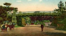
1891: Ölfusá
Selfoss, Iceland - Ölfusá River
| Bridgemeister ID: | 2922 (added 2019-09-15) |
| Year Completed: | 1891 |
| Name: | Ölfusá |
| Location: | Selfoss, Iceland |
| Crossing: | Ölfusá River |
| Use: | Vehicular |
| Status: | Collapsed, 1944 |
| Main Cables: | Wire (steel) |
Notes:
Image Sets:
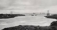
1891: Friedrichsbrücke
Mannheim, Germany - Neckar River
| Bridgemeister ID: | 8461 (added 2024-03-17) |
| Year Completed: | 1891 |
| Name: | Friedrichsbrücke |
| Location: | Mannheim, Germany |
| Crossing: | Neckar River |
| Coordinates: | 49.493861 N 8.471778 E |
| Maps: | Acme, GeoHack, Google, OpenStreetMap |
| Use: | Vehicular |
| Status: | Replaced |
| Suspended Spans: | 3 |
| Main Span: | 1 x 74.7 meters (245.1 feet) |
| Side Spans: | 2 x 56.15 meters (184.2 feet) |
Notes:
- This bridge likely functioned more as a cantilever bridge than a suspension bridge.
- 1938-1940: The bridge undergoes a major reconstruction to widen the bridge. The towers appear to have been replaced at this time, but the suspension/cantilever system is retained. The resulting structure is listed separately.
- Replaced 1845 Kettenbrücke (Chain, Ketten) - Mannheim, Germany.
- Replaced by 1940 Friedrichsbrücke - Mannheim, Germany.
- All past and present bridges at this location.
External Links:
- Wikipedia - Kurpfalzbrücke. History of several bridges at this location.
Image Sets:
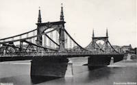
1891: Geisecke
Geisecke vicinity, North Rhine-Westphalia, Germany - Ruhr River
| Bridgemeister ID: | 2292 (added 2007-04-24) |
| Year Completed: | 1891 |
| Name: | Geisecke |
| Location: | Geisecke vicinity, North Rhine-Westphalia, Germany |
| Crossing: | Ruhr River |
| Use: | Footbridge |
| Status: | Demolished, 1928 |
| Deck width: | 1.0 meters |
External Links:
1891: Livron
Livron-sur-Drôme, Drôme and La Voulte-sur-Rhône, Ardèche, France - Petit Rhône River
| Bridgemeister ID: | 1806 (added 2005-05-19) |
| Year Completed: | 1891 |
| Name: | Livron |
| Location: | Livron-sur-Drôme, Drôme and La Voulte-sur-Rhône, Ardèche, France |
| Crossing: | Petit Rhône River |
| Coordinates: | 44.795194 N 4.796055 E |
| Maps: | Acme, GeoHack, Google, OpenStreetMap |
| Use: | Vehicular (one-lane) |
| Status: | In use (last checked: 2022) |
| Main Cables: | Wire |
| Suspended Spans: | 1 |
| Main Span: | 1 x 101 meters (331.4 feet) estimated |
Notes:
External Links:
Image Sets:
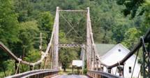
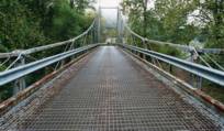
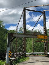
1891: Lower
English Center Borough, Pennsylvania, USA - Little Pine Creek
| Bridgemeister ID: | 99 (added before 2003) |
| Year Completed: | 1891 |
| Name: | Lower |
| Location: | English Center Borough, Pennsylvania, USA |
| Crossing: | Little Pine Creek |
| Coordinates: | 41.4349 N 77.28887 W |
| Maps: | Acme, GeoHack, Google, OpenStreetMap |
| Principals: | Dean & Westbrook |
| References: | HAERPA461, HHP, SSB |
| Use: | Vehicular (one-lane) |
| Status: | In use (last checked: 2023) |
| Main Cables: | Eyebar (steel) |
| Suspended Spans: | 1 |
| Main Span: | 1 x 91.4 meters (300 feet) |
Notes:
- This bridge is an eyebar suspension and truss hybrid similar to the Florianopolis, Silver, and Saint Marys bridges.
- 2012, May: Closed for two weeks for repairs after a snapped support was discovered.
- Companion to 1891 Upper - English Center Borough, Pennsylvania, USA.
- See 1926 Hercilio Luz (Florianopolis) - Florianopolis, Santa Catarina, Brazil.
- See 1928 Point Pleasant (Silver) - Point Pleasant, West Virginia and Kanauga, Gallipolis vicinity, Ohio, USA.
- See 1928 Saint Marys (Hi Carpenter, Short Route) - Saint Marys, West Virginia and Newport, Ohio, USA.
Annotated Citations:
- Crossley, Pat. "Historic bridge on the list to be rehabbed." Williamsport Sun-Gazette, 9 Mar. 2023, https://www.sungazette.com/news/top-news/2023/03/historic-bridge-on-the-list-to-be-rehabbed/
$12 million rehabilitation project planned. "According to Maggie Baker, a spokesperson with PennDOT… 'After traffic is switched to the temporary bridge, the existing bridge will be carefully dismantled. The existing structural components of the bridge will be shipped to a fabricator to be cleaned and painted. Remedies for damaged components will be coordinated with the onsite cultural resource representative. Abutments will be carefully dismantled and reconstructed.'"
External Links:
Image Sets:
1891: Upper
English Center Borough, Pennsylvania, USA - Little Pine Creek
| Bridgemeister ID: | 100 (added before 2003) |
| Year Completed: | 1891 |
| Name: | Upper |
| Location: | English Center Borough, Pennsylvania, USA |
| Crossing: | Little Pine Creek |
| Principals: | Dean & Westbrook |
| References: | HAERPA461 |
| Use: | Vehicular (one-lane) |
| Status: | Removed, 1932 |
| Main Cables: | Eyebar (steel) |
Notes:
- Slightly larger than the Lower Bridge at English Center.
- Companion to 1891 Lower - English Center Borough, Pennsylvania, USA.
1892: (footbridge)
Anderson, Indiana, USA - White River
| Bridgemeister ID: | 6467 (added 2021-08-13) |
| Year Completed: | 1892 |
| Name: | (footbridge) |
| Location: | Anderson, Indiana, USA |
| Crossing: | White River |
| Use: | Footbridge |
| Status: | Destroyed, March 27, 1921 |
| Main Cables: | Wire (steel) |
| Suspended Spans: | 3 |
| Main Span: | 1 |
| Side Spans: | 2 |
Annotated Citations:
- Jackson, Stephen T. "If the River Could Talk: Bridges at 27 sites." The Herald Bulletin., 3 July 2016, www.heraldbulletin.com/community/if-the-river-could-talk-bridges-at-27-sites/article_0141fb64-6416-526d-baa4-752e97f65b95.html
"Opened March 7, 1892, in what would today be the shadow of the Eisenhower Bridge, was a suspension bridge built to carry pedestrian traffic from Anderson to Park Place. Twin support towers at each end of the bridge held the suspension span in between… The fun lasted until a flood brought it down March 27, 1921."
1892: (footbridge)
Ardtornish, Morvern, Scotland, United Kingdom - Abhainn a' Ghlinne Ghil
| Bridgemeister ID: | 9165 (added 2025-04-06) |
| Year Completed: | 1892 |
| Name: | (footbridge) |
| Location: | Ardtornish, Morvern, Scotland, United Kingdom |
| Crossing: | Abhainn a' Ghlinne Ghil |
| Coordinates: | 56.586333 N 5.748472 W |
| Maps: | Acme, GeoHack, Google, OpenStreetMap |
| Use: | Footbridge |
| Status: | Derelict (last checked: 2024) |
| Main Cables: | Wire |
| Suspended Spans: | 1 |
| Main Span: | 1 x 18 meters (59.1 feet) estimated |
| Characteristics: | Monocable |
Notes:
- Highly unusual short-span monocable suspension bridge seemingly constructed from a hodgepodge of material. It has been sitting derelict for many years, but supposedly retains most of its original components.
External Links:
- Flickr - Single cable suspension bridge, Ardtornish Estate. Image of the bridge. Taken June 6, 2013.
- Flickr - Single cable suspension bridge, Ardtornish Estate. Image of the bridge. Taken June 6, 2013.
- Flickr - Single cable suspension bridge, Ardtornish Estate. Image of the bridge. Taken June 6, 2013.
- Flickr - Single cable suspension bridge, Ardtornish Estate. Image of the bridge. Taken June 6, 2013.
- https://www.kweimar.de/Bilder_XML.php?ket=H1994. Description of the bridge and its components.
1892: Androscoggin Pedestrian
Topsham and Brunswick, Maine, USA - Androscoggin River
| Bridgemeister ID: | 101 (added before 2003) |
| Year Completed: | 1892 |
| Name: | Androscoggin Pedestrian |
| Also Known As: | Swinging, Androscoggin Swinging |
| Location: | Topsham and Brunswick, Maine, USA |
| Crossing: | Androscoggin River |
| Coordinates: | 43.918069 N 69.973122 W |
| Maps: | Acme, GeoHack, Google, OpenStreetMap |
| Principals: | John A. Roebling's Sons Co. |
| References: | PPH19991019, PPH20050801 |
| Use: | Footbridge |
| Status: | Destroyed, 1936 |
| Main Cables: | Wire (steel) |
Notes:
- c. 1913-1916: Original timber towers replaced with steel towers.
- 1936: Deck destroyed by flood. Steel towers and cables survive.
- Replaced by 1936 Androscoggin Pedestrian (Swinging) - Topsham and Brunswick, Maine, USA.
- All past and present bridges at this location.
External Links:
1892: Aurec-sur-Loire
Aurec-sur-Loire, Haute-Loire, France - Loire River
| Bridgemeister ID: | 1607 (added 2005-02-06) |
| Year Completed: | 1892 |
| Name: | Aurec-sur-Loire |
| Location: | Aurec-sur-Loire, Haute-Loire, France |
| Crossing: | Loire River |
| Coordinates: | 45.369475 N 4.196837 E |
| Maps: | Acme, GeoHack, Google, OpenStreetMap |
| Use: | Vehicular (one-lane) |
| Status: | Only towers remain (last checked: 2021) |
| Main Cables: | Wire |
| Suspended Spans: | 3 |
| Main Span: | 1 |
| Side Spans: | 2 |
Notes:
- Approaches, abutments, piers, and pylons still in existence, 2018, but the original deck and cables are completely gone. A newer pedestrian suspension bridge is effectively sitting on the original bridge's piers between the original pylons.
- Later at same location (footbridge) - Aurec-sur-Loire, Haute-Loire, France.
- All past and present bridges at this location.
Image Sets:
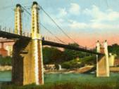
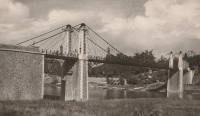
1892: Cammeray
Willoughby, New South Wales, Australia - Long Bay Gully
| Bridgemeister ID: | 421 (added before 2003) |
| Year Completed: | 1892 |
| Name: | Cammeray |
| Also Known As: | North Sydney, Northbridge |
| Location: | Willoughby, New South Wales, Australia |
| Crossing: | Long Bay Gully |
| Coordinates: | 33.816899 S 151.212336 E |
| Maps: | Acme, GeoHack, Google, OpenStreetMap |
| References: | PTS2, STC |
| Use: | Vehicular |
| Status: | Only towers remain, since 1939 (last checked: 2019) |
| Main Cables: | Wire |
| Suspended Spans: | 3 |
| Main Span: | 1 x 152.4 meters (500 feet) |
| Side Spans: | 2 x 38.1 meters (125 feet) |
Notes:
- Replaced with arch in 1939, but original towers retained. STC says replaced 1937.
External Links:
Image Sets:
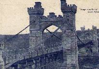
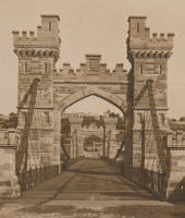
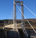
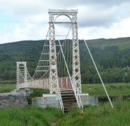
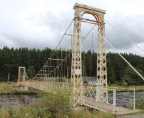
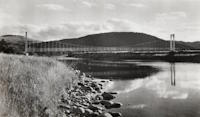
1892: Polhollick
Ballater vicinity, Aberdeenshire, Scotland, United Kingdom - River Dee
| Bridgemeister ID: | 1905 (added 2005-10-08) |
| Year Completed: | 1892 |
| Name: | Polhollick |
| Location: | Ballater vicinity, Aberdeenshire, Scotland, United Kingdom |
| Crossing: | River Dee |
| Coordinates: | 57.055048 N 3.083452 W |
| Maps: | Acme, GeoHack, Google, OpenStreetMap |
| Principals: | James Abernethy & Co. |
| References: | HARPER, HBR |
| Use: | Footbridge |
| Status: | In use (last checked: 2014) |
| Main Cables: | Wire (steel) |
| Suspended Spans: | 1 |
| Main Span: | 1 x 54.4 meters (178.5 feet) |
Notes:
- Closed May 2015 for repairs. Reopened October, 2015.
External Links:
- The Happy Pontist: Scottish Bridges: 19. Polhollick Suspension Bridge
- The Happy Pontist: Scottish Bridges: 44. Polhollick Bridge (revisited)
- Structurae - Structure ID 20021613
Image Sets:
1893: (suspension bridge)
Hamua, New Zealand - Makakahi River
| Bridgemeister ID: | 674 (added 2003-03-08) |
| Year Completed: | 1893 |
| Name: | (suspension bridge) |
| Location: | Hamua, New Zealand |
| Crossing: | Makakahi River |
| Principals: | Joseph Dawson |
| References: | GAP |
1893: Am Kaltenborn
Wetter and Volmarstein, North Rhine-Westphalia, Germany - Ruhr River
| Bridgemeister ID: | 2168 (added 2007-01-12) |
| Year Completed: | 1893 |
| Name: | Am Kaltenborn |
| Location: | Wetter and Volmarstein, North Rhine-Westphalia, Germany |
| Crossing: | Ruhr River |
| Coordinates: | 51.37610 N 7.39749 E |
| Maps: | Acme, GeoHack, Google, OpenStreetMap |
| Principals: | Siller & Jamart, B. Rittershausen |
| Use: | Footbridge |
| Status: | Extant (last checked: 2006) |
| Main Cables: | Wire |
| Suspended Spans: | 1 |
| Main Span: | 1 x 38 meters (124.7 feet) |
| Deck width: | 1.7 meters |
External Links:
Image Sets:
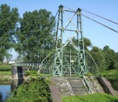
1893: Cable
Chicago, Illinois, USA - Garfield Park Lagoon
| Bridgemeister ID: | 320 (added before 2003) |
| Year Completed: | 1893 |
| Name: | Cable |
| Location: | Chicago, Illinois, USA |
| Crossing: | Garfield Park Lagoon |
| At or Near Feature: | Garfield Park |
| Coordinates: | 41.883548 N 87.714527 W |
| Maps: | Acme, GeoHack, Google, OpenStreetMap |
| References: | HBE |
| Use: | Footbridge |
| Status: | In use (last checked: 2021) |
| Main Cables: | Wire |
| Suspended Spans: | 1 |
| Main Span: | 1 x 12 meters (39.4 feet) estimated |
Notes:
- 1870 and 1874 are also sometimes cited as year of completion.
External Links:
Image Sets:

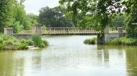
1893: Dennis
Dennis, Texas, USA - Brazos River
| Bridgemeister ID: | 116 (added before 2003) |
| Year Completed: | 1893 |
| Name: | Dennis |
| Location: | Dennis, Texas, USA |
| Crossing: | Brazos River |
| Coordinates: | 32.615639 N 97.926361 W |
| Maps: | Acme, GeoHack, Google, OpenStreetMap |
| Principals: | Flinn-Moyer Co. |
| Use: | Vehicular |
| Status: | Demolished, 1962 |
| Main Cables: | Wire (steel) |
External Links:
- Flickr - Dennis, Texas Suspension Bridge. Image of the bridge. Taken c. 1960-1962.
- Flickr - Dennis, Texas Suspension Bridge. Image of the bridge. Taken c. 1960-1962.
1893: Dorrator
Falkirk, Scotland, United Kingdom - River Carron
| Bridgemeister ID: | 2201 (added 2007-01-28) |
| Year Completed: | 1893 |
| Name: | Dorrator |
| Also Known As: | Falkirk, Carronvale |
| Location: | Falkirk, Scotland, United Kingdom |
| Crossing: | River Carron |
| Coordinates: | 56.011418 N 3.819145 W |
| Maps: | Acme, GeoHack, Google, OpenStreetMap |
| Principals: | Louis Harper |
| References: | AAJ, HARPER |
| Use: | Footbridge |
| Status: | Only towers remain (last checked: 2014) |
| Main Cables: | Wire |
| Suspended Spans: | 1 |
| Main Span: | 1 x 27 meters (88.6 feet) |
Notes:
- Replaced 2014. One tower remains as a monument to the Harper bridge.
- Similar to 1893 Trentham - Trentham, Stoke-on-Trent, England, United Kingdom.
External Links:
Image Sets:
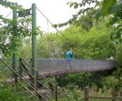
1893: Feugh
Banchory, Scotland, United Kingdom - Water of Feugh
| Bridgemeister ID: | 2196 (added 2007-01-26) |
| Year Completed: | 1893 |
| Name: | Feugh |
| Location: | Banchory, Scotland, United Kingdom |
| Crossing: | Water of Feugh |
| Coordinates: | 57.042679 N 2.493234 W |
| Maps: | Acme, GeoHack, Google, OpenStreetMap |
| Principals: | Louis Harper |
| References: | AAJ, HARPER |
| Use: | Footbridge |
| Status: | In use (last checked: 2014) |
| Main Cables: | Wire |
| Suspended Spans: | 1 |
| Main Span: | 1 x 30 meters (98.4 feet) |
Notes:
- Towers replaced, at some point. Unclear how much of the present-day (2020) bridge is original.
External Links:
Image Sets:
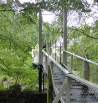

1893: Mandeville
Kaiapoi, New Zealand - Kaiapoi River
| Bridgemeister ID: | 673 (added 2003-03-08) |
| Year Completed: | 1893 |
| Name: | Mandeville |
| Also Known As: | Swing |
| Location: | Kaiapoi, New Zealand |
| Crossing: | Kaiapoi River |
| At or Near Feature: | Trousselot Park |
| Coordinates: | 43.3811 S 172.65584 E |
| Maps: | Acme, GeoHack, Google, OpenStreetMap |
| References: | GAP |
| Use: | Footbridge |
| Status: | In use (last checked: 2019) |
| Main Cables: | Wire |
| Suspended Spans: | 3 |
| Main Spans: | 3 |
Notes:
- Damaged by earthquake 2010, subsequently repaired.
- Similar to 1900 Mafeking (Revell's) - Raven Quay, New Zealand.
- Similar to Butcher's Ford (Durrell's Ford, Hassall's Ford, Butchers) - Kaiapoi, New Zealand.
External Links:
Image Sets:
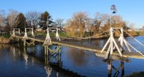
1893: Rivière de l'Est
Sainte Rose, Réunion, France - Rivière de l'Est
| Bridgemeister ID: | 992 (added 2003-11-16) |
| Year Completed: | 1893 |
| Name: | Rivière de l'Est |
| Also Known As: | River of the East |
| Location: | Sainte Rose, Réunion, France |
| Crossing: | Rivière de l'Est |
| Coordinates: | 21.125067 S 55.7484896 E |
| Maps: | Acme, GeoHack, Google, OpenStreetMap |
| Principals: | Ferdinand Arnodin |
| References: | PTS2 |
| Use: | Vehicular (one-lane) |
| Status: | In use (last checked: 2023) |
| Main Cables: | Wire |
| Suspended Spans: | 1 |
| Main Span: | 1 x 150 meters (492.1 feet) |
Notes:
- 2021-2023: Major renovation by Freyssinet.
External Links:
Image Sets:
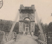
1893: Trentham
Trentham, Stoke-on-Trent, England, United Kingdom - River Trent
| Bridgemeister ID: | 2200 (added 2007-01-28) |
| Year Completed: | 1893 |
| Name: | Trentham |
| Location: | Trentham, Stoke-on-Trent, England, United Kingdom |
| Crossing: | River Trent |
| Coordinates: | 52.963486 N 2.198944 W |
| Maps: | Acme, GeoHack, Google, OpenStreetMap |
| References: | HARPER |
| Use: | Footbridge |
| Status: | Replaced, c.1930's |
| Main Cables: | Wire |
| Suspended Spans: | 1 |
| Main Span: | 1 x 21.3 meters (70 feet) |
Notes:
External Links:
Image Sets:
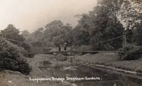
1893: Viscaya
Portugalete and Las Arenas, Spain - Nervión River (Ibaizabal River)
| Bridgemeister ID: | 422 (added before 2003) |
| Year Completed: | 1893 |
| Name: | Viscaya |
| Also Known As: | Biscay, Portugalete, Bizkaia |
| Location: | Portugalete and Las Arenas, Spain |
| Crossing: | Nervión River (Ibaizabal River) |
| Coordinates: | 43.32376 N 3.01655 W |
| Maps: | Acme, GeoHack, Google, OpenStreetMap |
| Principals: | Ferdinand Arnodin, Alberto Palacio |
| Use: | Transporter |
| Status: | In use (last checked: 2021) |
| Main Cables: | Wire |
| Suspended Spans: | 1 |
External Links:
Image Sets:
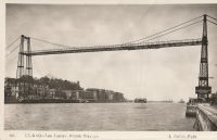
1893: Watson's
Riverside, Illinois, USA - Des Plaines River
| Bridgemeister ID: | 5669 (added 2021-01-30) |
| Year Completed: | 1893 |
| Name: | Watson's |
| Location: | Riverside, Illinois, USA |
| Crossing: | Des Plaines River |
| Coordinates: | 41.825778 N 87.817795 W |
| Maps: | Acme, GeoHack, Google, OpenStreetMap |
| Use: | Footbridge |
| Status: | Replaced |
| Main Cables: | Wire |
| Suspended Spans: | 1 |
| Characteristics: | Partially underspanned |
Notes:
- Appears to have been predominantly underspanned.
- Replaced by 1905 Swinging - Riverside, Illinois, USA.
- All past and present bridges at this location.
1894: (footbridge)
Grimsby, England, United Kingdom - River Freshney
| Bridgemeister ID: | 5079 (added 2020-08-30) |
| Year Completed: | 1894 |
| Name: | (footbridge) |
| Location: | Grimsby, England, United Kingdom |
| Crossing: | River Freshney |
| Coordinates: | 53.570454 N 0.095989 W |
| Maps: | Acme, GeoHack, Google, OpenStreetMap |
| Principals: | Harper & Co. |
| References: | HARPER |
| Use: | Footbridge |
| Status: | Only towers remain (last checked: 2014) |
| Main Cables: | Wire |
| Suspended Spans: | 1 |
| Main Span: | 1 x 10.7 meters (35 feet) |
Notes:
- Replaced, but elements of the suspension bridge were retained in the new structure which is now (2020) boarded up.
- Built as part of same project as 1894 (footbridge) - Grimsby, England, United Kingdom.
- Built as part of same project as 1894 (footbridge) - Grimsby, England, United Kingdom.
1894: (footbridge)
Grimsby, England, United Kingdom - River Freshney
| Bridgemeister ID: | 5080 (added 2020-08-30) |
| Year Completed: | 1894 |
| Name: | (footbridge) |
| Location: | Grimsby, England, United Kingdom |
| Crossing: | River Freshney |
| Coordinates: | 53.569623 N 0.094252 W |
| Maps: | Acme, GeoHack, Google, OpenStreetMap |
| Principals: | Harper & Co. |
| References: | HARPER |
| Use: | Footbridge |
| Status: | Replaced |
| Main Cables: | Wire |
| Suspended Spans: | 1 |
| Main Span: | 1 x 15.2 meters (50 feet) |
Notes:
- Coordinates are for likely location of this bridge, since replaced.
- Built as part of same project as 1894 (footbridge) - Grimsby, England, United Kingdom.
- Built as part of same project as 1894 (footbridge) - Grimsby, England, United Kingdom.
1894: (footbridge)
Grimsby, England, United Kingdom - River Freshney
| Bridgemeister ID: | 5081 (added 2020-08-30) |
| Year Completed: | 1894 |
| Name: | (footbridge) |
| Location: | Grimsby, England, United Kingdom |
| Crossing: | River Freshney |
| Coordinates: | 53.568240 N 0.092003 W |
| Maps: | Acme, GeoHack, Google, OpenStreetMap |
| Principals: | Harper & Co. |
| References: | HARPER |
| Use: | Footbridge |
| Status: | Replaced |
| Main Cables: | Wire |
| Suspended Spans: | 1 |
| Main Span: | 1 x 15.2 meters (50 feet) |
Notes:
- Coordinates are for likely location of this bridge, since replaced.
- Built as part of same project as 1894 (footbridge) - Grimsby, England, United Kingdom.
- Built as part of same project as 1894 (footbridge) - Grimsby, England, United Kingdom.
1894: Arcediano
Guadalajara vicinity, Mexico - Grande de Santiago River
| Bridgemeister ID: | 2492 (added 2008-12-23) |
| Year Completed: | 1894 |
| Name: | Arcediano |
| Location: | Guadalajara vicinity, Mexico |
| Crossing: | Grande de Santiago River |
| At or Near Feature: | Barranca de Portillo |
| Coordinates: | 20.741396 N 103.294783 W |
| Maps: | Acme, GeoHack, Google, OpenStreetMap |
| Use: | Vehicular (one-lane) |
| Status: | Restricted to foot traffic (last checked: 2022) |
| Main Cables: | Wire |
| Suspended Spans: | 1 |
| Main Span: | 1 x 71 meters (232.9 feet) estimated |
Notes:
- 2005: Dismantled and reassembled 700 meters downstream from original location to make way for construction of the Arcediano dam. Coordinates provided here are for the newer location.
Image Sets:
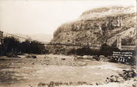
1894: Bonpas
Bonpas, Vaucluse and Bouches-du-Rhône, France - Durance River
| Bridgemeister ID: | 2082 (added 2006-06-11) |
| Year Completed: | 1894 |
| Name: | Bonpas |
| Also Known As: | Bompas, Bompard |
| Location: | Bonpas, Vaucluse and Bouches-du-Rhône, France |
| Crossing: | Durance River |
| Coordinates: | 43.887445 N 4.916439 E |
| Maps: | Acme, GeoHack, Google, OpenStreetMap |
| Use: | Vehicular |
| Status: | Destroyed, 1944 |
| Suspended Spans: | 4 |
| Main Spans: | 2 |
| Side Spans: | 2 |
External Links:
Image Sets:
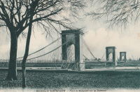
1894: Chamba
Chamba, Himachal Pradesh, India - Ravi River
| Bridgemeister ID: | 7711 (added 2023-07-07) |
| Year Completed: | 1894 |
| Name: | Chamba |
| Location: | Chamba, Himachal Pradesh, India |
| Crossing: | Ravi River |
| Coordinates: | 32.555334 N 76.120818 E |
| Maps: | Acme, GeoHack, Google, OpenStreetMap |
| Use: | Vehicular |
| Status: | Removed |
| Suspended Spans: | 1 |
Notes:
- Appears to have been located on the alignment currently (2020s) occupied by a large box girder bridge and immediately adjacent to a later suspension bridge (bypassed by the box girder bridge).
- See Chamba Cable-stayed Suspension Bridge for an old cable-stayed bridge that may have been at or near this location.
- Next to Sheetla (Old Sheetla, Old Shitla, Sheetala, ओल्ड शीतला ब्रिज) - Chamba, Himachal Pradesh, India.
- All past and present bridges at this location.
Image Sets:
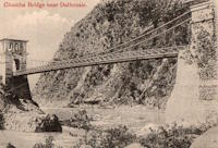
1894: Cromdale
Cromdale, Scotland, United Kingdom - River Spey
| Bridgemeister ID: | 5077 (added 2020-08-30) |
| Year Completed: | 1894 |
| Name: | Cromdale |
| Location: | Cromdale, Scotland, United Kingdom |
| Crossing: | River Spey |
| Coordinates: | 57.341528 N 3.553306 W |
| Maps: | Acme, GeoHack, Google, OpenStreetMap |
| References: | HARPER |
| Use: | Footbridge |
| Status: | Removed, 1921 |
| Main Cables: | Wire |
| Suspended Spans: | 1 |
Notes:
- Replaced 1881 Cromdale - Cromdale, Scotland, United Kingdom.
- All past and present bridges at this location.
Image Sets:
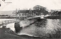
1894: Devil's Dyke Aerial Cableway
Fulking, Brighton vicinity, England, United Kingdom - Devil's Dyke
| Bridgemeister ID: | 4843 (added 2020-07-11) |
| Year Completed: | 1894 |
| Name: | Devil's Dyke Aerial Cableway |
| Location: | Fulking, Brighton vicinity, England, United Kingdom |
| Crossing: | Devil's Dyke |
| References: | AAJ |
| Use: | Tramway |
| Status: | Closed, 1909 |
| Main Cables: | Wire (steel) |
| Suspended Spans: | 3 |
| Main Span: | 1 |
| Side Spans: | 2 |
External Links:
1894: Kallar
Kallar, Nilgiri Hills and Coonoor, Tamil Nadu, India
| Bridgemeister ID: | 7474 (added 2022-12-25) |
| Year Completed: | 1894 |
| Name: | Kallar |
| Location: | Kallar, Nilgiri Hills and Coonoor, Tamil Nadu, India |
| Coordinates: | 11.337556 N 76.881783 E |
| Maps: | Acme, GeoHack, Google, OpenStreetMap |
| Use: | Vehicular |
| Status: | Demolished, 2015 |
| Suspended Spans: | 1 |
Notes:
- 1920s: Bypassed
- 1990s: Only towers remain.
- 2015: Tower(s) demolished.
External Links:
- Facebook - Bridge connecting Mettupalayam and Ooty/Coonoor in Tamilnadu.. Images of the demolition of the suspension bridge tower. Posted October 9, 2015
- Facebook - Bridge on the River Kallar. Post detailing the history of the bridge site. Posted January 20, 2018.
- Facebook - Waiting For A Safe New Bridge At Kallar. Post regarding the situation at this crossing with images of the demolished suspension bridge towers. Posted October 15, 2015.
- Heritage Bridge near Kallar Demolished | The Hindu. Article about demolition of the bridge. October 12, 2015.
- Historians upset over demolition of 120-year-old structure that supports Kallar’s Hanging Bridge | Coimbatore News - Times of India. Article regarding demolition of the towers, October 10, 2015.
- Pradeep Damodaran: Oldest bridge connecting Nilgiris with Coimbatore at Kallar lies vandalized, uncared for. Blog post with image of one of the bridge towers, posted August 12, 2013.
- The eighty one years old suspension bridge across the Kallar River, connecting Coimbatore and the... | The Hindu Images. Image with suspension bridge tower visible in the background.
- The History of Coonoor - Clean Coonoor. History of the area including an image of the bridge.
- YouTube - Kallar Bridge connecting Mettupalayam and Ooty, Tamilnadu | India Video. Video with footage of the suspension bridge tower. Posted July 16, 2013.
Image Sets:
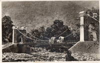
1894: Occidente
Santa Fé de Antioquia, Colombia - Cauca River
| Bridgemeister ID: | 934 (added 2003-10-25) |
| Year Completed: | 1894 |
| Name: | Occidente |
| Also Known As: | Western |
| Location: | Santa Fé de Antioquia, Colombia |
| Crossing: | Cauca River |
| Coordinates: | 6.577965 N 75.798177 W |
| Maps: | Acme, GeoHack, Google, OpenStreetMap |
| Principals: | José María Villa |
| References: | AAJ, HBE, PTS2 |
| Use: | Vehicular (one-lane), with walkway |
| Status: | In use (last checked: 2019) |
| Main Cables: | Wire |
| Main Span: | 1 x 286.5 meters (940 feet) |
External Links:
Image Sets:
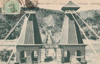
1894: Partab
Bunji vicinity, Pakistan - Indus River
| Bridgemeister ID: | 2566 (added 2012-02-04) |
| Year Completed: | 1894 |
| Name: | Partab |
| Also Known As: | Bunji |
| Location: | Bunji vicinity, Pakistan |
| Crossing: | Indus River |
| Coordinates: | 35.729820 N 74.623571 E |
| Maps: | Acme, GeoHack, Google, OpenStreetMap |
| Principals: | Algernon Durand |
| Use: | Vehicular |
| Status: | In use (last checked: 2012) |
| Main Cables: | Wire |
1894: Pokororo
Ngatimoti and Woodstock, New Zealand - Motueka River
| Bridgemeister ID: | 675 (added 2003-03-08) |
| Year Completed: | 1894 |
| Name: | Pokororo |
| Also Known As: | Ngatimoti |
| Location: | Ngatimoti and Woodstock, New Zealand |
| Crossing: | Motueka River |
| References: | GAP |
| Use: | Footbridge |
| Main Cables: | Wire |
| Suspended Spans: | 1 |
| Main Span: | 1 x 91.4 meters (299.9 feet) |
Notes:
- GAP: Originally footbridge, widened 1916. Collapsed October, 1931. Rebuilt.
External Links:
1894: Stell
Chickasha, Oklahoma, USA - Washita River
| Bridgemeister ID: | 2332 (added 2007-07-07) |
| Year Completed: | 1894 |
| Name: | Stell |
| Location: | Chickasha, Oklahoma, USA |
| Crossing: | Washita River |
| Use: | Vehicular (one-lane) |
| Status: | Removed |
| Main Cables: | Wire |
External Links:
- Turnpikes and Toll Bridges | The Encyclopedia of Oklahoma History and Culture. Image of the bridge. It appears to have been similar to the Flinn-Moyer Beveridge Bridge in Texas.
1894: Swinging
Eureka Springs vicinity, Arkansas, USA - King's River
| Bridgemeister ID: | 1822 (added 2005-05-21) |
| Year Completed: | 1894 |
| Name: | Swinging |
| Location: | Eureka Springs vicinity, Arkansas, USA |
| Crossing: | King's River |
| Coordinates: | 36.389667 N 93.659528 W |
| Maps: | Acme, GeoHack, Google, OpenStreetMap |
| Use: | Vehicular |
| Status: | Removed |
| Main Cables: | Wire |
| Suspended Spans: | 2 |
| Main Spans: | 2 x 76.8 meters (252 feet) |
External Links:
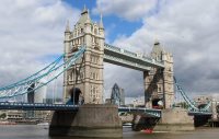
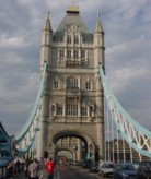
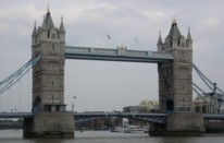
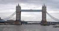
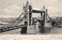
1894: Tower
London, England, United Kingdom - River Thames
| Bridgemeister ID: | 3845 (added 2020-03-07) |
| Year Completed: | 1894 |
| Name: | Tower |
| Location: | London, England, United Kingdom |
| Crossing: | River Thames |
| Coordinates: | 51.505837 N 0.075281 W |
| Maps: | Acme, GeoHack, Google, OpenStreetMap |
| References: | PTS2 |
| Use: | Vehicular |
| Status: | In use (last checked: 2023) |
| Suspended Spans: | 2 |
| Side Spans: | 2 x 82.3 meters (270 feet) |
Image Sets:
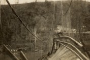
1895: Drake
Warsaw, Missouri, USA - Osage River
| Bridgemeister ID: | 1069 (added 2003-12-27) |
| Year Completed: | 1895 |
| Name: | Drake |
| Location: | Warsaw, Missouri, USA |
| Crossing: | Osage River |
| Principals: | Dr. Daniel M. Eddy |
| References: | BOTO |
| Use: | Vehicular |
| Status: | Collapsed, 1913 |
| Main Cables: | Wire |
Notes:
- Collapsed under weight of cattle 1913.
- Replaced by 1913 Middle - Warsaw, Missouri, USA.
- All past and present bridges at this location.
Image Sets:
1895: Duck Reach
Launceston, Tasmania, Australia - South Esk River
| Bridgemeister ID: | 1859 (added 2005-07-25) |
| Year Completed: | 1895 |
| Name: | Duck Reach |
| Location: | Launceston, Tasmania, Australia |
| Crossing: | South Esk River |
| Coordinates: | 41.458944 S 147.111885 E |
| Maps: | Acme, GeoHack, Google, OpenStreetMap |
| Use: | Footbridge |
| Status: | Destroyed, 1929, by flood |
Notes:
- Near 1904 Alexandra (Basin) - Launceston, Tasmania, Australia.
- Replaced by 1939 Duck Reach - Launceston, Tasmania, Australia.
- All past and present bridges at this location.
Image Sets:

| Bridgemeister ID: | 3867 (added 2020-03-07) |
| Year Completed: | 1895 |
| Name: | Grøtte |
| Location: | Grøtan, Rennebu, Trøndelag, Norway |
| Crossing: | Orkla |
| Coordinates: | 62.83606 N 9.91830 E |
| Maps: | Acme, GeoHack, Google, kart.1881.no, OpenStreetMap |
| Principals: | Sivert Gunnes |
| Use: | Vehicular (one-lane) |
| Status: | In use (last checked: 2018) |
| Main Cables: | Wire |
| Suspended Spans: | 1 |
| Main Span: | 1 x 31 meters (101.7 feet) estimated |
External Links:
| Bridgemeister ID: | 343 (added before 2003) |
| Year Completed: | 1895 |
| Name: | Mill Creek Park |
| Also Known As: | White, Silver, Old Steel, Cinderella, Fairy Tale |
| Location: | Youngstown vicinity, Ohio, USA |
| At or Near Feature: | Mill Creek Park |
| Coordinates: | 41.07325 N 80.68886 W |
| Maps: | Acme, GeoHack, Google, OpenStreetMap |
| Principals: | Charles Evan Fowler |
| References: | AAJ, HBE, IEA, PTS2 |
| Use: | Vehicular (two-lane) |
| Status: | In use (last checked: 2021) |
| Main Cables: | Eyebar |
| Suspended Spans: | 1 |
| Main Span: | 1 x 27.4 meters (90 feet) |
| Characteristics: | Braced (trussed) chain/cable |
Notes:
- Short stiffened eyebar ("braced chain") of the style that Lindenthal often proposed. A mid-span support was added many years ago.
- Major rehabilitation started, June 2007. Reopened November, 2007.
External Links:
Image Sets:
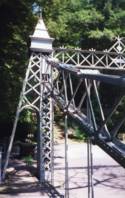
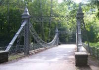
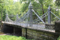
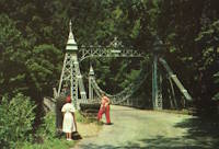
1895: Pantar
Pantar, Lanao Province, Mindanao, Philippines - Agus River
| Bridgemeister ID: | 1706 (added 2005-03-29) |
| Year Completed: | 1895 |
| Name: | Pantar |
| Location: | Pantar, Lanao Province, Mindanao, Philippines |
| Crossing: | Agus River |
| Coordinates: | 8.055806 N 124.267611 E |
| Maps: | Acme, GeoHack, Google, OpenStreetMap |
| Use: | Vehicular (one-lane) |
| Status: | Removed |
| Main Cables: | Wire |
| Suspended Spans: | 1 |
Notes:
- 1898: Burned during the Spanish-American War.
- 1903: The bridge is rebuilt.
External Links:
- Alamy - The Spanish Army in the Philippines 1896-1898. Suspension bridge over the Agus river. Philippine Island.. Possibly a predecessor bridge at the same location.
- Facebook. Image of the destroyed bridge. "The ruins of the Spanish-era Pantar bridge as found on arrival by the men of Company E, 2nd Battalion US Engineers in early 1903. The bridge was destroyed by the Spanish as they retreated during the Spanish-American War."
- Facebook. Possibly a predecessor bridge at the same location. "PUENTE DE ALFONSO XIII sobre al rio Agüs, entre los fuertes de Salazar y Sungut en el camino militar de Iligan á Marahuit".
- Flickr - Bridge at Pantar,Lanao del Norte, Northern Mindanao, Philippines 1898. Image of the bridge.
Image Sets:


1895: Sellack Boat
Sellack Boat, Ross on Wye, England, United Kingdom - River Wye
| Bridgemeister ID: | 1210 (added 2004-02-07) |
| Year Completed: | 1895 |
| Name: | Sellack Boat |
| Location: | Sellack Boat, Ross on Wye, England, United Kingdom |
| Crossing: | River Wye |
| Coordinates: | 51.948935 N 2.634423 W |
| Maps: | Acme, GeoHack, Google, OpenStreetMap |
| Principals: | Louis Harper, Harpers Limited |
| References: | BRW, HARPER |
| Use: | Footbridge |
| Status: | In use (last checked: 2014) |
| Main Cables: | Wire |
| Suspended Spans: | 1 |
| Main Span: | 1 x 57.9 meters (190 feet) |
| Deck width: | 6 feet |
Notes:
- HARPER: Completed in 1895.
External Links:
Image Sets:
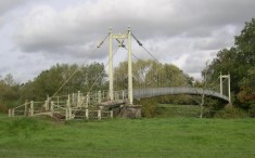
1895: Swinging
Renfrew, Ontario, Canada - Bonnechere River
| Bridgemeister ID: | 590 (added 2003-01-05) |
| Year Completed: | 1895 |
| Name: | Swinging |
| Location: | Renfrew, Ontario, Canada |
| Crossing: | Bonnechere River |
| Coordinates: | 45.478217 N 76.691764 W |
| Maps: | Acme, GeoHack, Google, OpenStreetMap |
| Use: | Footbridge |
| Status: | In use (last checked: 2020) |
| Main Cables: | Wire (steel) |
| Suspended Spans: | 2 |
| Main Spans: | 2 |
Notes:
- 1983: Rebuilt.
- 2020, December: Rehabilitation project likely.
- 2021, October: Contract awarded for repairs.
Annotated Citations:
- McIntyre, Bruce. "Swinging Bridge will be upgraded at a cost of almost $300,000." Toronto Star, 20 October 2021, https://www.thestar.com/news/canada/2021/10/20/swinging-bridge-will-be-upgraded-at-a-cost-of-almost-300000.html.
"In his report to council recently, Development and Property Director Mike Asselin said the bridge was an important piece of infrastructure and just like other municipal property like bridges and roads, council was faced with the prospect of investing in one of its assets or eventually be forced to close the bridge due to safety concerns. Although there had been some repairs completed in 2020, it was more of a stop-gap measure to deal with some immediate issues."
Image Sets:
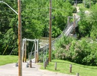
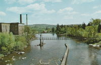
1896: Beveridge
San Saba, Texas, USA - San Saba River
| Bridgemeister ID: | 102 (added before 2003) |
| Year Completed: | 1896 |
| Name: | Beveridge |
| Location: | San Saba, Texas, USA |
| Crossing: | San Saba River |
| Coordinates: | 31.21083 N 98.74083 W |
| Maps: | Acme, GeoHack, Google, OpenStreetMap |
| Principals: | Flinn-Moyer Co. |
| References: | HAERTX98 |
| Use: | Vehicular (one-lane) |
| Status: | Restricted to foot traffic (last checked: 2008) |
| Main Cables: | Wire |
| Suspended Spans: | 1 |
Notes:
- Located near the locally famous Wedding Oak tree.
- 1938: Reconstructed by Austin Bridge Co.
- 2006: Major restoration project completed.
External Links:
- Beveridge Bridge Restoration Project - YouTube. A 27-minute video.
- Bridgehunter.com - BH33362
- Structurae - Structure ID 20005565
Image Sets:
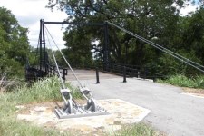
1896: Chosica
Lurigancho-Chosica, Peru
| Bridgemeister ID: | 5925 (added 2021-06-20) |
| Year Completed: | 1896 |
| Name: | Chosica |
| Location: | Lurigancho-Chosica, Peru |
| Coordinates: | 11.935041 S 76.692574 W |
| Maps: | Acme, GeoHack, Google, OpenStreetMap |
| Use: | Vehicular (one-lane) |
| Status: | Restricted to foot traffic (last checked: 2021) |
| Main Cables: | Wire (steel) |
| Suspended Spans: | 1 |
Image Sets:
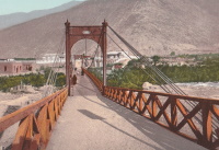
1896: Clear Fork Of The Brazos
Woodson vicinity, Shackelford County, Texas, USA - Clear Fork Brazos River
| Bridgemeister ID: | 103 (added before 2003) |
| Year Completed: | 1896 |
| Name: | Clear Fork Of The Brazos |
| Location: | Woodson vicinity, Shackelford County, Texas, USA |
| Crossing: | Clear Fork Brazos River |
| Coordinates: | 32.921611 N 99.167944 W |
| Maps: | Acme, GeoHack, Google, OpenStreetMap |
| Principals: | Flinn-Moyer Co. |
| References: | BRAZ, HAERTX64, HAERTX98 |
| Use: | Vehicular |
| Status: | Extant (last checked: 2019) |
| Main Cables: | Wire |
| Suspended Spans: | 1 |
External Links:
Image Sets:

1897: (footbridge)
Addingham, England, United Kingdom - River Wharfe
| Bridgemeister ID: | 1207 (added 2004-02-07) |
| Year Completed: | 1897 |
| Name: | (footbridge) |
| Location: | Addingham, England, United Kingdom |
| Crossing: | River Wharfe |
| Use: | Footbridge |
| Status: | Destroyed, 1936 |
| Main Cables: | Wire |
Notes:
- Destroyed by flood, 1936.
- Replaced by (footbridge) - Addingham, England, United Kingdom.
- All past and present bridges at this location.
Do you have any information or photos for these bridges that you would like to share? Please email david.denenberg@bridgemeister.com.
Mail | Facebook | X (Twitter) | Bluesky