Suspension Bridges 1999-2022 (1-100 of 1,077)
This is a list of bridges 1 through 100 (of 1,077 total) in the suspension bridge inventory completed from 1999 through 2022, the year the Çanakkale 1915 bridge was completed. Wherever you see a Bridgemeister ID number click it to isolate the bridge on its own page.
Related Lists:
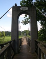
1999: (footbridge)
Monteviot, Ancrum vicinity, Scotland, United Kingdom - River Teviot
| Bridgemeister ID: | 1434 (added 2004-07-30) |
| Year Completed: | 1999 |
| Name: | (footbridge) |
| Location: | Monteviot, Ancrum vicinity, Scotland, United Kingdom |
| Crossing: | River Teviot |
| Coordinates: | 55.512985 N 2.555607 W |
| Maps: | Acme, GeoHack, Google, OpenStreetMap |
| Use: | Footbridge |
| Status: | In use (last checked: 2009) |
| Main Cables: | Wire (steel) |
| Suspended Spans: | 1 |
| Main Span: | 1 x 69.8 meters (229 feet) |
| Deck width: | 3 feet |
Image Sets:
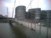
1999: Convertible
Duisburg, Germany - Inner Harbor
| Bridgemeister ID: | 576 (added 2002-12-31) |
| Year Completed: | 1999 |
| Name: | Convertible |
| Also Known As: | Inner Harbor |
| Location: | Duisburg, Germany |
| Crossing: | Inner Harbor |
| Coordinates: | 51.43861 N 6.76413 E |
| Maps: | Acme, GeoHack, Google, OpenStreetMap |
| Principals: | Schlaich Bergermann Partner |
| References: | AR200003, BAR, BBU |
| Use: | Footbridge |
| Status: | In use (last checked: 2004) |
| Main Cables: | Wire (steel) |
| Suspended Spans: | 1 |
| Main Span: | 1 x 73.72 meters (241.9 feet) estimated |
| Deck width: | 3.5 meters |
Notes:
- This footbridge is "convertible" because it can be raised to make way for boats. The backstays are shortened using jacks causing the towers to tilt back and the deck to arch up and out of the way. Eckhard Bernstorff notes, "the deck (weight 150 tons) has 14 segments. When the towers tilt back by shortening the main cables about 2.5 meters, the deck lifts 9 meters."
External Links:
Image Sets:
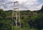
1999: Forrest and Maxie Preston Memorial Pedestrian
River, Johnson County, Kentucky, USA - Big Sandy River Levisa Fork
| Bridgemeister ID: | 329 (added before 2003) |
| Year Completed: | 1999 |
| Name: | Forrest and Maxie Preston Memorial Pedestrian |
| Location: | River, Johnson County, Kentucky, USA |
| Crossing: | Big Sandy River Levisa Fork |
| Coordinates: | 37.86015 N 82.726117 W |
| Maps: | Acme, GeoHack, Google, OpenStreetMap |
| Principals: | Bush and Burchett Inc., Bocook Engineering, S.E.A. Engineers Inc., Issam Harik |
| References: | UKODF99 |
| Use: | Footbridge |
| Status: | In use (last checked: 2005) |
| Main Cables: | Wire (steel) |
| Suspended Spans: | 3 |
| Main Span: | 1 x 96.3 meters (316 feet) estimated |
| Side Spans: | 2 x 14.3 meters (47 feet) estimated |
Notes:
- From an old Kentucky Transportation Cabinet web page: "Interested in seeing the world's longest plastic bridge? Visit Johnson County, where the 410-ft-long Forest and Maxie Preston Memorial Pedestrian Bridge recently opened. The bridge was built from a high performance composite material - glass fiber that is reinforced with plastic resins."
- A University of Kentucky web page refers to the deck material as "glass fiber-reinforced polymer composites."
External Links:
Image Sets:
1999: Gyaing
Zar Ta Pyin (ဇာသပြင်) and Kalagon (ခရုံဂူ), Myanmar - Gyaing River
| Bridgemeister ID: | 4666 (added 2020-06-19) |
| Year Completed: | 1999 |
| Name: | Gyaing |
| Location: | Zar Ta Pyin (ဇာသပြင်) and Kalagon (ခရုံဂူ), Myanmar |
| Crossing: | Gyaing River |
| Coordinates: | 16.563718 N 97.732273 E |
| Maps: | Acme, GeoHack, Google, OpenStreetMap |
| Use: | Vehicular |
| Status: | In use (last checked: 2024) |
| Main Cables: | Wire (steel) |
| Suspended Spans: | 3 |
| Main Span: | 1 x 460 meters (1,509.2 feet) estimated |
| Side Spans: | 2 |
Notes:
- 2024: A large, adjacent cable-stayed bridge is under construction.
External Links:
| Bridgemeister ID: | 963 (added 2003-11-01) |
| Year Completed: | 1999 |
| Name: | Haicang |
| Also Known As: | 厦门市海沧大桥 |
| Location: | Xiamen (厦门市) and Haicang District (海沧区), Fujian, China |
| Coordinates: | 24.497106 N 118.067964 E |
| Maps: | Acme, GeoHack, Google, OpenStreetMap |
| References: | BCG |
| Use: | Vehicular (major highway) |
| Status: | In use |
| Main Cables: | Wire (steel) |
| Suspended Spans: | 3 |
| Main Span: | 1 x 648 meters (2,126 feet) |
| Side Spans: | 2 x 230 meters (754.6 feet) |
External Links:
1999: Jiangyin
Jiangyin (江阴市), Wuxi (无锡市) and Jingjiang (靖江市), Taizhou (泰州市), Jiangsu, China - Yangtze River
| Bridgemeister ID: | 498 (added before 2003) |
| Year Completed: | 1999 |
| Name: | Jiangyin |
| Location: | Jiangyin (江阴市), Wuxi (无锡市) and Jingjiang (靖江市), Taizhou (泰州市), Jiangsu, China |
| Crossing: | Yangtze River |
| Coordinates: | 31.943965 N 120.273911 E |
| Maps: | Acme, GeoHack, Google, OpenStreetMap |
| References: | BC3, BCG, BDU |
| Use: | Vehicular (major highway) |
| Status: | In use (last checked: 2023) |
| Main Cables: | Wire (steel) |
| Suspended Spans: | 1 |
| Main Span: | 1 x 1,385 meters (4,544 feet) |
External Links:
| Bridgemeister ID: | 503 (added before 2003) |
| Year Completed: | 1999 |
| Name: | Kurushima Kaikyō I |
| Also Known As: | 来島海峡大橋 |
| Location: | Ōshima (大島) and Imabari (今治市), Ehime, Japan |
| Coordinates: | 34.125903 N 133.013167 E |
| Maps: | Acme, GeoHack, Google, OpenStreetMap |
| Principals: | Honshu-Shikoku Bridge Authority |
| References: | BAR |
| Use: | Vehicular (major highway) |
| Status: | In use (last checked: 2019) |
| Main Cables: | Wire (steel) |
| Suspended Spans: | 3 |
| Main Span: | 1 x 600 meters (1,968.5 feet) |
| Side Spans: | 1 x 140 meters (459.3 feet), 1 x 170 meters (557.7 feet) |
| Deck width: | 27 meters |
Notes:
- Connects to 1999 Kurushima Kaikyō II (来島海峡大橋) - Onomichi and Imabari (今治市), Ehime, Japan.
- Connects to 1999 Kurushima Kaikyō III (来島海峡大橋) - Onomichi and Imabari (今治市), Ehime, Japan.
- All past and present bridges at this location.
External Links:
| Bridgemeister ID: | 504 (added before 2003) |
| Year Completed: | 1999 |
| Name: | Kurushima Kaikyō II |
| Also Known As: | 来島海峡大橋 |
| Location: | Onomichi and Imabari (今治市), Ehime, Japan |
| Coordinates: | 34.121616 N 133.001921 E |
| Maps: | Acme, GeoHack, Google, OpenStreetMap |
| Principals: | Honshu-Shikoku Bridge Authority |
| References: | BAR |
| Use: | Vehicular (major highway) |
| Status: | In use (last checked: 2019) |
| Main Cables: | Wire (steel) |
| Suspended Spans: | 2 |
| Main Span: | 1 x 1,020 meters (3,346.5 feet) |
| Side Span: | 1 x 250 meters (820.2 feet) |
| Deck width: | 27 meters |
Notes:
- Connects to 1999 Kurushima Kaikyō I (来島海峡大橋) - Ōshima (大島) and Imabari (今治市), Ehime, Japan.
- Connects to 1999 Kurushima Kaikyō III (来島海峡大橋) - Onomichi and Imabari (今治市), Ehime, Japan.
- All past and present bridges at this location.
External Links:
| Bridgemeister ID: | 505 (added before 2003) |
| Year Completed: | 1999 |
| Name: | Kurushima Kaikyō III |
| Also Known As: | 来島海峡大橋 |
| Location: | Onomichi and Imabari (今治市), Ehime, Japan |
| Coordinates: | 34.115198 N 132.984055 E |
| Maps: | Acme, GeoHack, Google, OpenStreetMap |
| Principals: | Honshu-Shikoku Bridge Authority |
| References: | BAR |
| Use: | Vehicular (major highway) |
| Status: | In use (last checked: 2019) |
| Main Cables: | Wire (steel) |
| Suspended Spans: | 1 |
| Main Span: | 1 x 1,030 meters (3,379.3 feet) |
| Deck width: | 27 meters |
Notes:
- Connects to 1999 Kurushima Kaikyō I (来島海峡大橋) - Ōshima (大島) and Imabari (今治市), Ehime, Japan.
- Connects to 1999 Kurushima Kaikyō II (来島海峡大橋) - Onomichi and Imabari (今治市), Ehime, Japan.
- All past and present bridges at this location.
External Links:
1999: Peter DeFazio
Eugene, Oregon, USA - Willamette River
| Bridgemeister ID: | 573 (added 2002-12-31) |
| Year Completed: | 1999 |
| Name: | Peter DeFazio |
| Also Known As: | Ferry Street |
| Location: | Eugene, Oregon, USA |
| Crossing: | Willamette River |
| Coordinates: | 44.056083 N 123.084533 W |
| Maps: | Acme, GeoHack, Google, OpenStreetMap |
| Principals: | Jiri Strasky, OBEC Consulting Engineers, Mowat Construction Company |
| References: | BBU |
| Use: | Footbridge |
| Status: | In use (last checked: 2005) |
| Main Cables: | Wire (steel) |
| Suspended Spans: | 3 |
| Main Span: | 1 x 10³ meters (337.9 feet) |
| Side Spans: | 2 x 23 meters (75.5 feet) |
| Deck width: | 6.5 meters |
Notes:
- Footbridge, bicycle bridge.
- Similar to 2003 McKenzie River - Eugene vicinity, Oregon, USA.
External Links:
Image Sets:
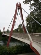
2000: (footbridge)
Bramwell, West Virginia, USA - Bluestone River
| Bridgemeister ID: | 2518 (added 2009-12-30) |
| Year Completed: | 2000 |
| Name: | (footbridge) |
| Location: | Bramwell, West Virginia, USA |
| Crossing: | Bluestone River |
| Coordinates: | 37.32488 N 81.31427 W |
| Maps: | Acme, GeoHack, Google, OpenStreetMap |
| Use: | Footbridge |
| Status: | In use (last checked: 2008) |
| Main Cables: | Wire (steel) |
| Suspended Spans: | 1 |
| Main Span: | 1 x 20.4 meters (67 feet) |
Notes:
Image Sets:
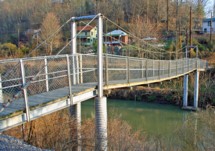
2000: (footbridge)
Langenargen, Germany - Argen River
| Bridgemeister ID: | 930 (added 2003-10-25) |
| Year Completed: | 2000 |
| Name: | (footbridge) |
| Location: | Langenargen, Germany |
| Crossing: | Argen River |
| Coordinates: | 47.59018 N 9.55693 E |
| Maps: | Acme, GeoHack, Google, OpenStreetMap |
| Use: | Footbridge |
| Status: | In use (last checked: 2013) |
| Main Cables: | Wire (steel) |
| Suspended Spans: | 1 |
| Main Span: | 1 x 40 meters (131.2 feet) |
Notes:
- Modern footbridge distinct from 1898 Langenargen bridge.
- Near 1898 Langenargen - Langenargen and Gohren, Kressbronn am Bodensee, Baden-Württemberg, Germany.
Image Sets:
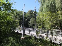
2000: (footbridge)
Lázně Toušeň, Prague vicinity, Czechia - Elbe River
| Bridgemeister ID: | 855 (added 2003-08-07) |
| Year Completed: | 2000 |
| Name: | (footbridge) |
| Location: | Lázně Toušeň, Prague vicinity, Czechia |
| Crossing: | Elbe River |
| Coordinates: | 50.173496 N 14.722408 E |
| Maps: | Acme, GeoHack, Google, OpenStreetMap |
| Use: | Footbridge |
| Status: | In use (last checked: 2018) |
| Main Cables: | Wire (steel) |
| Suspended Spans: | 1 |
| Main Span: | 1 x 10⁴ meters (341.2 feet) |
External Links:
2000: (suspension bridge)
Gharm (Garm) vicinity, Tajikistan - Vakhsh River
| Bridgemeister ID: | 945 (added 2003-10-30) |
| Year Completed: | 2000 |
| Name: | (suspension bridge) |
| Location: | Gharm (Garm) vicinity, Tajikistan |
| Crossing: | Vakhsh River |
| Coordinates: | 39.005556 N 70.312667 E |
| Maps: | Acme, GeoHack, Google, OpenStreetMap |
| Use: | Vehicular |
| Status: | Extant (last checked: 2022) |
| Suspended Spans: | 1 |
| Main Span: | 1 x 95 meters (311.7 feet) estimated |
Notes:
- Road bridge, carries the Kalak-Gharm-Jirgital Road.
External Links:
2000: Akinada
Kawajirichokashiwa, Hiroshima, Japan - Menekonoseto Strait
| Bridgemeister ID: | 506 (added before 2003) |
| Year Completed: | 2000 |
| Name: | Akinada |
| Also Known As: | 安芸灘大橋 |
| Location: | Kawajirichokashiwa, Hiroshima, Japan |
| Crossing: | Menekonoseto Strait |
| Coordinates: | 34.206374 N 132.679199 E |
| Maps: | Acme, GeoHack, Google, OpenStreetMap |
| References: | BAR |
| Use: | Vehicular (two-lane, heavy vehicles), with walkway |
| Status: | In use (last checked: 2019) |
| Main Cables: | Wire (steel) |
| Suspended Spans: | 3 |
| Main Span: | 1 x 750 meters (2,460.6 feet) |
| Side Spans: | 1 x 170 meters (557.7 feet), 1 x 255 meters (836.6 feet) |
External Links:
2000: Chavanon Viaduct
Merlines, Corrèze and Messeix, Puy-de-Dôme, France - Chavanon Valley
| Bridgemeister ID: | 509 (added before 2003) |
| Year Completed: | 2000 |
| Name: | Chavanon Viaduct |
| Location: | Merlines, Corrèze and Messeix, Puy-de-Dôme, France |
| Crossing: | Chavanon Valley |
| Coordinates: | 45.62404 N 2.479349 E |
| Maps: | Acme, GeoHack, Google, OpenStreetMap |
| References: | BPF |
| Use: | Vehicular (major highway) |
| Status: | In use (last checked: 2019) |
| Main Cables: | Wire (steel) |
| Suspended Spans: | 1 |
| Main Span: | 1 x 300 meters (984.3 feet) |
| Characteristics: | Monocable |
Notes:
- Monocable across A-pylon towers.
External Links:
2000: Debbie's Dream Catcher
Owensboro vicinity, Kentucky, USA - Panther Creek
| Bridgemeister ID: | 7024 (added 2022-05-15) |
| Year Completed: | 2000 |
| Name: | Debbie's Dream Catcher |
| Location: | Owensboro vicinity, Kentucky, USA |
| Crossing: | Panther Creek |
| At or Near Feature: | Panther Creek Park |
| Coordinates: | 37.716219 N 87.222361 W |
| Maps: | Acme, GeoHack, Google, OpenStreetMap |
| Use: | Footbridge |
| Status: | In use (last checked: 2022) |
| Main Cables: | Wire (steel) |
| Suspended Spans: | 3 |
| Main Span: | 1 |
| Side Spans: | 2 |
Notes:
- 2022, February: Deck replaced.
- Connects to Swinger - Owensboro vicinity, Kentucky, USA.
- All past and present bridges at this location.
2000: Egongyan
Chongqing, Sichuan, China - Yangtze River
| Bridgemeister ID: | 1272 (added 2004-03-14) |
| Year Completed: | 2000 |
| Name: | Egongyan |
| Also Known As: | 鹅公岩大桥 |
| Location: | Chongqing, Sichuan, China |
| Crossing: | Yangtze River |
| Coordinates: | 29.523321 N 106.528853 E |
| Maps: | Acme, GeoHack, Google, OpenStreetMap |
| References: | BCG |
| Use: | Vehicular (major highway) |
| Status: | In use (last checked: 2019) |
| Main Cables: | Wire (steel) |
| Suspended Spans: | 3 |
| Main Span: | 1 x 600 meters (1,968.5 feet) |
| Side Spans: | 2 |
Notes:
- Next to 2019 Egongyan Rail Transit (Egongyan Metro Line) - Chongqing, Sichuan, China.
- All past and present bridges at this location.
External Links:
2000: Folkwang
Essen, Germany - Bismarckstraße
| Bridgemeister ID: | 1614 (added 2005-02-21) |
| Year Completed: | 2000 |
| Name: | Folkwang |
| Location: | Essen, Germany |
| Crossing: | Bismarckstraße |
| Coordinates: | 51.443306 N 7.005722 E |
| Maps: | Acme, GeoHack, Google, OpenStreetMap |
| Use: | Footbridge |
| Status: | In use (last checked: 2023) |
| Main Cables: | Wire (steel) |
| Main Span: | 1 x 27 meters (88.6 feet) |
| Deck width: | 3.1 meters |
| Characteristics: | Monocable |
Notes:
- Monocable over A-shaped towers.
External Links:
Image Sets:
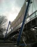
2000: La Manche
La Manche, Newfoundland and Labrador, Canada - La Manche River
| Bridgemeister ID: | 853 (added 2003-08-06) |
| Year Completed: | 2000 |
| Name: | La Manche |
| Location: | La Manche, Newfoundland and Labrador, Canada |
| Crossing: | La Manche River |
| Coordinates: | 47.16658 N 52.86638 W |
| Maps: | Acme, GeoHack, Google, OpenStreetMap |
| Use: | Footbridge |
| Status: | In use (last checked: 2024) |
| Main Cables: | Wire (steel) |
| Suspended Spans: | 1 |
Notes:
- Single-towered footbridge carrying the East Coast Trail. Plaque at the bridge the original suspension bridge (at or near this location) was destroyed January 28, 1966. The current bridge was officially opened June 17, 2000.
| Bridgemeister ID: | 1691 (added 2005-03-27) |
| Year Completed: | 2000 |
| Name: | Loch |
| Location: | Loch, Victoria, Australia |
| Coordinates: | 38.368133 S 145.71105 E |
| Maps: | Acme, GeoHack, Google, OpenStreetMap |
| Use: | Footbridge |
| Status: | In use (last checked: 2016) |
| Main Cables: | Wire |
Notes:
- A sign at the bridge reads, "Loch Stock & Barrell - Pedestrian Suspension Bridge - A Loch Memorial Reserve Community Project."
2000: Luisa-Häuser
Marburg, Germany - Lahn River
| Bridgemeister ID: | 1049 (added 2003-12-07) |
| Year Completed: | 2000 |
| Name: | Luisa-Häuser |
| Location: | Marburg, Germany |
| Crossing: | Lahn River |
| Coordinates: | 50.80873 N 8.7747 E |
| Maps: | Acme, GeoHack, Google, OpenStreetMap |
| Principals: | Gerdum and Breuer |
| Use: | Footbridge |
| Status: | In use (last checked: 2005) |
| Main Cables: | Wire (steel) |
| Suspended Spans: | 2 |
| Main Span: | 1 x 48.47 meters (159 feet) |
| Side Span: | 1 |
| Deck width: | 3.5 meters |
External Links:
Image Sets:
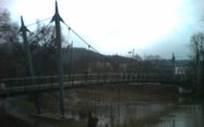
2000: McAllister
Ogden, Guysborough vicinity, Nova Scotia, Canada - Salmon River
| Bridgemeister ID: | 2368 (added 2007-09-16) |
| Year Completed: | 2000 |
| Name: | McAllister |
| Location: | Ogden, Guysborough vicinity, Nova Scotia, Canada |
| Crossing: | Salmon River |
| At or Near Feature: | Guysborough Nature Trail |
| Coordinates: | 45.346667 N 61.616139 W |
| Maps: | Acme, GeoHack, Google, OpenStreetMap |
| Principals: | Galeb Construction |
| Use: | Footbridge and Snowmobile |
| Status: | In use (last checked: 2024) |
| Main Cables: | Wire (steel) |
| Suspended Spans: | 2 |
| Main Span: | 1 x 60 meters (196.9 feet) |
| Side Span: | 1 |
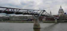
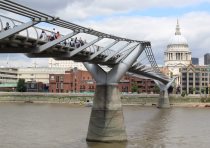
2000: Millennium
London, England, United Kingdom - River Thames
| Bridgemeister ID: | 568 (added 2002-12-31) |
| Year Completed: | 2000 |
| Name: | Millennium |
| Location: | London, England, United Kingdom |
| Crossing: | River Thames |
| Coordinates: | 51.50964 N 0.09856 W |
| Maps: | Acme, GeoHack, Google, OpenStreetMap |
| Principals: | Anthony Caro, Foster & Partners, Ove Arup & Partners |
| References: | BAR, BBU |
| Use: | Footbridge |
| Status: | In use (last checked: 2019) |
| Main Cables: | Wire (steel) |
| Suspended Spans: | 3 |
| Main Span: | 1 |
| Side Spans: | 2 |
External Links:
Image Sets:
| Bridgemeister ID: | 1923 (added 2005-10-22) |
| Year Completed: | 2000 |
| Name: | Minami Alps Sesso |
| Also Known As: | 南アルプス接岨大吊橋 |
| Location: | Kawanehon (Honkawane), Haibara District, Shizuoka, Japan |
| Coordinates: | 35.174071 N 138.189618 E |
| Maps: | Acme, GeoHack, Google, OpenStreetMap |
| Use: | Footbridge |
| Status: | In use (last checked: 2024) |
| Main Cables: | Wire (steel) |
| Suspended Spans: | 3 |
| Main Span: | 1 x 160 meters (524.9 feet) |
| Side Spans: | 2 x 30 meters (98.4 feet) |
2000: Ronda Norte
Elche, Valencia, Spain - Vinalopó River
| Bridgemeister ID: | 889 (added 2003-09-06) |
| Year Completed: | 2000 |
| Name: | Ronda Norte |
| Also Known As: | Vinalopó River |
| Location: | Elche, Valencia, Spain |
| Crossing: | Vinalopó River |
| Coordinates: | 38.279305 N 0.702661 W |
| Maps: | Acme, GeoHack, Google, OpenStreetMap |
| Use: | Vehicular (major highway) |
| Status: | In use (last checked: 2019) |
| Suspended Spans: | 1 |
| Main Span: | 1 x 164.5 meters (539.7 feet) |
| Deck width: | 23 meters |
Notes:
- Unusual asymmetrical structure with one tower.
External Links:
2000: Semey
Semipatalinsk, Kazakhstan - Irtysh River
| Bridgemeister ID: | 1100 (added 2004-01-02) |
| Year Completed: | 2000 |
| Name: | Semey |
| Also Known As: | Semipatalinsk Irtysh River |
| Location: | Semipatalinsk, Kazakhstan |
| Crossing: | Irtysh River |
| Coordinates: | 50.410509 N 80.224928 E |
| Maps: | Acme, GeoHack, Google, OpenStreetMap |
| Use: | Vehicular (major highway) |
| Status: | In use (last checked: 2019) |
| Main Cables: | Wire (steel) |
| Suspended Spans: | 1 |
| Main Span: | 1 x 750 meters (2,460.6 feet) |
External Links:
2000: Storda
Bergen, Hordaland, Norway - Hardangerfjord
| Bridgemeister ID: | 507 (added before 2003) |
| Year Completed: | 2000 |
| Name: | Storda |
| Location: | Bergen, Hordaland, Norway |
| Crossing: | Hardangerfjord |
| Coordinates: | 59.747327 N 5.402815 E |
| Maps: | Acme, GeoHack, Google, kart.1881.no, OpenStreetMap |
| Use: | Vehicular (two-lane, heavy vehicles), with walkway |
| Status: | In use (last checked: 2019) |
| Main Cables: | Wire (steel) |
| Suspended Spans: | 1 |
| Main Span: | 1 x 677 meters (2,221.1 feet) |
Notes:
External Links:
2000: Yeongjong Grand
Incheon, South Korea
| Bridgemeister ID: | 883 (added 2003-09-06) |
| Year Completed: | 2000 |
| Name: | Yeongjong Grand |
| Also Known As: | 영종대교, Youngjong |
| Location: | Incheon, South Korea |
| Coordinates: | 37.544944 N 126.582769 E |
| Maps: | Acme, GeoHack, Google, OpenStreetMap |
| Principals: | Samsung Corporation |
| Use: | Vehicular (major highway) and Rail |
| Status: | In use (last checked: 2025) |
| Main Cables: | Wire (steel) |
| Suspended Spans: | 3 |
| Main Span: | 1 x 550 meters (1,804.5 feet) |
| Side Spans: | 2 |
Notes:
- Two decks with 10 lanes for vehicles and 2 for rail. Two main cables over A-shaped pylons.
External Links:
2000: Yichang
Xiaoting District (猇亭区), Yichang (宜昌市), Hubei, China - Yangtze River
| Bridgemeister ID: | 1273 (added 2004-03-14) |
| Year Completed: | 2000 |
| Name: | Yichang |
| Also Known As: | 宜昌长江公路大桥 |
| Location: | Xiaoting District (猇亭区), Yichang (宜昌市), Hubei, China |
| Crossing: | Yangtze River |
| Coordinates: | 30.569852 N 111.391768 E |
| Maps: | Acme, GeoHack, Google, OpenStreetMap |
| References: | BCG |
| Use: | Vehicular |
| Status: | In use (last checked: 2019) |
| Main Cables: | Wire (steel) |
| Main Span: | 1 x 960 meters (3,149.6 feet) |
External Links:
2001: (footbridge)
Battambang vicinity, Cambodia - Sangker River
| Bridgemeister ID: | 3199 (added 2019-11-10) |
| Year Completed: | 2001 |
| Name: | (footbridge) |
| Location: | Battambang vicinity, Cambodia |
| Crossing: | Sangker River |
| Coordinates: | 13.048928 N 103.196297 E |
| Maps: | Acme, GeoHack, Google, OpenStreetMap |
| Use: | Footbridge |
| Status: | In use (last checked: 2014) |
| Main Cables: | Wire (steel) |
| Suspended Spans: | 1 |
External Links:
2001: (footbridge)
Botung, Mandailing Natal Regency, North Sumatra, Indonesia
| Bridgemeister ID: | 8033 (added 2023-12-23) |
| Year Completed: | 2001 |
| Name: | (footbridge) |
| Location: | Botung, Mandailing Natal Regency, North Sumatra, Indonesia |
| Coordinates: | 0.646139 N 99.817083 E |
| Maps: | Acme, GeoHack, Google, OpenStreetMap |
| Use: | Footbridge |
| Status: | In use (last checked: 2023) |
| Main Cables: | Wire (iron) |
| Suspended Spans: | 1 |
2001: (footbridge)
Chattanooga, Tennessee, USA - South Chickamauga Creek
| Bridgemeister ID: | 2513 (added 2009-12-30) |
| Year Completed: | 2001 |
| Name: | (footbridge) |
| Location: | Chattanooga, Tennessee, USA |
| Crossing: | South Chickamauga Creek |
| At or Near Feature: | Elise Chapin Sanctuary at Audobon Acres |
| Coordinates: | 34.996926 N 85.184675 W |
| Maps: | Acme, GeoHack, Google, OpenStreetMap |
| Principals: | S & R Construction |
| Use: | Footbridge |
| Status: | In use (last checked: 2019) |
| Main Cables: | Wire (steel) |
| Suspended Spans: | 1 |
| Main Span: | 1 x 38.1 meters (125 feet) |
Notes:
- Replaced 1948 (footbridge) - Chattanooga, Tennessee, USA.
- All past and present bridges at this location.
External Links:
Image Sets:
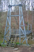
2001: (footbridge)
Houston, Texas, USA - ravine along Lake Carter
| Bridgemeister ID: | 967 (added 2003-11-01) |
| Year Completed: | 2001 |
| Name: | (footbridge) |
| Location: | Houston, Texas, USA |
| Crossing: | ravine along Lake Carter |
| Coordinates: | 29.77431 N 95.47557 W |
| Maps: | Acme, GeoHack, Google, OpenStreetMap |
| Principals: | Sahale, LLC. |
| Use: | Footbridge |
| Status: | In use |
| Main Cables: | Wire (steel) |
| Suspended Spans: | 1 |
| Main Span: | 1 x 20.1 meters (66 feet) |
| Deck width: | 4 feet |
Notes:
- This bridge is located on private property.
External Links:
2001: (footbridge)
Sanghiang Tanjung, Lebak and Pasirtanjung, Lebak, Banten, Indonesia - Ciberang River
| Bridgemeister ID: | 6468 (added 2021-08-14) |
| Year Completed: | 2001 |
| Name: | (footbridge) |
| Location: | Sanghiang Tanjung, Lebak and Pasirtanjung, Lebak, Banten, Indonesia |
| Crossing: | Ciberang River |
| Coordinates: | 6.393431 S 106.254467 E |
| Maps: | Acme, GeoHack, Google, OpenStreetMap |
| Use: | Footbridge |
| Status: | Replaced, 2012 |
| Main Cables: | Wire (steel) |
| Main Span: | 1 |
Notes:
- 2012, January 19-20: The bridge gains worldwide attention as it was recently severely damaged by flooding but schoolchildren are still using the nearly destroyed structure to and from school every day.
- Replaced by 2012 (footbridge) - Sanghiang Tanjung, Lebak and Pasirtanjung, Lebak, Banten, Indonesia.
- All past and present bridges at this location.
External Links:
2001: (footbridge)
Sarreguemines, Moselle, France - Sarre River
| Bridgemeister ID: | 1889 (added 2005-10-01) |
| Year Completed: | 2001 |
| Name: | (footbridge) |
| Location: | Sarreguemines, Moselle, France |
| Crossing: | Sarre River |
| Coordinates: | 49.110183 N 7.072017 E |
| Maps: | Acme, GeoHack, Google, OpenStreetMap |
| Use: | Footbridge |
| Status: | In use (last checked: 2017) |
| Main Cables: | Wire (steel) |
| Suspended Spans: | 2 |
| Side Spans: | 2 |
| Characteristics: | Self-anchored |
Notes:
- Self-anchored. Inclined suspenders.
External Links:
2001: (footbridge)
Shepparton, Victoria, Australia - Goulburn River
| Bridgemeister ID: | 1750 (added 2005-04-20) |
| Year Completed: | 2001 |
| Name: | (footbridge) |
| Location: | Shepparton, Victoria, Australia |
| Crossing: | Goulburn River |
| Coordinates: | 36.387517 S 145.393 E |
| Maps: | Acme, GeoHack, Google, OpenStreetMap |
| Use: | Footbridge |
| Status: | In use (last checked: 2013) |
| Main Cables: | Wire (steel) |
Notes:
- Wide footbridge.
2001: (footbridge)
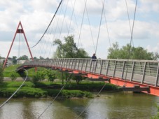
Tours, Indre-et-Loire, France - Cher River
| Bridgemeister ID: | 1019 (added 2003-11-22) |
| Year Completed: | 2001 |
| Name: | (footbridge) |
| Location: | Tours, Indre-et-Loire, France |
| Crossing: | Cher River |
| Coordinates: | 47.37155 N 0.682467 E |
| Maps: | Acme, GeoHack, Google, OpenStreetMap |
| Principals: | Alain Spielmann |
| Use: | Footbridge |
| Status: | In use (last checked: 2005) |
| Main Cables: | Wire (steel) |
| Suspended Spans: | 1 |
| Characteristics: | Monocable |
Notes:
- Monocable from A-shaped towers.
External Links:
Image Sets:
2001: Bømla
Bergen, Hordaland, Norway
| Bridgemeister ID: | 508 (added before 2003) |
| Year Completed: | 2001 |
| Name: | Bømla |
| Location: | Bergen, Hordaland, Norway |
| Coordinates: | 59.737039 N 5.379233 E |
| Maps: | Acme, GeoHack, Google, kart.1881.no, OpenStreetMap |
| Use: | Vehicular (two-lane, heavy vehicles), with walkway |
| Status: | In use (last checked: 2019) |
| Main Cables: | Wire (steel) |
| Suspended Spans: | 1 |
Notes:
External Links:
2001: Bernier
Bromptonville, Sherbrooke vicinity, Quebec, Canada - St. François River
| Bridgemeister ID: | 1163 (added 2004-01-19) |
| Year Completed: | 2001 |
| Name: | Bernier |
| Location: | Bromptonville, Sherbrooke vicinity, Quebec, Canada |
| Crossing: | St. François River |
| Coordinates: | 45.483752 N 71.960675 W |
| Maps: | Acme, GeoHack, Google, OpenStreetMap |
| Principals: | Canadian Military Engineers (CME) |
| Use: | Footbridge |
| Status: | Destroyed, January, 2018 |
| Main Cables: | Wire (steel) |
Notes:
- Destroyed by flood and ice jam, January 2018, along with the adjacent rail bridge.
- Replaced 1978 Bernier - Bromptonville, Sherbrooke vicinity, Quebec, Canada.
- All past and present bridges at this location.
2001: Cross Fork
Cross Fork vicinity, Pennsylvania, USA - Cross Fork Creek
| Bridgemeister ID: | 2401 (added 2007-12-08) |
| Year Completed: | 2001 |
| Name: | Cross Fork |
| Location: | Cross Fork vicinity, Pennsylvania, USA |
| Crossing: | Cross Fork Creek |
| Coordinates: | 41.57235 N 77.78174 W |
| Maps: | Acme, GeoHack, Google, OpenStreetMap |
| Principals: | Potter County Trailblazers, Dept. of Conservation and Natural Resources |
| Use: | Footbridge |
| Status: | In use (last checked: 2002) |
| Main Cables: | Wire (steel) |
| Suspended Spans: | 1 |
Image Sets:
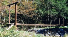
2001: Duona
Maolin District, Kaohsiung City, Taiwan - Zhuokou River
| Bridgemeister ID: | 2487 (added 2008-12-22) |
| Year Completed: | 2001 |
| Name: | Duona |
| Also Known As: | 多纳大桥, Duo-na, Dona, Duonagao |
| Location: | Maolin District, Kaohsiung City, Taiwan |
| Crossing: | Zhuokou River |
| At or Near Feature: | Maolin National Scenic Area |
| Coordinates: | 22.914053 N 120.689410 E |
| Maps: | Acme, GeoHack, Google, OpenStreetMap |
| Use: | Footbridge |
| Status: | In use (last checked: 2019) |
| Main Cables: | Wire (steel) |
| Suspended Spans: | 1 |
| Main Span: | 1 x 232 meters (761.2 feet) |
Notes:
- Major renovation completed, 2015.
External Links:
2001: East Street
Mount Morgan, Queensland, Australia - Dee River
| Bridgemeister ID: | 2675 (added 2019-03-24) |
| Year Completed: | 2001 |
| Name: | East Street |
| Also Known As: | Private Victor Stanley Jones |
| Location: | Mount Morgan, Queensland, Australia |
| Crossing: | Dee River |
| Coordinates: | 23.642740 S 150.389375 E |
| Maps: | Acme, GeoHack, Google, OpenStreetMap |
| Use: | Footbridge |
| Status: | In use (last checked: 2021) |
| Main Cables: | Wire |
| Suspended Spans: | 1 |
Notes:
- Closed briefly in late 2020 for repairs and refurbishment.
- At former location of East Street - Mount Morgan, Queensland, Australia.
- All past and present bridges at this location.
2001: Farinet
Saillon and Leytron, Switzerland - Salentze Gorge
| Bridgemeister ID: | 1871 (added 2005-08-06) |
| Year Completed: | 2001 |
| Name: | Farinet |
| Location: | Saillon and Leytron, Switzerland |
| Crossing: | Salentze Gorge |
| Coordinates: | 46.183344 N 7.182941 E |
| Maps: | Acme, GeoHack, Google, OpenStreetMap |
| Use: | Footbridge |
| Status: | In use (last checked: 2021) |
| Main Cables: | Wire (steel) |
| Main Span: | 1 x 95 meters (311.7 feet) estimated |
| Deck width: | 1.2 meters |
Notes:
- This bridge is 136 meters high.
External Links:
2001: Flakkebrua
Flakk, Birkenes, Agder, Norway - Tovdalselva
| Bridgemeister ID: | 4317 (added 2020-04-10) |
| Year Completed: | 2001 |
| Name: | Flakkebrua |
| Location: | Flakk, Birkenes, Agder, Norway |
| Crossing: | Tovdalselva |
| Coordinates: | 58.338767 N 8.221410 E |
| Maps: | Acme, GeoHack, Google, kart.1881.no, OpenStreetMap |
| Use: | Footbridge |
| Status: | In use (last checked: 2019) |
| Main Cables: | Wire (steel) |
| Suspended Spans: | 2 |
| Main Span: | 1 x 59 meters (193.6 feet) estimated |
| Side Span: | 1 x 7.5 meters (24.6 feet) estimated |
| Deck width: | ~1.4 meters |
Notes:
2001: Halgavor
Bodmin, Cornwall and Lanhydrock, England, United Kingdom - A30 Highway
| Bridgemeister ID: | 964 (added 2003-11-01) |
| Year Completed: | 2001 |
| Name: | Halgavor |
| Location: | Bodmin, Cornwall and Lanhydrock, England, United Kingdom |
| Crossing: | A30 Highway |
| Coordinates: | 50.4503 N 4.697267 W |
| Maps: | Acme, GeoHack, Google, OpenStreetMap |
| Principals: | Flint & Neill Partnership, Wilkinson Eyre |
| References: | BAR |
| Use: | Footbridge |
| Status: | In use (last checked: 2008) |
| Main Cables: | Wire (steel) |
| Suspended Spans: | 1 |
| Main Span: | 1 x 48 meters (157.5 feet) |
| Deck width: | 3.5 meters |
Notes:
- Unconventional design with swept-back towers. Wide deck, intended to carry pedestrians, cyclists, and horses.
External Links:
| Bridgemeister ID: | 7893 (added 2023-10-14) |
| Year Completed: | 2001 |
| Name: | Hornuyoc |
| Location: | Acopampa and Hornuyoc, Peru |
| Crossing: | Rio Santa |
| Coordinates: | 9.298338 S 77.629652 W |
| Maps: | Acme, GeoHack, Google, OpenStreetMap |
| Use: | Vehicular (one-lane) |
| Status: | Removed, 2017 |
| Main Cables: | Wire (steel) |
| Suspended Spans: | 1 |
| Main Span: | 1 x 50 meters (164 feet) estimated |
2001: Kutai Kartanegara
Teluk Dalam, Kutai Kartanegara Regency and Tenggarong, Kutai Kartanegara Regency, East Kalimantan, Indonesia - Mahakam River
| Bridgemeister ID: | 8450 (added 2024-03-10) |
| Year Completed: | 2001 |
| Name: | Kutai Kartanegara |
| Also Known As: | Kukar |
| Location: | Teluk Dalam, Kutai Kartanegara Regency and Tenggarong, Kutai Kartanegara Regency, East Kalimantan, Indonesia |
| Crossing: | Mahakam River |
| Coordinates: | 0.444302 S 117.002891 E |
| Maps: | Acme, GeoHack, Google, OpenStreetMap |
| Use: | Vehicular (two-lane, heavy vehicles) |
| Status: | Collapsed, November 26, 2011 |
| Main Cables: | Wire (steel) |
| Suspended Spans: | 3 |
| Main Span: | 1 x 270 meters (885.8 feet) |
| Side Spans: | 2 x 100 meters (328.1 feet) |
Notes:
- 2011, November 26: Bridge collapses killing 24 and injuring dozens of people.
External Links:
- Google Maps. Image of the bridge. Dated January 2011.
- Google Maps. Image of the bridge. Dated July 2008.
- Google Maps. Patrick S. O'Donnell observes: "Image showing the abutment/anchorage where the main cable strands, via an exposed splay area, were affixed to the eyebar / rods. Also visible is the extension of the abutment/hammerhead outer pier cap that the final main cable band rested on - the point where the start of the splay of the 19 strands." Dated April 2018 after the suspension bridge's abutments were reused for the replacement bridge.
- Google Maps. Another image showing where the main cables connected to the anchorage. Dated September 2022.
- Tragedi Jembatan Kartanegara, Sebab-Sebab yang Tak Mesti Terjadi - Kaltim Kece. Patrick S. O'Donnell summarizes: "This article goes further in depth of the cause of the collapse. It brings up multiple issues, including an anchorage block that had slid 15 centimeters. One issue: 'Lack of knowledge'. Then goes on to say 'The planners of the bridge builder have indeed asked for recommendations from Japanese experts. However, the recommendations received allegedly violated the code of practice at that time.'"
- Wikimedia Commons - Kutai Kartanegara Bridge after collapse. Image of the bridge after the collapse. Dated November 28, 2011.
- Wikipedia - Jembatan Kutai Kartanegara
- Wikipedia - Jembatan Kutai Kartanegara sebelum ambruk pada 2011.. Image of the bridge.
- Wikipedia - List of bridge failures. Cause of failure: "Human error. As workers were repairing a cable during maintenance work, a support cable snapped, causing the roadway to fall into the 50-metre-deep Mahakam River. Exact cause remains unknown and undetermined." Casualties: "20 killed, 40 injured (33 missing)."
- Wikipedia - Sisa badan jalan. Image of the bridge after the collapse. Dated November 27, 2011.
- Wikipedia - Sisi utara jembatan. Image of the bridge after the collapse. Dated November 27, 2011.
- Wikipedia - Tampak dari jalan utama. Image of the bridge after the collapse. Dated November 27, 2011.
- Wikipedia - the picture of kutai kartanegara bridge after collapse on november 26th, 2011. it remain 2 main pillars. Image of the bridge after the collapse. Dated November 27, 2011.
2001: Kutai Kertanegara I
Tenggarong and Samarinda, East Kalimantan, Indonesia - Mahakam River
| Bridgemeister ID: | 1196 (added 2004-01-27) |
| Year Completed: | 2001 |
| Name: | Kutai Kertanegara I |
| Location: | Tenggarong and Samarinda, East Kalimantan, Indonesia |
| Crossing: | Mahakam River |
| Principals: | Direktorat Jenderal Bina Marga, PT Hutama Karya, PT Perentjana Djaja |
| Use: | Vehicular |
| Status: | Collapsed, Nov. 26, 2011 |
| Main Cables: | Wire (steel) |
| Main Span: | 1 x 270 meters (885.8 feet) |
Notes:
- Suspenders snapped and entire bridge deck collapsed November 26, 2011 while undergoing maintenance.
External Links:
2001: Luojiaohe
Shuangshanzhen (双山镇), Dafang (大方县), Bijie (毕节市), Guizhou, China - Luojiao River
| Bridgemeister ID: | 4695 (added 2020-06-20) |
| Year Completed: | 2001 |
| Name: | Luojiaohe |
| Also Known As: | 贵毕公路落脚河大桥 |
| Location: | Shuangshanzhen (双山镇), Dafang (大方县), Bijie (毕节市), Guizhou, China |
| Crossing: | Luojiao River |
| Coordinates: | 27.207948 N 105.531504 E |
| Maps: | Acme, GeoHack, Google, OpenStreetMap |
| Use: | Vehicular (two-lane, heavy vehicles) |
| Status: | In use (last checked: 2023) |
| Main Cables: | Wire (steel) |
| Suspended Spans: | 1 |
| Main Span: | 1 x 268 meters (879.3 feet) |
External Links:
2001: Sightseeing
Tunxi District (屯溪区), Huangshan City (黄山市), Anhui, China - Xin'an River
| Bridgemeister ID: | 8848 (added 2024-09-29) |
| Year Completed: | 2001 |
| Name: | Sightseeing |
| Also Known As: | 黄山市观光索桥 |
| Location: | Tunxi District (屯溪区), Huangshan City (黄山市), Anhui, China |
| Crossing: | Xin'an River |
| Coordinates: | 29.715556 N 118.336639 E |
| Maps: | Acme, GeoHack, Google, OpenStreetMap |
| Use: | Footbridge |
| Status: | In use (last checked: 2020) |
| Main Cables: | Wire (steel) |
| Suspended Spans: | 3 |
| Main Span: | 1 |
| Side Spans: | 2 |
External Links:
2001: Skevington Crossing
Rogue River, Oregon, USA - Evans Creek
| Bridgemeister ID: | 866 (added 2003-08-23) |
| Year Completed: | 2001 |
| Name: | Skevington Crossing |
| Location: | Rogue River, Oregon, USA |
| Crossing: | Evans Creek |
| At or Near Feature: | Palmerton Park |
| Coordinates: | 42.439917 N 123.172683 W |
| Maps: | Acme, GeoHack, Google, OpenStreetMap |
| Use: | Footbridge |
| Status: | In use (last checked: 2003) |
| Main Cables: | Wire (steel) |
| Suspended Spans: | 1 |
Image Sets:
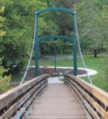
2001: Wuchuan Nanmu
Fenglezhen, Guizhou, China - Fengle River
| Bridgemeister ID: | 4741 (added 2020-06-27) |
| Year Completed: | 2001 |
| Name: | Wuchuan Nanmu |
| Also Known As: | 务川楠木吊桥 |
| Location: | Fenglezhen, Guizhou, China |
| Crossing: | Fengle River |
| Coordinates: | 28.252200 N 107.843041 E |
| Maps: | Acme, GeoHack, Google, OpenStreetMap |
| Use: | Footbridge |
| Status: | In use (last checked: 2019) |
| Main Cables: | Wire (steel) |
| Suspended Spans: | 1 |
| Main Span: | 1 x 130 meters (426.5 feet) |
External Links:
2001: Xixihe
Qianxi (黔西市), Bijie (毕节市) and Dafang (大方县), Bijie (毕节市), Guizhou, China - Xixi River
| Bridgemeister ID: | 4566 (added 2020-06-02) |
| Year Completed: | 2001 |
| Name: | Xixihe |
| Also Known As: | Xi Xi, Xixi, 贵毕公路西溪河大桥 |
| Location: | Qianxi (黔西市), Bijie (毕节市) and Dafang (大方县), Bijie (毕节市), Guizhou, China |
| Crossing: | Xixi River |
| Coordinates: | 27.030944 N 105.807306 E |
| Maps: | Acme, GeoHack, Google, OpenStreetMap |
| Use: | Vehicular (two-lane, heavy vehicles) |
| Status: | In use (last checked: 2023) |
| Main Cables: | Wire (steel) |
| Suspended Spans: | 1 |
| Main Span: | 1 x 338 meters (1,108.9 feet) |
External Links:
2001: Zhongxian
Zhongxian, Chongqing, China - Yangtze River
| Bridgemeister ID: | 4598 (added 2020-06-06) |
| Year Completed: | 2001 |
| Name: | Zhongxian |
| Also Known As: | 忠县长江大桥 |
| Location: | Zhongxian, Chongqing, China |
| Crossing: | Yangtze River |
| Coordinates: | 30.302000 N 108.049639 E |
| Maps: | Acme, GeoHack, Google, OpenStreetMap |
| Use: | Vehicular (four or more lanes) |
| Status: | In use (last checked: 2019) |
| Main Cables: | Wire (steel) |
| Suspended Spans: | 1 |
| Main Span: | 1 x 560 meters (1,837.3 feet) |
External Links:
2002: (footbridge)
Pliezhausen vicinity, Baden-Württemberg, Germany - Neckar River
| Bridgemeister ID: | 2253 (added 2007-04-08) |
| Year Completed: | 2002 |
| Name: | (footbridge) |
| Location: | Pliezhausen vicinity, Baden-Württemberg, Germany |
| Crossing: | Neckar River |
| Coordinates: | 48.558365 N 9.219604 E |
| Maps: | Acme, GeoHack, Google, OpenStreetMap |
| Principals: | Holzbau Amann GmbH |
| Use: | Footbridge |
| Status: | In use (last checked: 2019) |
| Main Cables: | Rod |
| Suspended Spans: | 1 |
External Links:
2002: (suspension bridge)
Magee property, Blackwell vicinity, Virginia, USA - North Fork Holston River
| Bridgemeister ID: | 826 (added 2003-05-31) |
| Year Completed: | 2002 |
| Name: | (suspension bridge) |
| Location: | Magee property, Blackwell vicinity, Virginia, USA |
| Crossing: | North Fork Holston River |
| Coordinates: | 36.83143 N 81.90466 W |
| Maps: | Acme, GeoHack, Google, OpenStreetMap |
| Status: | In use |
| Main Cables: | Wire |
| Suspended Spans: | 3 |
| Main Span: | 1 x 59.4 meters (195 feet) |
| Side Spans: | 1 x 15.2 meters (50 feet), 1 x 9.1 meters (30 feet) |
Notes:
- Patrick S. O'Donnell notes this private residential bridge is wide enough (6 feet) for the owner to drive his golf cart across.
Image Sets:
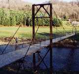
2002: Agen
Agen, Lot-et-Garonne, France - Garonne River
| Bridgemeister ID: | 1032 (added 2003-11-30) |
| Year Completed: | 2002 |
| Name: | Agen |
| Location: | Agen, Lot-et-Garonne, France |
| Crossing: | Garonne River |
| Coordinates: | 44.201950 N 0.608290 E |
| Maps: | Acme, GeoHack, Google, OpenStreetMap |
| Use: | Footbridge |
| Status: | In use (last checked: 2019) |
| Main Cables: | Wire (steel) |
| Suspended Spans: | 3 |
| Main Span: | 1 x 174.25 meters (571.7 feet) |
| Side Spans: | 1 x 29.5 meters (96.8 feet), 1 x 20.6 meters (67.6 feet) |
| Deck width: | 2.3 meters |
Notes:
External Links:
2002: Antahuaya
Pacarán, Peru - Rio Cañete
| Bridgemeister ID: | 8609 (added 2024-05-26) |
| Year Completed: | 2002 |
| Name: | Antahuaya |
| Location: | Pacarán, Peru |
| Crossing: | Rio Cañete |
| Coordinates: | 12.885083 S 76.077889 W |
| Maps: | Acme, GeoHack, Google, OpenStreetMap |
| Principals: | Inprocon Asociados S.A. |
| Use: | Footbridge |
| Status: | Extant (last checked: 2023) |
| Main Cables: | Wire (steel) |
| Main Span: | 1 x 60 meters (196.9 feet) |
2002: Gwangandaegyo
Busan, South Korea
| Bridgemeister ID: | 962 (added 2003-11-01) |
| Year Completed: | 2002 |
| Name: | Gwangandaegyo |
| Also Known As: | Kwang-An, Gwangan Diamond |
| Location: | Busan, South Korea |
| Coordinates: | 35.145052 N 129.127909 E |
| Maps: | Acme, GeoHack, Google, OpenStreetMap |
| Use: | Vehicular (double-deck) |
| Status: | In use (last checked: 2019) |
| Main Cables: | Wire (steel) |
| Suspended Spans: | 3 |
| Main Span: | 1 x 500 meters (1,640.4 feet) |
| Side Spans: | 1 x 200 meters (656.2 feet), 1 x 400 meters (1,312.3 feet) |
External Links:
2002: Islandwood
Islandwood, Port Blakely, Washington, USA
| Bridgemeister ID: | 854 (added 2003-08-07) |
| Year Completed: | 2002 |
| Name: | Islandwood |
| Location: | Islandwood, Port Blakely, Washington, USA |
| Coordinates: | 47.60382 N 122.52683 W |
| Maps: | Acme, GeoHack, Google, OpenStreetMap |
| Principals: | Sahale, LLC |
| Use: | Footbridge |
| Status: | In use (last checked: 2007) |
| Main Cables: | Wire (steel) |
| Suspended Spans: | 1 |
| Main Span: | 1 x 57.9 meters (190 feet) |
| Deck width: | 4 feet |
External Links:
Image Sets:
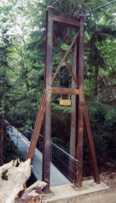
2002: Kamimoku Yume
Minakami, Gunma, Japan - Tone River
| Bridgemeister ID: | 7899 (added 2023-10-15) |
| Year Completed: | 2002 |
| Name: | Kamimoku Yume |
| Also Known As: | 上牧夢のブリッジ |
| Location: | Minakami, Gunma, Japan |
| Crossing: | Tone River |
| Coordinates: | 36.735561 N 138.981120 E |
| Maps: | Acme, GeoHack, Google, OpenStreetMap |
| Suspended Spans: | 2 |
| Main Spans: | 2 |
External Links:
2002: Koovery Kadavu
Koovery (കൂവേരി), Kerala, India - Kuppam River
| Bridgemeister ID: | 7773 (added 2023-08-17) |
| Year Completed: | 2002 |
| Name: | Koovery Kadavu |
| Also Known As: | കൂവേരി കടവ് തൂക്കു പാലം |
| Location: | Koovery (കൂവേരി), Kerala, India |
| Crossing: | Kuppam River |
| Coordinates: | 12.118973 N 75.395421 E |
| Maps: | Acme, GeoHack, Google, OpenStreetMap |
| Use: | Footbridge |
| Status: | In use (last checked: 2023) |
| Main Cables: | Wire (steel) |
| Main Span: | 1 |
2002: Martinska Ves
Martinska Ves, Croatia - Sava River
| Bridgemeister ID: | 4537 (added 2020-05-17) |
| Year Completed: | 2002 |
| Name: | Martinska Ves |
| Location: | Martinska Ves, Croatia |
| Crossing: | Sava River |
| Coordinates: | 45.586535 N 16.370627 E |
| Maps: | Acme, GeoHack, Google, OpenStreetMap |
| Use: | Vehicular (one-lane) |
| Status: | In use (last checked: 2019) |
| Main Cables: | Wire (steel) |
External Links:
2002: Nagisa
Ajigasawa, Aomori, Japan - Nakamura River
| Bridgemeister ID: | 1991 (added 2005-12-03) |
| Year Completed: | 2002 |
| Name: | Nagisa |
| Also Known As: | なぎさブリッジ |
| Location: | Ajigasawa, Aomori, Japan |
| Crossing: | Nakamura River |
| At or Near Feature: | Hamanasu Park, Shinsetsu Seaside Park |
| Coordinates: | 40.779559 N 140.220842 E |
| Maps: | Acme, GeoHack, Google, OpenStreetMap |
| Use: | Footbridge |
| Status: | In use (last checked: 2019) |
| Main Cables: | Wire (steel) |
| Suspended Spans: | 1 |
| Main Span: | 1 x 110.15 meters (361.4 feet) |
Notes:
- In a paper title "Construction of Nagisa Bridge Hybrid System of Cable Stayed PC Bridge and Steel Suspension Bridge" (by Yuzuru Sato, et. al.) the bridge is described as "The structure of this bridge is a hybrid structure of cable-stayed prestressed concrete bridge and steel suspension bridge. It is the first application as this structure type of bridge in the world. Concrete girders near pylons are supported by stay cables. Steel girders are supported by suspension cables in the central part of the span. This is new type system for prestressed concrete bridges with longer span and has many structural features compared with ordinary cable-stayed bridge and suspension bridge." and makes comparison to Arnodin suspension bridges where cable stays are the primary support for part of the deck.
- See 1879 Saint-Ilpize - Saint-Ilpize, Haute-Loire, France.
- See 1887 de l'Abîme - Cusy and Gruffy, Haute-Savoie, France.
- See 1898 Rouen Transporter - Rouen, Seine-Maritime, France.
2002: Popolopen
Fort Montgomery, New York, USA - Popolopen Creek
| Bridgemeister ID: | 951 (added 2003-10-31) |
| Year Completed: | 2002 |
| Name: | Popolopen |
| Also Known As: | William J. Moreau Popolopen |
| Location: | Fort Montgomery, New York, USA |
| Crossing: | Popolopen Creek |
| At or Near Feature: | Bear Mountain Park, Appalachian Trail |
| Coordinates: | 41.323017 N 73.989017 W |
| Maps: | Acme, GeoHack, Google, OpenStreetMap |
| Principals: | Cleveland Bridge USA, Dorman Long Technology, Creative Pultrusions Inc. |
| Use: | Footbridge |
| Status: | In use (last checked: 2020) |
| Main Cables: | Wire (steel) |
| Suspended Spans: | 1 |
| Main Span: | 1 x 102.4 meters (336 feet) |
| Deck width: | 11 feet |
Notes:
- Hybrid truss-suspension.
- Dedicated June 27, 2014 to William J. Moreau, a former Chief Engineer of the New York State Bridge Authority.
- Near 1924 Bear Mountain - Anthony's Nose and Bear Mountain, New York, USA.
External Links:
Image Sets:
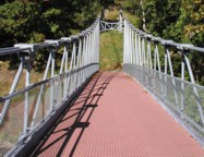
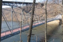
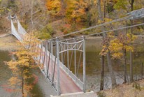
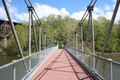
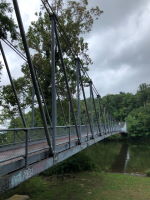
2002: Sangham
Komsing, Pangin vicinity and Boleng vicinity, Arunachal Pradesh, India - Siyom River
| Bridgemeister ID: | 6249 (added 2021-07-18) |
| Year Completed: | 2002 |
| Name: | Sangham |
| Also Known As: | Sangam Bailey |
| Location: | Komsing, Pangin vicinity and Boleng vicinity, Arunachal Pradesh, India |
| Crossing: | Siyom River |
| Coordinates: | 28.233717 N 94.996286 E |
| Maps: | Acme, GeoHack, Google, OpenStreetMap |
| Use: | Vehicular (one-lane) |
| Status: | Collapsed, June, 2021 |
| Main Cables: | Wire (steel) |
| Suspended Spans: | 1 |
| Main Span: | 1 |
Notes:
- 2021, June: Collapsed while a truck was crossing. Locals quickly erect a bamboo replacement bridge to allow foot traffic.
- Near 2022 Nugong - Komsing, Arunachal Pradesh, India.
2002: Sörnzig-Fischheim
Sörnzig and Fischheim, Saxony, Germany - Zwickauer Mulde River
| Bridgemeister ID: | 2167 (added 2007-01-12) |
| Year Completed: | 2002 |
| Name: | Sörnzig-Fischheim |
| Location: | Sörnzig and Fischheim, Saxony, Germany |
| Crossing: | Zwickauer Mulde River |
| Coordinates: | 51.022007 N 12.789679 E |
| Maps: | Acme, GeoHack, Google, OpenStreetMap |
| Principals: | Metallbau Michaelis |
| Use: | Footbridge |
| Status: | In use (last checked: 2006) |
| Main Cables: | Wire (steel) |
| Suspended Spans: | 1 |
| Main Span: | 1 x 60 meters (196.9 feet) |
| Deck width: | 1.6 meters |
Notes:
- Eckhard Bernstorff notes: "Cable forces guided through truss of towers and side spans."
- Replaced 1958 Sörnzig-Fischheim - Sörnzig and Fischheim, Saxony, Germany.
- All past and present bridges at this location.
Image Sets:
2002: Shwe Laung
Shwelaung, Myanmar
2002: Swinging
Basalt, Colorado, USA - Frying Pan River
| Bridgemeister ID: | 2226 (added 2007-03-18) |
| Year Completed: | 2002 |
| Name: | Swinging |
| Location: | Basalt, Colorado, USA |
| Crossing: | Frying Pan River |
| Coordinates: | 39.36828 N 107.03178 W |
| Maps: | Acme, GeoHack, Google, OpenStreetMap |
| Principals: | Sahale, LLC |
| Use: | Footbridge |
| Status: | In use (last checked: 2006) |
| Main Cables: | Wire (steel) |
| Suspended Spans: | 1 |
| Main Span: | 1 x 19.8 meters (65 feet) estimated |
Notes:
- A display at the bridge indicates this bridge was a replacement for another suspension bridge. Completion year of 2002 is taken from the dedication date, January 11, 2002. Bridge may have been completed earlier (in late 2001).
Image Sets:
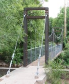
2002: Tallulah Gorge
Tallulah Gorge State Park, Georgia, USA - Tallulah River
| Bridgemeister ID: | 605 (added 2003-01-14) |
| Year Completed: | 2002 |
| Name: | Tallulah Gorge |
| Location: | Tallulah Gorge State Park, Georgia, USA |
| Crossing: | Tallulah River |
| At or Near Feature: | Hurricane Falls |
| Coordinates: | 34.7387 N 83.391467 W |
| Maps: | Acme, GeoHack, Google, OpenStreetMap |
| Use: | Footbridge |
| Status: | In use (last checked: 2007) |
| Main Cables: | Wire (steel) |
| Main Span: | 1 x 76.2 meters (250 feet) estimated |
External Links:
2002: Tem
Tem, Tajikistan and Demogan, Afghanistan - Pyandzh "Pyanj" River
| Bridgemeister ID: | 940 (added 2003-10-27) |
| Year Completed: | 2002 |
| Name: | Tem |
| Location: | Tem, Tajikistan and Demogan, Afghanistan |
| Crossing: | Pyandzh "Pyanj" River |
| Coordinates: | 37.528056 N 71.503417 E |
| Maps: | Acme, GeoHack, Google, OpenStreetMap |
| Use: | Vehicular (one-lane) |
| Status: | Extant (last checked: 2023) |
| Suspended Spans: | 1 |
| Main Span: | 1 x 135 meters (442.9 feet) |
Notes:
- Built as part of same project as 2004 Tajik-Afghan Friendship - Darwaz, Tajikistan and Darwaz, Afghanistan.
External Links:
2003: (footbridge)
Cascine di tavola, Tuscany, Italy - Filimortula River
| Bridgemeister ID: | 1039 (added 2003-12-06) |
| Year Completed: | 2003 |
| Name: | (footbridge) |
| Location: | Cascine di tavola, Tuscany, Italy |
| Crossing: | Filimortula River |
| Coordinates: | 43.828243 N 11.051458 E |
| Maps: | Acme, GeoHack, Google, OpenStreetMap |
| Use: | Footbridge |
| Status: | In use |
Notes:
- Unconventional design. The main cable ends are anchored to the tops of posts that are inclined away from the bridge.
- Near former location of 1833 Leopoldus II - Poggio a Cajano, Florence vicinity, Tuscany, Italy.
External Links:
| Bridgemeister ID: | 916 (added 2003-10-12) |
| Year Completed: | 2003 |
| Name: | (footbridge) |
| Location: | Collingwood, Ontario, Canada |
| Coordinates: | 44.48883 N 80.31083 W |
| Maps: | Acme, GeoHack, Google, OpenStreetMap |
| Use: | Footbridge |
| Status: | In use (last checked: 2005) |
| Main Cables: | Wire (steel) |
| Suspended Spans: | 1 |
| Main Span: | 1 x 126 meters (413.4 feet) |
Notes:
- Located at the Scenic Caves attraction, the owners claim this large (126-meter main span) footbridge is the longest footbridge in Ontario.
2003: (footbridge)
Henderson vicinity, Virginia, USA - North Fork Holston River
| Bridgemeister ID: | 827 (added 2003-05-31) |
| Year Completed: | 2003 |
| Name: | (footbridge) |
| Location: | Henderson vicinity, Virginia, USA |
| Crossing: | North Fork Holston River |
| Coordinates: | 36.83980 N 81.88095 W |
| Maps: | Acme, GeoHack, Google, OpenStreetMap |
| Use: | Footbridge |
| Status: | In use |
| Main Spans: | 1 x 44.2 meters (145 feet), 1 x 43.3 meters (142 feet) |
Notes:
Image Sets:
2003: (suspension bridge)
NHPC Quarters and Khamdong (खाम्डोंग), Sikkim, India - Teesta River
| Bridgemeister ID: | 4631 (added 2020-06-07) |
| Year Completed: | 2003 |
| Name: | (suspension bridge) |
| Location: | NHPC Quarters and Khamdong (खाम्डोंग), Sikkim, India |
| Crossing: | Teesta River |
| At or Near Feature: | Teesta-V Power Station |
| Coordinates: | 27.249695 N 88.458803 E |
| Maps: | Acme, GeoHack, Google, OpenStreetMap |
| Use: | Vehicular |
| Status: | Only towers remain, since October 2023 |
| Main Cables: | Wire (steel) |
| Suspended Spans: | 1 |
| Main Span: | 1 x 96 meters (315 feet) estimated |
Notes:
- Appears to have been destroyed by the large Sikkim flash flood event in October, 2023.
- Next to 2024 (footbridge) - NHPC Quarters and Khamdong (खाम्डोंग), Sikkim, India.
- Replaced by 2025 (suspension bridge) - NHPC Quarters and Khamdong (खाम्डोंग), Sikkim, India.
- All past and present bridges at this location.
External Links:
- Facebook. Video showing the 2024 footbridge (with towers lit up) and the adjacent remnant tower and cables from the bridge destroyed in 2023.
- Google Maps. Image of the bridge. Dated November 2021.
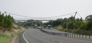
2003: A5 Nesscliffe Bypass
Nesscliffe, Shropshire, England, United Kingdom - A5 Roadway
| Bridgemeister ID: | 1315 (added 2004-04-18) |
| Year Completed: | 2003 |
| Name: | A5 Nesscliffe Bypass |
| Location: | Nesscliffe, Shropshire, England, United Kingdom |
| Crossing: | A5 Roadway |
| Coordinates: | 52.76524 N 2.91796 W |
| Maps: | Acme, GeoHack, Google, OpenStreetMap |
| Use: | Footbridge |
| Status: | In use (last checked: 2012) |
| Main Cables: | Wire (steel) |
| Suspended Spans: | 1 |
Notes:
- Sign at bridge notes it was officially opened March 21, 2003.
Image Sets:
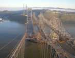
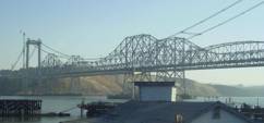
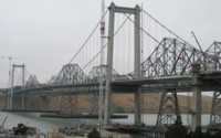
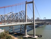
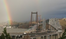
2003: Al Zampa Memorial
Crockett and Vallejo, California, USA - Carquinez Strait
| Bridgemeister ID: | 878 (added 2003-09-01) |
| Year Completed: | 2003 |
| Name: | Al Zampa Memorial |
| Location: | Crockett and Vallejo, California, USA |
| Crossing: | Carquinez Strait |
| Coordinates: | 38.06097 N 122.22639 W |
| Maps: | Acme, GeoHack, Google, OpenStreetMap |
| References: | AZB, BAR |
| Use: | Vehicular (major highway), with walkway |
| Status: | In use (last checked: 2018) |
| Main Cables: | Wire (steel) |
| Suspended Spans: | 3 |
| Main Span: | 1 x 728 meters (2,388.5 feet) |
| Side Spans: | 1 x 181 meters (593.8 feet), 1 x 147 meters (482.3 feet) |
External Links:
Image Sets:
| Bridgemeister ID: | 4568 (added 2020-06-02) |
| Year Completed: | 2003 |
| Name: | Azhihe |
| Also Known As: | 阿志河大桥 |
| Location: | Changliuxiang, Guizhou, China |
| Coordinates: | 26.215657 N 105.196275 E |
| Maps: | Acme, GeoHack, Google, OpenStreetMap |
| Use: | Vehicular (two-lane, heavy vehicles), with walkway |
| Status: | In use (last checked: 2020) |
| Main Cables: | Wire (steel) |
| Suspended Spans: | 1 |
External Links:
2003: Beipanjiang
Xingbeizhen, Guizhou, China - Beipan River
| Bridgemeister ID: | 4663 (added 2020-06-19) |
| Year Completed: | 2003 |
| Name: | Beipanjiang |
| Also Known As: | 关兴公路北盘江大桥 |
| Location: | Xingbeizhen, Guizhou, China |
| Crossing: | Beipan River |
| Coordinates: | 25.650611 N 105.692111 E |
| Maps: | Acme, GeoHack, Google, OpenStreetMap |
| Use: | Vehicular (major highway) |
| Status: | In use (last checked: 2020) |
| Main Cables: | Wire (steel) |
| Suspended Spans: | 1 |
| Main Span: | 1 x 388 meters (1,273 feet) |
External Links:
| Bridgemeister ID: | 2697 (added 2019-05-27) |
| Year Completed: | 2003 |
| Name: | Bob Mac's Crossing |
| Location: | Athens, Texas, USA |
| At or Near Feature: | East Texas Arboretum |
| Coordinates: | 32.207487 N 95.878114 W |
| Maps: | Acme, GeoHack, Google, OpenStreetMap |
| Principals: | Bob McDonald, San Jacinto Engineering |
| Use: | Footbridge |
| Status: | In use (last checked: 2019) |
| Main Cables: | Wire (steel) |
External Links:
2003: Demorieux
Le Mans, Sarthe, France - Boulevard Demorieux
| Bridgemeister ID: | 9010 (added 2024-12-25) |
| Year Completed: | 2003 |
| Name: | Demorieux |
| Location: | Le Mans, Sarthe, France |
| Crossing: | Boulevard Demorieux |
| Coordinates: | 47.995639 N 0.186417 E |
| Maps: | Acme, GeoHack, Google, OpenStreetMap |
| Use: | Footbridge |
| Status: | In use |
| Main Cables: | Wire (steel) |
| Suspended Spans: | 1 |
Notes:
- Pedestrian walkway connecting two buildings.
External Links:
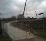
2003: Erzbahnschwinge
Bochum, Germany - Gahlensche Straße
| Bridgemeister ID: | 1557 (added 2004-11-26) |
| Year Completed: | 2003 |
| Name: | Erzbahnschwinge |
| Location: | Bochum, Germany |
| Crossing: | Gahlensche Straße |
| Coordinates: | 51.48495 N 7.194383 E |
| Maps: | Acme, GeoHack, Google, OpenStreetMap |
| Principals: | Schlaich Bergermann Partner |
| Use: | Footbridge |
| Status: | In use (last checked: 2004) |
| Main Cables: | Wire (steel) |
| Characteristics: | Self-anchored |
Notes:
- Unconventional design with curved deck which is suspended along one edge.
- Similar to 1987 (footbridge) - Kelheim, Germany.
- Similar to 2004 Liberty - Greenville, South Carolina, USA.
External Links:
Image Sets:
2003: Malimbong
Matande, Malimbong vicinity, Mamasa Regency, West Sulawesi, Indonesia - Mamasa River
| Bridgemeister ID: | 6828 (added 2021-12-26) |
| Year Completed: | 2003 |
| Name: | Malimbong |
| Location: | Matande, Malimbong vicinity, Mamasa Regency, West Sulawesi, Indonesia |
| Crossing: | Mamasa River |
| Coordinates: | 3.274167 S 119.379521 E |
| Maps: | Acme, GeoHack, Google, OpenStreetMap |
| Use: | Footbridge |
| Status: | In use (last checked: 2019) |
| Main Cables: | Wire (steel) |
| Suspended Spans: | 1 |
| Main Span: | 1 x 56.4 meters (185 feet) estimated |
External Links:
2003: McKenzie River
Eugene vicinity, Oregon, USA - McKenzie River
| Bridgemeister ID: | 2147 (added 2006-11-18) |
| Year Completed: | 2003 |
| Name: | McKenzie River |
| Location: | Eugene vicinity, Oregon, USA |
| Crossing: | McKenzie River |
| Coordinates: | 44.11687 N 123.08218 W |
| Maps: | Acme, GeoHack, Google, OpenStreetMap |
| Principals: | OBEC Consulting Engineers, Jiri Strasky |
| Use: | Footbridge |
| Status: | In use (last checked: 2006) |
| Main Cables: | Wire (steel) |
| Suspended Spans: | 3 |
| Main Span: | 1 x 131 meters (429.8 feet) |
| Side Spans: | 2 x 37 meters (121.4 feet) |
Notes:
- Similar to 1999 Peter DeFazio (Ferry Street) - Eugene, Oregon, USA.
- Near (pipeline bridge) - Eugene vicinity, Oregon, USA.
External Links:
2003: Potwisha
Three Rivers vicinity, California, USA - Middle Fork Kaweah River
| Bridgemeister ID: | 2391 (added 2007-11-20) |
| Year Completed: | 2003 |
| Name: | Potwisha |
| Location: | Three Rivers vicinity, California, USA |
| Crossing: | Middle Fork Kaweah River |
| At or Near Feature: | Sequioa National Park |
| Coordinates: | 36.512310 N 118.800187 W |
| Maps: | Acme, GeoHack, Google, OpenStreetMap |
| Principals: | MCS Construction, Blair, Church & Flynn Consulting Engineers |
| Use: | Footbridge |
| Status: | In use (last checked: 2019) |
| Main Cables: | Wire (steel) |
| Suspended Spans: | 1 |
2003: San Francisco
Uchiza, Peru
| Bridgemeister ID: | 7470 (added 2022-12-25) |
| Year Completed: | 2003 |
| Name: | San Francisco |
| Location: | Uchiza, Peru |
| Coordinates: | 8.486166 S 76.463191 W |
| Maps: | Acme, GeoHack, Google, OpenStreetMap |
| Principals: | Inprocon Asociados S.A. |
| Use: | Vehicular (one-lane) |
| Status: | In use (last checked: 2022) |
| Main Cables: | Wire (steel) |
| Suspended Spans: | 1 |
| Main Span: | 1 x 145 meters (475.7 feet) estimated |
External Links:
- Facebook. Post with several images of deck refurbishment, posted July 2, 2021.
- Facebook. Post with several images of ongoing work around the bridge, posted June 23, 2021.
- Facebook. Post with several images of the finished work on and around the bridge, posted August 4, 2021.
- Google Maps - Puente San Francisco. Several images of the bridge.
- Wikimedia - Puente San Francisco. Image of the bridge, 2007.
2003: Sanchinarro Shopping Mall
Madrid, Spain
| Bridgemeister ID: | 9000 (added 2024-12-25) |
| Year Completed: | 2003 |
| Name: | Sanchinarro Shopping Mall |
| Location: | Madrid, Spain |
| At or Near Feature: | El Corte Inglés Sanchinarro |
| Coordinates: | 40.497472 N 3.662417 W |
| Maps: | Acme, GeoHack, Google, OpenStreetMap |
| Use: | Footbridge |
| Status: | In use (last checked: 2024) |
| Main Cables: | Wire (steel) |
| Suspended Spans: | 1 |
| Characteristics: | Partially underspanned |
Notes:
- One of two suspension bridges at the Sanchinarro shopping mall. This one provides a street-level entrance to the mall.
- Next to 2003 Sanchinarro Shopping Mall - Madrid, Spain.
- All past and present bridges at this location.
External Links:
2003: Sanchinarro Shopping Mall
Madrid, Spain
| Bridgemeister ID: | 9001 (added 2024-12-25) |
| Year Completed: | 2003 |
| Name: | Sanchinarro Shopping Mall |
| Location: | Madrid, Spain |
| At or Near Feature: | El Corte Inglés Sanchinarro |
| Coordinates: | 40.496861 N 3.663000 W |
| Maps: | Acme, GeoHack, Google, OpenStreetMap |
| Use: | Vehicular |
| Status: | Extant (last checked: 2022) |
| Main Cables: | Wire (steel) |
| Suspended Spans: | 1 |
| Characteristics: | Partially underspanned |
Notes:
- One of two suspension bridges at the Sanchinarro shopping mall. This one provides vehicular access to the parking garage.
- Next to 2003 Sanchinarro Shopping Mall - Madrid, Spain.
- All past and present bridges at this location.
External Links:
2003: Wakema
Wakema, Myanmar - Wakema Creek
| Bridgemeister ID: | 1026 (added 2003-11-22) |
| Year Completed: | 2003 |
| Name: | Wakema |
| Location: | Wakema, Myanmar |
| Crossing: | Wakema Creek |
| Coordinates: | 16.608000 N 95.182418 E |
| Maps: | Acme, GeoHack, Google, OpenStreetMap |
| Use: | Vehicular |
| Status: | In use (last checked: 2017) |
| Main Cables: | Wire (steel) |
2004: (footbridge)
Charlton, Victoria, Australia - Avoca River
| Bridgemeister ID: | 1501 (added 2004-10-08) |
| Year Completed: | 2004 |
| Name: | (footbridge) |
| Location: | Charlton, Victoria, Australia |
| Crossing: | Avoca River |
| Coordinates: | 36.26725 S 143.351283 E |
| Maps: | Acme, GeoHack, Google, OpenStreetMap |
| Use: | Footbridge |
| Status: | In use (last checked: 2004) |
| Main Cables: | Wire |
2004: (footbridge)
Conner vicinity and Darby vicinity, Montana, USA - Bitterroot River
| Bridgemeister ID: | 1516 (added 2004-10-10) |
| Year Completed: | 2004 |
| Name: | (footbridge) |
| Location: | Conner vicinity and Darby vicinity, Montana, USA |
| Crossing: | Bitterroot River |
| Coordinates: | 45.95001 N 114.13475 W |
| Maps: | Acme, GeoHack, Google, OpenStreetMap |
| Principals: | Sahale, LLC |
| Use: | Footbridge |
| Status: | In use (last checked: 2007) |
| Main Cables: | Wire (steel) |
| Suspended Spans: | 1 |
| Main Span: | 1 x 61 meters (200 feet) |
| Deck width: | 5 feet |
2004: (footbridge)
Frankenberg, Sachsenburg vicinity, Saxony, Germany - Zschopau River
| Bridgemeister ID: | 2163 (added 2007-01-12) |
| Year Completed: | 2004 |
| Name: | (footbridge) |
| Location: | Frankenberg, Sachsenburg vicinity, Saxony, Germany |
| Crossing: | Zschopau River |
| Coordinates: | 50.931877 N 13.025694 E |
| Maps: | Acme, GeoHack, Google, OpenStreetMap |
| Principals: | Montage & Stahlbau Standke |
| Use: | Footbridge |
| Status: | In use (last checked: 2006) |
| Main Cables: | Wire (steel) |
| Suspended Spans: | 1 |
| Main Span: | 1 x 52 meters (170.6 feet) |
| Deck width: | 1.1 meters between side rails, 1.4 meters total |
Notes:
- Replacement for an older suspension bridge.
- Replaced (footbridge) - Frankenberg, Sachsenburg vicinity, Saxony, Germany.
- All past and present bridges at this location.
External Links:
Image Sets:
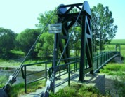
2004: Am Hasennest
Klein Limmritz, Döbeln vicinity, Saxony, Germany - Zschopau River
| Bridgemeister ID: | 2250 (added 2007-03-28) |
| Year Completed: | 2004 |
| Name: | Am Hasennest |
| Location: | Klein Limmritz, Döbeln vicinity, Saxony, Germany |
| Crossing: | Zschopau River |
| Coordinates: | 51.112008 N 13.043936 E |
| Maps: | Acme, GeoHack, Google, OpenStreetMap |
| Principals: | STM Montage |
| Use: | Footbridge |
| Status: | In use (last checked: 2019) |
| Main Cables: | Wire (steel) |
| Suspended Spans: | 1 |
| Main Span: | 1 x 84 meters (275.6 feet) |
External Links:
2004: Berber
Superior, Arizona, USA - Queen Creek
| Bridgemeister ID: | 2443 (added 2008-04-23) |
| Year Completed: | 2004 |
| Name: | Berber |
| Location: | Superior, Arizona, USA |
| Crossing: | Queen Creek |
| At or Near Feature: | Boyce Arboretum |
| Coordinates: | 33.277250 N 111.153117 W |
| Maps: | Acme, GeoHack, Google, OpenStreetMap |
| Use: | Footbridge |
| Status: | In use (last checked: 2017) |
| Main Cables: | Wire (steel) |
| Suspended Spans: | 1 |
Image Sets:
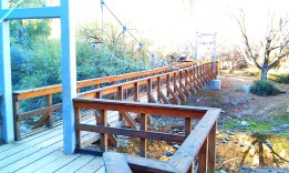
2004: Doll
Doll vicinity, Brora, Scotland, United Kingdom - River Brora
| Bridgemeister ID: | 2613 (added 2014-04-15) |
| Year Completed: | 2004 |
| Name: | Doll |
| Also Known As: | Ford |
| Location: | Doll vicinity, Brora, Scotland, United Kingdom |
| Crossing: | River Brora |
| At or Near Feature: | Brora Ford |
| Coordinates: | 58.01495 N 3.91287 W |
| Maps: | Acme, GeoHack, Google, OpenStreetMap |
| Use: | Footbridge |
| Status: | In use (last checked: 2022) |
| Main Cables: | Wire (steel) |
| Suspended Spans: | 1 |
Image Sets:
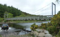
| Bridgemeister ID: | 8106 (added 2023-12-28) |
| Year Completed: | 2004 |
| Name: | Fushun Tianhu |
| Location: | Xinfu District (新抚区), Fushun (抚顺市), Liaoning, China |
| Crossing: | Hun River |
| Coordinates: | 41.876556 N 123.975528 E |
| Maps: | Acme, GeoHack, Google, OpenStreetMap |
| Use: | Vehicular |
| Status: | In use (last checked: 2023) |
| Main Cables: | Wire (steel) |
| Main Span: | 1 |
| Side Spans: | 2 |
| Characteristics: | Self-anchored |
External Links:
2004: Gröna
Gröna, Sachsen-Anhalt, Germany - Saale River
| Bridgemeister ID: | 1844 (added 2005-07-16) |
| Year Completed: | 2004 |
| Name: | Gröna |
| Location: | Gröna, Sachsen-Anhalt, Germany |
| Crossing: | Saale River |
| Coordinates: | 51.76250 N 11.69556 E |
| Maps: | Acme, GeoHack, Google, OpenStreetMap |
| Use: | Footbridge |
| Status: | In use (last checked: 2006) |
| Main Cables: | Wire (steel) |
| Suspended Spans: | 3 |
| Main Span: | 1 x 63.1 meters (207 feet) |
| Side Spans: | 2 x 19.4 meters (63.6 feet) |
| Deck width: | 2.5 meters |
Notes:
- Eckhard Bernstorff notes: "Main span gravity anchored because of tilted position of towers (similar to bridges without backstays like the Italian bridge over Filimortula River, 2003); side spans self anchored."
External Links:
Image Sets:
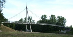
2004: Kangji
Jindong District (金东区), Jinhua (金华市), Zhejiang, China - Yiwu River
| Bridgemeister ID: | 8228 (added 2024-02-07) |
| Year Completed: | 2004 |
| Name: | Kangji |
| Also Known As: | 金华市康济桥 |
| Location: | Jindong District (金东区), Jinhua (金华市), Zhejiang, China |
| Crossing: | Yiwu River |
| Coordinates: | 29.109139 N 119.698278 E |
| Maps: | Acme, GeoHack, Google, OpenStreetMap |
| Use: | Vehicular |
| Status: | In use (last checked: 2023) |
| Main Cables: | Wire (steel) |
| Suspended Spans: | 3 |
| Main Span: | 1 x 100 meters (328.1 feet) |
| Side Spans: | 2 x 30 meters (98.4 feet) |
| Characteristics: | Self-anchored |
External Links:
Do you have any information or photos for these bridges that you would like to share? Please email david.denenberg@bridgemeister.com.
Mail | Facebook | X (Twitter) | Bluesky